Serravalle Sesia elevation
Serravalle Sesia (Piedmont, Provincia di Vercelli), Italy elevation is 333 meters and Serravalle Sesia elevation in feet is 1093 ft above sea level [src 1]. Serravalle Sesia is a seat of a third-order administrative division (feature code) with elevation that is 11 meters (36 ft) bigger than average city elevation in Italy.
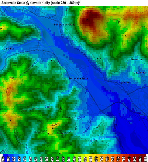
Below is the Elevation map of Serravalle Sesia, which displays elevation range with different colors. Scale of the first map is from 280 to 889 m (919 to 2917 ft) with average elevation of 439.8 meters (=1443 ft) [note 1]
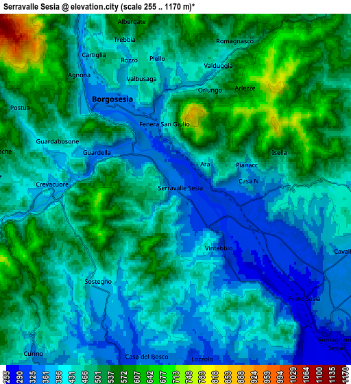
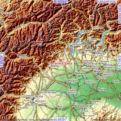
These maps also provides idea of topography and contour of this city, they are displayed at different zoom levels. More info about maps, scale and edge coordinates you can find below images.
| \ | Map #1 | Map #2 | Topo.Map |
| Scale [m] | 280..889 m | 255..1170 m | × |
| Scale [ft] | 919..2917 ft | 837..3839 ft | × |
| Average | 439.8 m = 1443 ft | 462.3 m = 1517 ft | × |
| Width | 6.83 km = 4.2 mi | 13.65 km = 8.5 mi | 218.5 km = 135.8 mi |
| Height | 6.83 km = 4.2 mi | 13.65 km = 8.5 mi | 218.5 km = 135.8 mi |
| ↑Max Latitude | 45.715542° | 45.746217° | 46.65864° |
| Latitude at center | 45.68485° | 45.68485° | 45.68485° |
| ↓Min Latitude | 45.654141° | 45.623416° | 44.69381° |
| ← Min Longitude | 8.264555° | 8.220609° | 6.90225° |
| Longitude center | 8.3085° | 8.3085° | 8.3085° |
| →Max Longitude | 8.352445° | 8.396391° | 9.71475° |
Nearby cities:
Cities around Serravalle Sesia sort by population:
• Borgosesia elevation 414 m
4.8 km,  326°
326°
• Grignasco 318 m
2.8 km,  101°
101°
• Prato Sesia 285 m
6.3 km,  127°
127°
• Crevacuore 387 m
5 km,  270°
270°
• Valduggia 403 m
4.9 km,  17°
17°
• Cavallirio 363 m
7.3 km,  110°
110°
• Lozzolo 300 m
7.4 km,  171°
171°
• Sostegno 403 m
4.7 km,  220°
220°
• Postua 450 m
7 km,  297°
297°
• Guardabosone 471 m
5 km,  292°
292°
• Ailoche 540 m
6.9 km,  282°
282°
• Frazione Chiesa 551 m
7.5 km, 277°
Multilingual:
 En español:
Serravalle Sesia elevación 333 m.
 En France:
Serravalle Sesia élévation 333 m.
 Auf Deutsch:
Serravalle Sesia höhe über dem Meeresspiegel ist 333 m.

Sources and notes:
- [note 1] Map square and city borders are not equal. Map elevation data is calculated only from area inside that square.
- [src 1] Elevation data from geonames database provided with same terms of usage.
- [src 2] The elevation map of Serravalle Sesia is generated using elevation data from NASA's 3 arcsec (90m) resolution SRTM data.
- [src 3] Base (background) map © OpenStreetMap contributors tiles are generated by Geofabrik and OpenTopoMap.
Copyright & License:
This Serravalle Sesia Elevation Map is licensed under CC BY-SA. You may reuse any part from this page, if you give a proper credit by linking to this URL:
 More info on terms of use page.