Talmassons elevation
Talmassons (Friuli Venezia Giulia, Provincia di Udine), Italy elevation is 27 meters and Talmassons elevation in feet is 89 ft above sea level [src 1]. Talmassons is a seat of a third-order administrative division (feature code) with elevation that is 295 meters (968 ft) smaller than average city elevation in Italy.
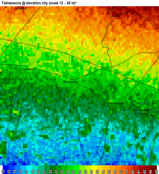
Below is the Elevation map of Talmassons, which displays elevation range with different colors. Scale of the first map is from 12 to 45 m (39 to 148 ft) with average elevation of 26.2 meters (=86 ft) [note 1]
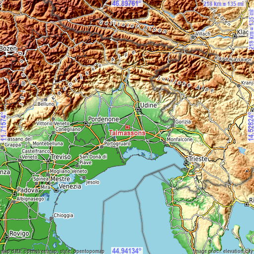
These maps also provides idea of topography and contour of this city, they are displayed at different zoom levels. More info about maps, scale and edge coordinates you can find below images.
| \ | Map #1 | Map #2 | Topo.Map |
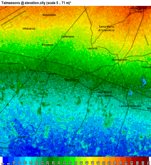
| Scale [m] | 12..45 m | 5..71 m | × |
| Scale [ft] | 39..148 ft | 16..233 ft | × |
| Average | 26.2 m = 86 ft | 28.4 m = 93 ft | × |
| Width | 6.8 km = 4.2 mi | 13.59 km = 8.4 mi | 217.5 km = 135.1 mi |
| Height | 6.8 km = 4.2 mi | 13.59 km = 8.4 mi | 217.5 km = 135.1 mi |
| ↑Max Latitude | 45.958658° | 45.9892° | 46.89761° |
| Latitude at center | 45.9281° | 45.9281° | 45.9281° |
| ↓Min Latitude | 45.897525° | 45.866933° | 44.94134° |
| ← Min Longitude | 13.078045° | 13.034099° | 11.71574° |
| Longitude center | 13.12199° | 13.12199° | 13.12199° |
| →Max Longitude | 13.165935° | 13.209881° | 14.52824° |
Nearby cities:
Cities around Talmassons sort by population:
• Basiliano elevation 70 m
10.4 km,  337°
337°
• Gonars 22 m
10 km,  109°
109°
• Castions di Strada 22 m
4.9 km, 110°
• Rivignano 14 m
8.5 km,  226°
226°
• Mortegliano 40 m
4.4 km,  63°
63°
• Campoformido 78 m
10.5 km,  15°
15°
• Bertiolo 33 m
5.4 km,  289°
289°
• Pozzuolo del Friuli 60 m
8.6 km,  42°
42°
• Pocenia 6 m
10.4 km,  188°
188°
• Teor 10 m
9.7 km,  211°
211°
• Lestizza 42 m
3.5 km,  26°
26°
• Bicinicco 34 m
10.1 km,  87°
87°
Multilingual:
 En español:
Talmassons elevación 27 m.
 En France:
Talmassons élévation 27 m.
 Auf Deutsch:
Talmassons höhe über dem Meeresspiegel ist 27 m.

Sources and notes:
- [note 1] Map square and city borders are not equal. Map elevation data is calculated only from area inside that square.
- [src 1] Elevation data from geonames database provided with same terms of usage.
- [src 2] The elevation map of Talmassons is generated using elevation data from NASA's 3 arcsec (90m) resolution SRTM data.
- [src 3] Base (background) map © OpenStreetMap contributors tiles are generated by Geofabrik and OpenTopoMap.
Copyright & License:
This Talmassons Elevation Map is licensed under CC BY-SA. You may reuse any part from this page, if you give a proper credit by linking to this URL:
 More info on terms of use page.