Gonars elevation
Gonars (Friuli Venezia Giulia, Provincia di Udine), Italy elevation is 22 meters and Gonars elevation in feet is 72 ft above sea level [src 1]. Gonars is a seat of a third-order administrative division (feature code) with elevation that is 300 meters (984 ft) smaller than average city elevation in Italy.
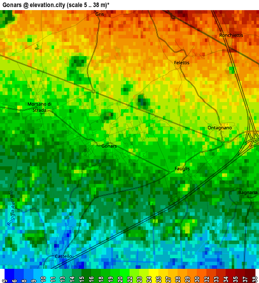
Below is the Elevation map of Gonars, which displays elevation range with different colors. Scale of the first map is from 5 to 38 m (16 to 125 ft) with average elevation of 20 meters (=66 ft) [note 1]
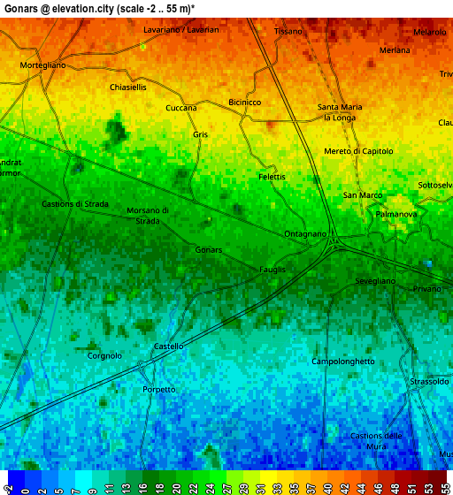
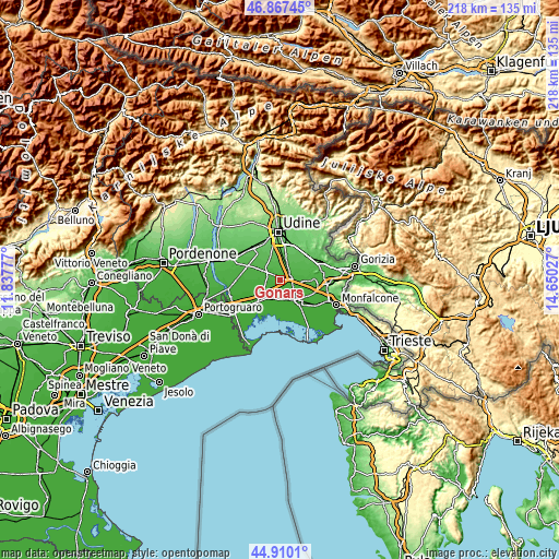
These maps also provides idea of topography and contour of this city, they are displayed at different zoom levels. More info about maps, scale and edge coordinates you can find below images.
| \ | Map #1 | Map #2 | Topo.Map |
| Scale [m] | 5..38 m | -2..55 m | × |
| Scale [ft] | 16..125 ft | -7..180 ft | × |
| Average | 20 m = 66 ft | 21 m = 69 ft | × |
| Width | 6.8 km = 4.2 mi | 13.6 km = 8.5 mi | 217.6 km = 135.2 mi |
| Height | 6.8 km = 4.2 mi | 13.6 km = 8.5 mi | 217.6 km = 135.2 mi |
| ↑Max Latitude | 45.927975° | 45.958533° | 46.86745° |
| Latitude at center | 45.8974° | 45.8974° | 45.8974° |
| ↓Min Latitude | 45.866808° | 45.836199° | 44.9101° |
| ← Min Longitude | 13.200075° | 13.156129° | 11.83777° |
| Longitude center | 13.24402° | 13.24402° | 13.24402° |
| →Max Longitude | 13.287965° | 13.331911° | 14.65027° |
Nearby cities:
Cities around Gonars sort by population:
• San Giorgio di Nogaro elevation 4 m
8.2 km,  198°
198°
• Castions di Strada 22 m
5.1 km,  289°
289°
• Mortegliano 40 m
7.7 km,  314°
314°
• Palmanova 27 m
5.2 km,  80°
80°
• Porpetto 7 m
5 km, 204°
• Sevegliano 20 m
4.9 km,  103°
103°
• Santa Maria la Longa 40 m
5.4 km,  40°
40°
• Ialmicco 29 m
8.1 km, 77°
• Sottoselva 30 m
6.4 km, 75°
• Bicinicco 34 m
3.9 km,  10°
10°
• Visco 22 m
8.1 km,  94°
94°
• Bagnaria Arsa 18 m
3.6 km,  115°
115°
Multilingual:
 En español:
Gonars elevación 22 m.
 En France:
Gonars élévation 22 m.


Sources and notes:
- [note 1] Map square and city borders are not equal. Map elevation data is calculated only from area inside that square.
- [src 1] Elevation data from geonames database provided with same terms of usage.
- [src 2] The elevation map of Gonars is generated using elevation data from NASA's 3 arcsec (90m) resolution SRTM data.
- [src 3] Base (background) map © OpenStreetMap contributors tiles are generated by Geofabrik and OpenTopoMap.
Copyright & License:
This Gonars Elevation Map is licensed under CC BY-SA. You may reuse any part from this page, if you give a proper credit by linking to this URL:
 More info on terms of use page.