Termeno elevation
Termeno (Trentino-Alto Adige, Bolzano), Italy elevation is 260 meters and Termeno elevation in feet is 853 ft above sea level [src 1]. Termeno is a seat of a third-order administrative division (feature code) with elevation that is 62 meters (203 ft) smaller than average city elevation in Italy.
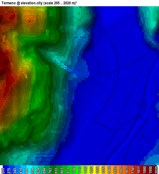
Below is the Elevation map of Termeno, which displays elevation range with different colors. Scale of the first map is from 205 to 2020 m (673 to 6627 ft) with average elevation of 570 meters (=1870 ft) [note 1]
These maps also provides idea of topography and contour of this city, they are displayed at different zoom levels. More info about maps, scale and edge coordinates you can find below images.
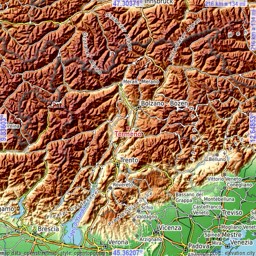
| \ | Map #1 | Topo.Map |
| Scale [m] | 205..2020 m | × |
| Scale [ft] | 673..6627 ft | × |
| Average | 570 m = 1870 ft | × |
| Width | 6.75 km = 4.2 mi | 215.9 km = 134.2 mi |
| Height | 6.75 km = 4.2 mi | 215.9 km = 134.2 mi |
| ↑Max Latitude | 46.37184° | 47.30371° |
| Latitude at center | 46.34151° | 46.34151° |
| ↓Min Latitude | 46.311164° | 45.36207° |
| ← Min Longitude | 11.198335° | 9.83603° |
| Longitude center | 11.24228° | 11.24228° |
| →Max Longitude | 11.286225° | 12.64853° |
Nearby cities:
Cities around Termeno sort by population:
• Caldaro sulla Strada del Vino elevation 429 m
8 km,  2°
2°
• Egna 224 m
3.6 km,  137°
137°
• Ora 249 m
4.3 km,  81°
81°
• Bronzolo 245 m
9.1 km,  41°
41°
• Aldino 1191 m
9.1 km,  72°
72°
• Laghetti 215 m
7.4 km,  181°
181°
• Magrè sulla Strada del Vino 234 m
6.4 km,  202°
202°
• Montagna 438 m
4.6 km,  105°
105°
• Cortaccia sulla Strada del Vino 344 m
3.4 km, 204°
• Trodena 1130 m
8.5 km,  104°
104°
• Cortina sulla Strada del Vino 212 m
8.2 km,  191°
191°
• Sfruz 1083 m
9.1 km,  268°
268°
Multilingual:
 En español:
Termeno elevación 260 m.
 En France:
Termeno élévation 260 m.
 Auf Deutsch:
Tramin an der Weinstrasse höhe über dem Meeresspiegel ist 260 m.

Sources and notes:
- [note 1] Map square and city borders are not equal. Map elevation data is calculated only from area inside that square.
- [src 1] Elevation data from geonames database provided with same terms of usage.
- [src 2] The elevation map of Termeno is generated using elevation data from NASA's 3 arcsec (90m) resolution SRTM data.
- [src 3] Base (background) map © OpenStreetMap contributors tiles are generated by Geofabrik and OpenTopoMap.
Copyright & License:
This Termeno Elevation Map is licensed under CC BY-SA. You may reuse any part from this page, if you give a proper credit by linking to this URL:
 More info on terms of use page.