Treviglio elevation
Treviglio (Lombardy, Provincia di Bergamo), Italy elevation is 128 meters and Treviglio elevation in feet is 420 ft above sea level [src 1]. Treviglio is a seat of a third-order administrative division (feature code) with elevation that is 194 meters (636 ft) smaller than average city elevation in Italy.
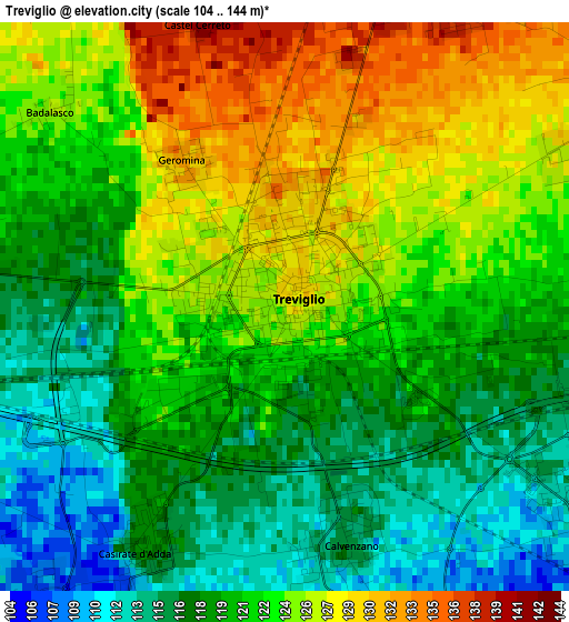
Below is the Elevation map of Treviglio, which displays elevation range with different colors. Scale of the first map is from 104 to 144 m (341 to 472 ft) with average elevation of 121.4 meters (=398 ft) [note 1]
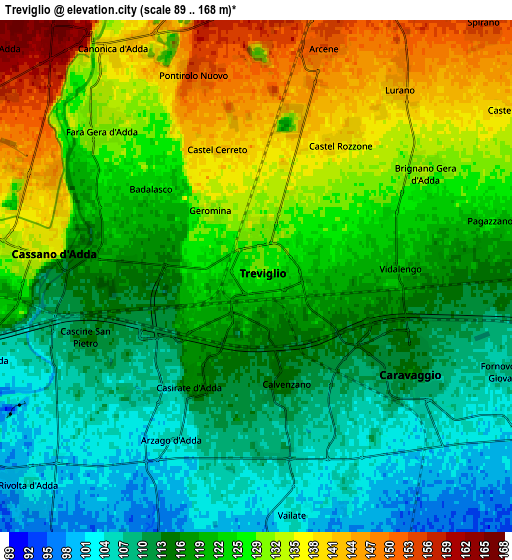
These maps also provides idea of topography and contour of this city, they are displayed at different zoom levels. More info about maps, scale and edge coordinates you can find below images.
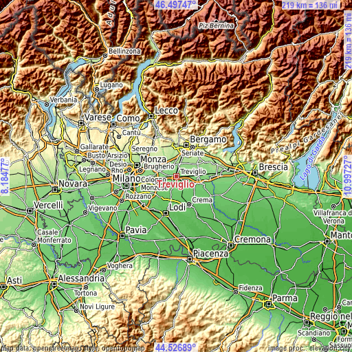
| \ | Map #1 | Map #2 | Topo.Map |
| Scale [m] | 104..144 m | 89..168 m | × |
| Scale [ft] | 341..472 ft | 292..551 ft | × |
| Average | 121.4 m = 398 ft | 121.7 m = 399 ft | × |
| Width | 6.85 km = 4.3 mi | 13.69 km = 8.5 mi | 219.1 km = 136.1 mi |
| Height | 6.85 km = 4.3 mi | 13.69 km = 8.5 mi | 219.1 km = 136.1 mi |
| ↑Max Latitude | 45.551592° | 45.582357° | 46.49747° |
| Latitude at center | 45.52081° | 45.52081° | 45.52081° |
| ↓Min Latitude | 45.490011° | 45.459196° | 44.52689° |
| ← Min Longitude | 9.547075° | 9.503129° | 8.18477° |
| Longitude center | 9.59102° | 9.59102° | 9.59102° |
| →Max Longitude | 9.634965° | 9.678911° | 10.99727° |
Nearby cities:
Cities around Treviglio sort by population:
• Cassano d'Adda elevation 135 m
5.9 km,  275°
275°
• Caravaggio 114 m
4.8 km,  124°
124°
• Fara Gera d'Adda 133 m
5.8 km,  313°
313°
• Brignano Gera d'Adda 130 m
4.8 km,  58°
58°
• Pontirolo Nuovo 154 m
5.6 km,  342°
342°
• Calvenzano 116 m
2.8 km,  166°
166°
• Casirate d'Adda 118 m
3.3 km,  210°
210°
• Castel Rozzone 139 m
4.2 km,  32°
32°
• Arzago d'Adda 105 m
4.9 km, 205°
• Geromina 131 m
2.1 km,  325°
325°
• Vidalengo 121 m
3.9 km,  87°
87°
• Badalasco 126 m
3.7 km, 310°
Multilingual:
 En español:
Treviglio elevación 128 m.
 En France:
Treviglio élévation 128 m.
 Auf Deutsch:
Treviglio höhe über dem Meeresspiegel ist 128 m.

Sources and notes:
- [note 1] Map square and city borders are not equal. Map elevation data is calculated only from area inside that square.
- [src 1] Elevation data from geonames database provided with same terms of usage.
- [src 2] The elevation map of Treviglio is generated using elevation data from NASA's 3 arcsec (90m) resolution SRTM data.
- [src 3] Base (background) map © OpenStreetMap contributors tiles are generated by Geofabrik and OpenTopoMap.
Copyright & License:
This Treviglio Elevation Map is licensed under CC BY-SA. You may reuse any part from this page, if you give a proper credit by linking to this URL:
 More info on terms of use page.