Valenza elevation
Valenza (Piedmont, Provincia di Alessandria), Italy elevation is 134 meters and Valenza elevation in feet is 440 ft above sea level [src 1]. Valenza is a seat of a third-order administrative division (feature code) with elevation that is 188 meters (617 ft) smaller than average city elevation in Italy.
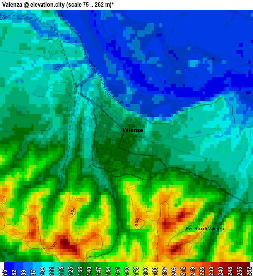
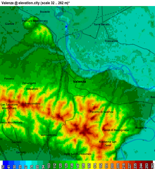
Below is the Elevation map of Valenza, which displays elevation range with different colors. Scale of the first map is from 75 to 262 m (246 to 860 ft) with average elevation of 129.3 meters (=424 ft) [note 1]
These maps also provides idea of topography and contour of this city, they are displayed at different zoom levels. More info about maps, scale and edge coordinates you can find below images.
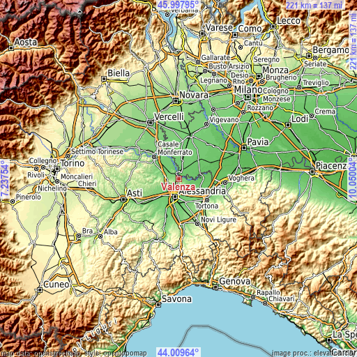
| \ | Map #1 | Map #2 | Topo.Map |
| Scale [m] | 75..262 m | 32..262 m | × |
| Scale [ft] | 246..860 ft | 105..860 ft | × |
| Average | 129.3 m = 424 ft | 119 m = 390 ft | × |
| Width | 6.91 km = 4.3 mi | 13.82 km = 8.6 mi | 221.1 km = 137.4 mi |
| Height | 6.91 km = 4.3 mi | 13.82 km = 8.6 mi | 221.1 km = 137.4 mi |
| ↑Max Latitude | 45.043479° | 45.074521° | 45.99795° |
| Latitude at center | 45.01242° | 45.01242° | 45.01242° |
| ↓Min Latitude | 44.981344° | 44.950252° | 44.00964° |
| ← Min Longitude | 8.599845° | 8.555899° | 7.23754° |
| Longitude center | 8.64379° | 8.64379° | 8.64379° |
| →Max Longitude | 8.687735° | 8.731681° | 10.05004° |
Nearby cities:
Cities around Valenza sort by population:
• San Salvatore Monferrato elevation 217 m
6.4 km,  252°
252°
• Valmadonna 125 m
4.9 km,  211°
211°
• Bassignana 98 m
7.1 km,  100°
100°
• Valle San Bartolomeo 95 m
6.9 km,  182°
182°
• Frascarolo 92 m
4.9 km,  38°
38°
• Castelletto Monferrato 183 m
7.1 km,  240°
240°
• Torre Beretti 91 m
5.7 km,  21°
21°
• Pecetto di Valenza 194 m
3.3 km,  141°
141°
• Rivarone 106 m
6.9 km,  124°
124°
• Bozzole 93 m
7 km,  334°
334°
• Pomaro Monferrato 119 m
6.7 km, 326°
• Montecastello 137 m
7.7 km,  154°
154°
Multilingual:
 En español:
Valenza elevación 134 m.
 En France:
Valenza élévation 134 m.


Sources and notes:
- [note 1] Map square and city borders are not equal. Map elevation data is calculated only from area inside that square.
- [src 1] Elevation data from geonames database provided with same terms of usage.
- [src 2] The elevation map of Valenza is generated using elevation data from NASA's 3 arcsec (90m) resolution SRTM data.
- [src 3] Base (background) map © OpenStreetMap contributors tiles are generated by Geofabrik and OpenTopoMap.
Copyright & License:
This Valenza Elevation Map is licensed under CC BY-SA. You may reuse any part from this page, if you give a proper credit by linking to this URL:
 More info on terms of use page.