Vescovato elevation
Vescovato (Lombardy, Provincia di Cremona), Italy elevation is 46 meters and Vescovato elevation in feet is 151 ft above sea level [src 1]. Vescovato is a seat of a third-order administrative division (feature code) with elevation that is 276 meters (906 ft) smaller than average city elevation in Italy.
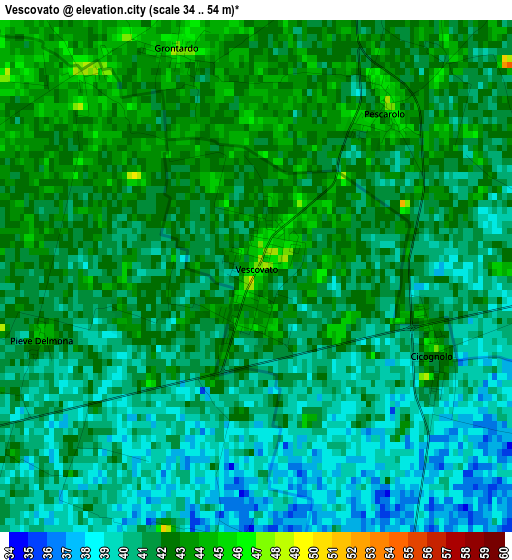
Below is the Elevation map of Vescovato, which displays elevation range with different colors. Scale of the first map is from 34 to 54 m (112 to 177 ft) with average elevation of 41 meters (=135 ft) [note 1]
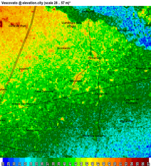
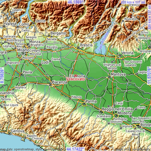
These maps also provides idea of topography and contour of this city, they are displayed at different zoom levels. More info about maps, scale and edge coordinates you can find below images.
| \ | Map #1 | Map #2 | Topo.Map |
| Scale [m] | 34..54 m | 28..57 m | × |
| Scale [ft] | 112..177 ft | 92..187 ft | × |
| Average | 41 m = 135 ft | 39.8 m = 131 ft | × |
| Width | 6.89 km = 4.3 mi | 13.78 km = 8.6 mi | 220.5 km = 137 mi |
| Height | 6.89 km = 4.3 mi | 13.78 km = 8.6 mi | 220.4 km = 136.9 mi |
| ↑Max Latitude | 45.205161° | 45.236115° | 46.1569° |
| Latitude at center | 45.17419° | 45.17419° | 45.17419° |
| ↓Min Latitude | 45.143202° | 45.112197° | 44.17422° |
| ← Min Longitude | 10.120565° | 10.076619° | 8.75826° |
| Longitude center | 10.16451° | 10.16451° | 10.16451° |
| →Max Longitude | 10.208455° | 10.252401° | 11.57076° |
Nearby cities:
Cities around Vescovato sort by population:
• Persico Dosimo elevation 46 m
4.8 km,  285°
285°
• Gadesco-Pieve Delmona 43 m
4.2 km,  244°
244°
• Pieve San Giacomo 37 m
5 km,  158°
158°
• Pescarolo 47 m
2.8 km,  38°
38°
• Ardole San Marino 44 m
5 km,  246°
246°
• Cicognolo 44 m
2.4 km,  107°
107°
• Grontardo 46 m
3.2 km,  341°
341°
• Malagnino 42 m
5.9 km,  221°
221°
• Dosimo 45 m
4.9 km,  283°
283°
• Scandolara Ripa d'Oglio 48 m
5.3 km,  353°
353°
• Gabbioneta 36 m
6.4 km, 43°
• Cappella de' Picenardi 40 m
5.4 km, 108°
Multilingual:
 En español:
Vescovato elevación 46 m.
 En France:
Vescovato élévation 46 m.
 Auf Deutsch:
Vescovato höhe über dem Meeresspiegel ist 46 m.

Sources and notes:
- [note 1] Map square and city borders are not equal. Map elevation data is calculated only from area inside that square.
- [src 1] Elevation data from geonames database provided with same terms of usage.
- [src 2] The elevation map of Vescovato is generated using elevation data from NASA's 3 arcsec (90m) resolution SRTM data.
- [src 3] Base (background) map © OpenStreetMap contributors tiles are generated by Geofabrik and OpenTopoMap.
Copyright & License:
This Vescovato Elevation Map is licensed under CC BY-SA. You may reuse any part from this page, if you give a proper credit by linking to this URL:
 More info on terms of use page.