Vodo elevation
Vodo (Veneto, Provincia di Belluno), Italy elevation is 886 meters and Vodo elevation in feet is 2907 ft above sea level [src 1]. Vodo is a seat of a third-order administrative division (feature code) with elevation that is 564 meters (1850 ft) bigger than average city elevation in Italy.
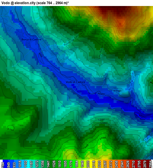
Below is the Elevation map of Vodo, which displays elevation range with different colors. Scale of the first map is from 764 to 2964 m (2507 to 9724 ft) with average elevation of 1364.7 meters (=4477 ft) [note 1]
These maps also provides idea of topography and contour of this city, they are displayed at different zoom levels. More info about maps, scale and edge coordinates you can find below images.
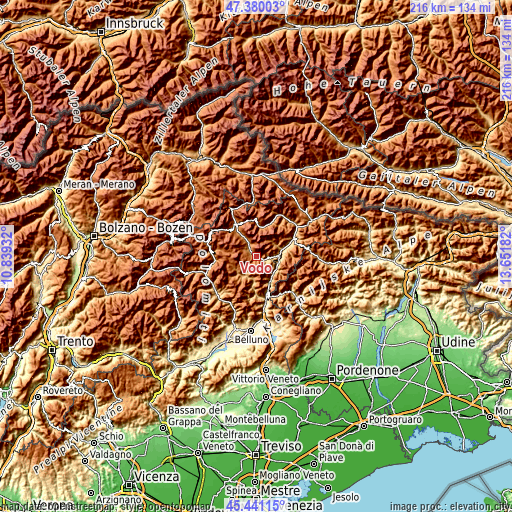
| \ | Map #1 | Topo.Map |
| Scale [m] | 764..2964 m | × |
| Scale [ft] | 2507..9724 ft | × |
| Average | 1364.7 m = 4477 ft | × |
| Width | 6.74 km = 4.2 mi | 215.6 km = 134 mi |
| Height | 6.74 km = 4.2 mi | 215.6 km = 134 mi |
| ↑Max Latitude | 46.449496° | 47.38003° |
| Latitude at center | 46.41921° | 46.41921° |
| ↓Min Latitude | 46.388907° | 45.44115° |
| ← Min Longitude | 12.201625° | 10.83932° |
| Longitude center | 12.24557° | 12.24557° |
| →Max Longitude | 12.289515° | 13.65182° |
Nearby cities:
Cities around Vodo sort by population:
• Pieve di Cadore elevation 843 m
9.1 km,  86°
86°
• Calalzo di Cadore 807 m
10.9 km,  73°
73°
• San Vito 1022 m
5.7 km,  328°
328°
• Forno di Zoldo 953 m
9.2 km,  213°
213°
• Valle di Cadore 845 m
6.8 km, 91°
• Borca 923 m
2.5 km,  313°
313°
• Bortolot 1443 m
6.6 km,  236°
236°
• Zoppè di Cadore 1443 m
6.6 km, 236°
• Fusine 1196 m
10.4 km, 242°
• Ospitale di Cadore 499 m
11.7 km,  149°
149°
• Cibiana 1026 m
4.6 km,  137°
137°
• Perarolo di Cadore 528 m
9 km,  108°
108°
Multilingual:
 En español:
Vodo elevación 886 m.
 En France:
Vodo di Cadore élévation 886 m.


Sources and notes:
- [note 1] Map square and city borders are not equal. Map elevation data is calculated only from area inside that square.
- [src 1] Elevation data from geonames database provided with same terms of usage.
- [src 2] The elevation map of Vodo is generated using elevation data from NASA's 3 arcsec (90m) resolution SRTM data.
- [src 3] Base (background) map © OpenStreetMap contributors tiles are generated by Geofabrik and OpenTopoMap.
Copyright & License:
This Vodo Elevation Map is licensed under CC BY-SA. You may reuse any part from this page, if you give a proper credit by linking to this URL:
 More info on terms of use page.