Zavattarello elevation
Zavattarello (Lombardy, Provincia di Pavia), Italy elevation is 544 meters and Zavattarello elevation in feet is 1785 ft above sea level [src 1]. Zavattarello is a seat of a third-order administrative division (feature code) with elevation that is 222 meters (728 ft) bigger than average city elevation in Italy.
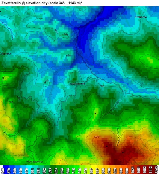
Below is the Elevation map of Zavattarello, which displays elevation range with different colors. Scale of the first map is from 348 to 1143 m (1142 to 3750 ft) with average elevation of 601 meters (=1972 ft) [note 1]
These maps also provides idea of topography and contour of this city, they are displayed at different zoom levels. More info about maps, scale and edge coordinates you can find below images.
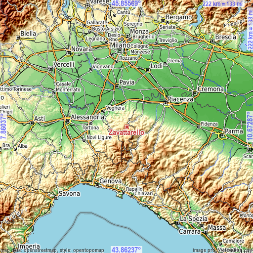
| \ | Map #1 | Topo.Map |
| Scale [m] | 348..1143 m | × |
| Scale [ft] | 1142..3750 ft | × |
| Average | 601 m = 1972 ft | × |
| Width | 6.93 km = 4.3 mi | 221.6 km = 137.7 mi |
| Height | 6.93 km = 4.3 mi | 221.6 km = 137.7 mi |
| ↑Max Latitude | 44.898797° | 45.85569° |
| Latitude at center | 44.86766° | 44.86766° |
| ↓Min Latitude | 44.836506° | 43.86237° |
| ← Min Longitude | 9.222675° | 7.86037° |
| Longitude center | 9.26662° | 9.26662° |
| →Max Longitude | 9.310565° | 10.67287° |
Nearby cities:
Cities around Zavattarello sort by population:
• Solaro elevation 441 m
7.5 km,  280°
280°
• Varzi 419 m
7.4 km,  227°
227°
• Nibbiano 290 m
6.4 km,  49°
49°
• Pometo 522 m
6.7 km,  4°
4°
• Romagnese 643 m
5.7 km,  121°
121°
• Caminata 351 m
5.8 km,  34°
34°
• Casa Ponte 411 m
8.1 km, 277°
• Mombelli 562 m
2.5 km,  272°
272°
• Menconico 722 m
8 km,  172°
172°
• Fortunago 459 m
8.8 km,  312°
312°
• Caseo 408 m
8.5 km, 4°
• Ruino 539 m
4.9 km,  8°
8°
Multilingual:
 En español:
Zavattarello elevación 544 m.
 En France:
Zavattarello élévation 544 m.
 Auf Deutsch:
Zavattarello höhe über dem Meeresspiegel ist 544 m.

Sources and notes:
- [note 1] Map square and city borders are not equal. Map elevation data is calculated only from area inside that square.
- [src 1] Elevation data from geonames database provided with same terms of usage.
- [src 2] The elevation map of Zavattarello is generated using elevation data from NASA's 3 arcsec (90m) resolution SRTM data.
- [src 3] Base (background) map © OpenStreetMap contributors tiles are generated by Geofabrik and OpenTopoMap.
Copyright & License:
This Zavattarello Elevation Map is licensed under CC BY-SA. You may reuse any part from this page, if you give a proper credit by linking to this URL:
 More info on terms of use page.