Cassaro elevation
Cassaro (Sicily, Provincia di Siracusa), Italy elevation is 552 meters and Cassaro elevation in feet is 1811 ft above sea level [src 1]. Cassaro is a seat of a third-order administrative division (feature code) with elevation that is 230 meters (755 ft) bigger than average city elevation in Italy.
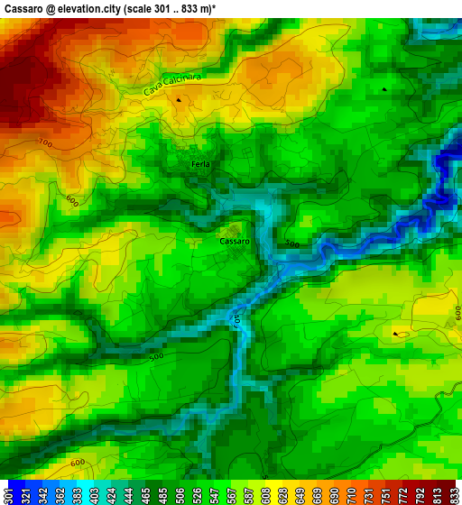
Below is the Elevation map of Cassaro, which displays elevation range with different colors. Scale of the first map is from 301 to 833 m (988 to 2733 ft) with average elevation of 555.8 meters (=1823 ft) [note 1]
These maps also provides idea of topography and contour of this city, they are displayed at different zoom levels. More info about maps, scale and edge coordinates you can find below images.
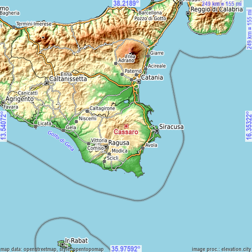
| \ | Map #1 | Topo.Map |
| Scale [m] | 301..833 m | × |
| Scale [ft] | 988..2733 ft | × |
| Average | 555.8 m = 1823 ft | × |
| Width | 7.79 km = 4.8 mi | 249.4 km = 155 mi |
| Height | 7.79 km = 4.8 mi | 249.4 km = 155 mi |
| ↑Max Latitude | 37.140749° | 38.2189° |
| Latitude at center | 37.10571° | 37.10571° |
| ↓Min Latitude | 37.070654° | 35.97592° |
| ← Min Longitude | 14.903025° | 13.54072° |
| Longitude center | 14.94697° | 14.94697° |
| →Max Longitude | 14.990915° | 16.35322° |
Nearby cities:
Cities around Cassaro sort by population:
• Francofonte elevation 300 m
14.7 km,  334°
334°
• Sortino 430 m
9.4 km,  51°
51°
• Palazzolo Acreide 668 m
6 km,  217°
217°
• Solarino 171 m
15.3 km,  91°
91°
• Canicattini Bagni 376 m
13.2 km,  128°
128°
• Vizzini 564 m
18 km,  290°
290°
• Monterosso Almo 674 m
16.2 km,  263°
263°
• Giarratana 521 m
15 km,  244°
244°
• Ferla 555 m
1.7 km,  335°
335°
• Pedagaggi 340 m
9.6 km,  354°
354°
• Buccheri 815 m
8.7 km,  284°
284°
• Buscemi 757 m
5.9 km,  248°
248°
Multilingual:
 En español:
Cassaro elevación 552 m.
 En France:
Cassaro élévation 552 m.


Sources and notes:
- [note 1] Map square and city borders are not equal. Map elevation data is calculated only from area inside that square.
- [src 1] Elevation data from geonames database provided with same terms of usage.
- [src 2] The elevation map of Cassaro is generated using elevation data from NASA's 3 arcsec (90m) resolution SRTM data.
- [src 3] Base (background) map © OpenStreetMap contributors tiles are generated by Geofabrik and OpenTopoMap.
Copyright & License:
This Cassaro Elevation Map is licensed under CC BY-SA. You may reuse any part from this page, if you give a proper credit by linking to this URL:
 More info on terms of use page.