Francofonte elevation
Francofonte (Sicily, Provincia di Siracusa), Italy elevation is 300 meters and Francofonte elevation in feet is 984 ft above sea level [src 1]. Francofonte is a seat of a third-order administrative division (feature code) with elevation that is 22 meters (72 ft) smaller than average city elevation in Italy.
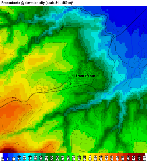
Below is the Elevation map of Francofonte, which displays elevation range with different colors. Scale of the first map is from 51 to 559 m (167 to 1834 ft) with average elevation of 250 meters (=820 ft) [note 1]
These maps also provides idea of topography and contour of this city, they are displayed at different zoom levels. More info about maps, scale and edge coordinates you can find below images.
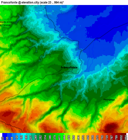
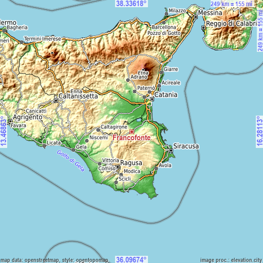
| \ | Map #1 | Map #2 | Topo.Map |
| Scale [m] | 51..559 m | 23..864 m | × |
| Scale [ft] | 167..1834 ft | 75..2835 ft | × |
| Average | 250 m = 820 ft | 319.7 m = 1049 ft | × |
| Width | 7.78 km = 4.8 mi | 15.56 km = 9.7 mi | 249 km = 154.7 mi |
| Height | 7.78 km = 4.8 mi | 15.56 km = 9.7 mi | 249 km = 154.7 mi |
| ↑Max Latitude | 37.259754° | 37.294722° | 38.33618° |
| Latitude at center | 37.22477° | 37.22477° | 37.22477° |
| ↓Min Latitude | 37.18977° | 37.154753° | 36.09674° |
| ← Min Longitude | 14.830935° | 14.786989° | 13.46863° |
| Longitude center | 14.87488° | 14.87488° | 14.87488° |
| →Max Longitude | 14.918825° | 14.962771° | 16.28113° |
Nearby cities:
Cities around Francofonte sort by population:
• Lentini elevation 61 m
12.8 km,  58°
58°
• Scordia 160 m
8.4 km,  338°
338°
• Palagonia 158 m
16.4 km,  315°
315°
• Carlentini 134 m
13.5 km, 62°
• Sortino 430 m
15.6 km,  118°
118°
• Militello in Val di Catania 428 m
9.2 km,  308°
308°
• Vizzini 564 m
12.6 km,  236°
236°
• Ferla 555 m
13 km,  154°
154°
• Pedagaggi 340 m
6.6 km, 123°
• Buccheri 815 m
11.3 km,  190°
190°
• Buscemi 757 m
15.5 km,  176°
176°
• Cassaro 552 m
14.7 km, 154°
Multilingual:
 En español:
Francofonte elevación 300 m.
 En France:
Francofonte élévation 300 m.
 Auf Deutsch:
Francofonte höhe über dem Meeresspiegel ist 300 m.

Sources and notes:
- [note 1] Map square and city borders are not equal. Map elevation data is calculated only from area inside that square.
- [src 1] Elevation data from geonames database provided with same terms of usage.
- [src 2] The elevation map of Francofonte is generated using elevation data from NASA's 3 arcsec (90m) resolution SRTM data.
- [src 3] Base (background) map © OpenStreetMap contributors tiles are generated by Geofabrik and OpenTopoMap.
Copyright & License:
This Francofonte Elevation Map is licensed under CC BY-SA. You may reuse any part from this page, if you give a proper credit by linking to this URL:
 More info on terms of use page.