Doria elevation
Doria (Calabria, Provincia di Cosenza), Italy elevation is 53 meters and Doria elevation in feet is 174 ft above sea level [src 1]. Doria is a populated place (feature code) with elevation that is 269 meters (883 ft) smaller than average city elevation in Italy.
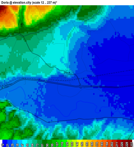
Below is the Elevation map of Doria, which displays elevation range with different colors. Scale of the first map is from 12 to 237 m (39 to 778 ft) with average elevation of 48.9 meters (=160 ft) [note 1]
These maps also provides idea of topography and contour of this city, they are displayed at different zoom levels. More info about maps, scale and edge coordinates you can find below images.
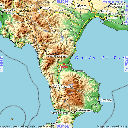
| \ | Map #1 | Topo.Map |
| Scale [m] | 12..237 m | × |
| Scale [ft] | 39..778 ft | × |
| Average | 48.9 m = 160 ft | × |
| Width | 7.52 km = 4.7 mi | 240.5 km = 149.4 mi |
| Height | 7.52 km = 4.7 mi | 240.5 km = 149.4 mi |
| ↑Max Latitude | 39.764208° | 40.80341° |
| Latitude at center | 39.73042° | 39.73042° |
| ↓Min Latitude | 39.696615° | 38.64047° |
| ← Min Longitude | 16.312025° | 14.94972° |
| Longitude center | 16.35597° | 16.35597° |
| →Max Longitude | 16.399915° | 17.76222° |
Nearby cities:
Cities around Doria sort by population:
• Cassano Allo Ionio elevation 164 m
6.2 km,  336°
336°
• Spezzano Albanese 347 m
8 km,  210°
210°
• Terranova da Sibari 287 m
8.4 km,  189°
189°
• Francavilla Marittima 145 m
10.1 km,  19°
19°
• San Lorenzo del Vallo 332 m
8.6 km, 214°
• Frascineto 469 m
13.9 km,  325°
325°
• Villapiana Lido 8 m
14.5 km,  51°
51°
• Sibari 6 m
8.7 km,  77°
77°
• Tarsia 210 m
13.9 km, 210°
• Cantinella 37 m
10.8 km,  132°
132°
• San Nico 39 m
9.4 km,  136°
136°
• Civita 426 m
11.4 km, 341°
Multilingual:
 En español:
Doria elevación 53 m.
 En France:
Doria élévation 53 m.


Sources and notes:
- [note 1] Map square and city borders are not equal. Map elevation data is calculated only from area inside that square.
- [src 1] Elevation data from geonames database provided with same terms of usage.
- [src 2] The elevation map of Doria is generated using elevation data from NASA's 3 arcsec (90m) resolution SRTM data.
- [src 3] Base (background) map © OpenStreetMap contributors tiles are generated by Geofabrik and OpenTopoMap.
Copyright & License:
This Doria Elevation Map is licensed under CC BY-SA. You may reuse any part from this page, if you give a proper credit by linking to this URL:
 More info on terms of use page.