Monastir elevation
Monastir (Sardinia, Provincia del Sud Sardegna), Italy elevation is 80 meters and Monastir elevation in feet is 262 ft above sea level [src 1]. Monastir is a seat of a third-order administrative division (feature code) with elevation that is 242 meters (794 ft) smaller than average city elevation in Italy.
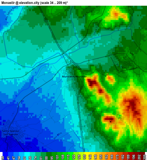
Below is the Elevation map of Monastir, which displays elevation range with different colors. Scale of the first map is from 34 to 209 m (112 to 686 ft) with average elevation of 82.6 meters (=271 ft) [note 1]
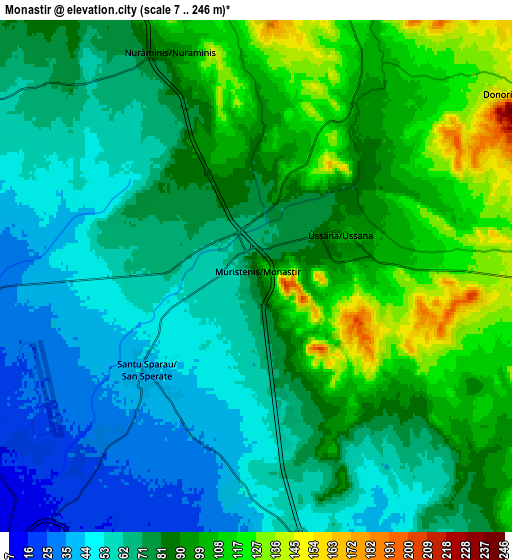
These maps also provides idea of topography and contour of this city, they are displayed at different zoom levels. More info about maps, scale and edge coordinates you can find below images.
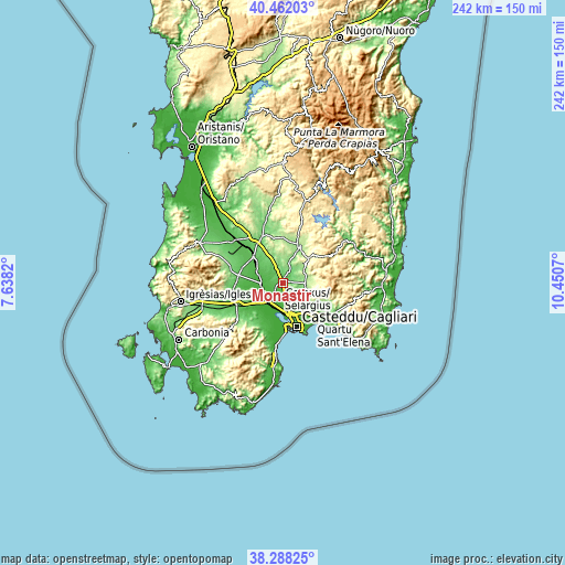
| \ | Map #1 | Map #2 | Topo.Map |
| Scale [m] | 34..209 m | 7..246 m | × |
| Scale [ft] | 112..686 ft | 23..807 ft | × |
| Average | 82.6 m = 271 ft | 79.8 m = 262 ft | × |
| Width | 7.55 km = 4.7 mi | 15.11 km = 9.4 mi | 241.7 km = 150.2 mi |
| Height | 7.55 km = 4.7 mi | 15.11 km = 9.4 mi | 241.7 km = 150.2 mi |
| ↑Max Latitude | 39.417558° | 39.451499° | 40.46203° |
| Latitude at center | 39.3836° | 39.3836° | 39.3836° |
| ↓Min Latitude | 39.349626° | 39.315635° | 38.28825° |
| ← Min Longitude | 9.000505° | 8.956559° | 7.6382° |
| Longitude center | 9.04445° | 9.04445° | 9.04445° |
| →Max Longitude | 9.088395° | 9.132341° | 10.4507° |
Nearby cities:
Cities around Monastir sort by population:
• Assemini elevation 8 m
11 km,  200°
200°
• Sestu 45 m
10.3 km,  156°
156°
• Dolianova 225 m
11.4 km,  93°
93°
• Decimomannu 11 m
10.4 km,  218°
218°
• San Sperate 42 m
4.3 km,  227°
227°
• Villasor 27 m
8.7 km,  268°
268°
• Ussana 98 m
2.9 km,  66°
66°
• Serdiana 171 m
9.9 km,  95°
95°
• Nuraminis 88 m
7.1 km,  338°
338°
• Donorì 153 m
8.9 km,  52°
52°
• Samatzai 164 m
11.1 km,  355°
355°
• Barrali 139 m
11.3 km,  25°
25°
Multilingual:
 En español:
Monastir elevación 80 m.
 En France:
Monastir élévation 80 m.


Sources and notes:
- [note 1] Map square and city borders are not equal. Map elevation data is calculated only from area inside that square.
- [src 1] Elevation data from geonames database provided with same terms of usage.
- [src 2] The elevation map of Monastir is generated using elevation data from NASA's 3 arcsec (90m) resolution SRTM data.
- [src 3] Base (background) map © OpenStreetMap contributors tiles are generated by Geofabrik and OpenTopoMap.
Copyright & License:
This Monastir Elevation Map is licensed under CC BY-SA. You may reuse any part from this page, if you give a proper credit by linking to this URL:
 More info on terms of use page.