Naro elevation
Naro (Sicily, Agrigento), Italy elevation is 489 meters and Naro elevation in feet is 1604 ft above sea level [src 1]. Naro is a seat of a third-order administrative division (feature code) with elevation that is 167 meters (548 ft) bigger than average city elevation in Italy.
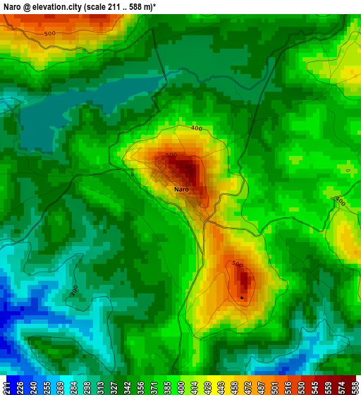
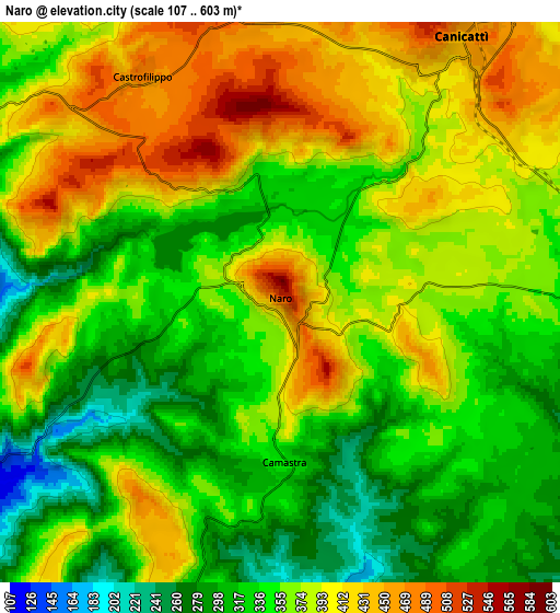
Below is the Elevation map of Naro, which displays elevation range with different colors. Scale of the first map is from 211 to 588 m (692 to 1929 ft) with average elevation of 361 meters (=1184 ft) [note 1]
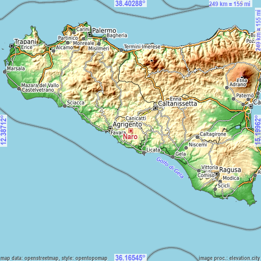
These maps also provides idea of topography and contour of this city, they are displayed at different zoom levels. More info about maps, scale and edge coordinates you can find below images.
| \ | Map #1 | Map #2 | Topo.Map |
| Scale [m] | 211..588 m | 107..603 m | × |
| Scale [ft] | 692..1929 ft | 351..1978 ft | × |
| Average | 361 m = 1184 ft | 364.6 m = 1196 ft | × |
| Width | 7.77 km = 4.8 mi | 15.55 km = 9.7 mi | 248.8 km = 154.6 mi |
| Height | 7.77 km = 4.8 mi | 15.55 km = 9.7 mi | 248.8 km = 154.6 mi |
| ↑Max Latitude | 37.327433° | 37.362369° | 38.40288° |
| Latitude at center | 37.29248° | 37.29248° | 37.29248° |
| ↓Min Latitude | 37.257511° | 37.222526° | 36.16545° |
| ← Min Longitude | 13.749425° | 13.705479° | 12.38712° |
| Longitude center | 13.79337° | 13.79337° | 13.79337° |
| →Max Longitude | 13.837315° | 13.881261° | 15.19962° |
Nearby cities:
Cities around Naro sort by population:
• Canicattì elevation 458 m
8.8 km,  33°
33°
• Favara 317 m
11.9 km,  283°
283°
• Palma di Montechiaro 176 m
11.6 km,  192°
192°
• Ravanusa 317 m
15.7 km,  100°
100°
• Campobello di Licata 323 m
11.7 km,  109°
109°
• Racalmuto 501 m
13.7 km,  335°
335°
• Grotte 512 m
14.9 km,  325°
325°
• Delia 438 m
14 km,  58°
58°
• Castrofilippo 488 m
7.5 km, 329°
• Camastra 349 m
4.3 km,  181°
181°
• Montedoro 447 m
18.1 km,  6°
6°
• Comitini 342 m
18.3 km,  314°
314°
Multilingual:
 En español:
Naro elevación 489 m.
 En France:
Naro élévation 489 m.


Sources and notes:
- [note 1] Map square and city borders are not equal. Map elevation data is calculated only from area inside that square.
- [src 1] Elevation data from geonames database provided with same terms of usage.
- [src 2] The elevation map of Naro is generated using elevation data from NASA's 3 arcsec (90m) resolution SRTM data.
- [src 3] Base (background) map © OpenStreetMap contributors tiles are generated by Geofabrik and OpenTopoMap.
Copyright & License:
This Naro Elevation Map is licensed under CC BY-SA. You may reuse any part from this page, if you give a proper credit by linking to this URL:
 More info on terms of use page.