Sant'Agata di Esaro elevation
Sant'Agata di Esaro (Calabria, Provincia di Cosenza), Italy elevation is 479 meters and Sant'Agata di Esaro elevation in feet is 1572 ft above sea level [src 1]. Sant'Agata di Esaro is a seat of a third-order administrative division (feature code) with elevation that is 157 meters (515 ft) bigger than average city elevation in Italy.
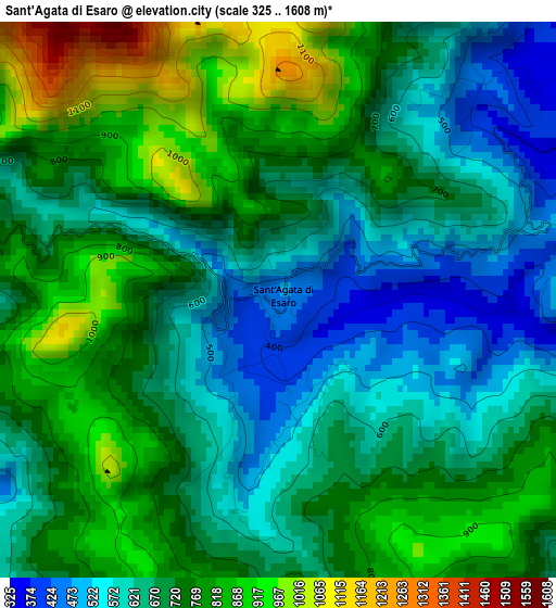
Below is the Elevation map of Sant'Agata di Esaro, which displays elevation range with different colors. Scale of the first map is from 325 to 1608 m (1066 to 5276 ft) with average elevation of 710.2 meters (=2330 ft) [note 1]
These maps also provides idea of topography and contour of this city, they are displayed at different zoom levels. More info about maps, scale and edge coordinates you can find below images.
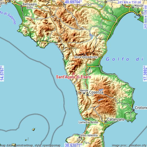
| \ | Map #1 | Topo.Map |
| Scale [m] | 325..1608 m | × |
| Scale [ft] | 1066..5276 ft | × |
| Average | 710.2 m = 2330 ft | × |
| Width | 7.53 km = 4.7 mi | 240.9 km = 149.7 mi |
| Height | 7.53 km = 4.7 mi | 240.9 km = 149.7 mi |
| ↑Max Latitude | 39.656191° | 40.69704° |
| Latitude at center | 39.62235° | 39.62235° |
| ↓Min Latitude | 39.588492° | 38.53071° |
| ← Min Longitude | 15.939005° | 14.5767° |
| Longitude center | 15.98295° | 15.98295° |
| →Max Longitude | 16.026895° | 17.3892° |
Nearby cities:
Cities around Sant'Agata di Esaro sort by population:
• Belvedere Marittimo elevation 198 m
10.3 km,  268°
268°
• Fagnano Castello 478 m
8.9 km,  129°
129°
• Cetraro 138 m
12.3 km,  196°
196°
• San Sosti 354 m
5.7 km,  44°
44°
• Cittadella del Capo 32 m
11.5 km,  232°
232°
• Mottafollone 374 m
7.6 km,  67°
67°
• Bonifati 427 m
8.1 km,  239°
239°
• San Donato di Ninea 800 m
11.4 km,  29°
29°
• Sangineto 280 m
6.1 km,  252°
252°
• Malvito 372 m
6.5 km,  111°
111°
• Santa Caterina Albanese 461 m
8.5 km,  118°
118°
• Buonvicino 443 m
11.2 km,  311°
311°
Multilingual:
 En español:
Sant'Agata di Esaro elevación 479 m.
 En France:
Sant'Agata di Esaro élévation 479 m.
 Auf Deutsch:
Sant'Agata di Esaro höhe über dem Meeresspiegel ist 479 m.
 На русском:
Sant'Agata di Esaro высота над уровнем моря 479 м
Sources and notes:
- [note 1] Map square and city borders are not equal. Map elevation data is calculated only from area inside that square.
- [src 1] Elevation data from geonames database provided with same terms of usage.
- [src 2] The elevation map of Sant'Agata di Esaro is generated using elevation data from NASA's 3 arcsec (90m) resolution SRTM data.
- [src 3] Base (background) map © OpenStreetMap contributors tiles are generated by Geofabrik and OpenTopoMap.
Copyright & License:
This Sant'Agata di Esaro Elevation Map is licensed under CC BY-SA. You may reuse any part from this page, if you give a proper credit by linking to this URL:
 More info on terms of use page.