Scarcelli elevation
Scarcelli (Calabria, Provincia di Cosenza), Italy elevation is 46 meters and Scarcelli elevation in feet is 151 ft above sea level [src 1]. Scarcelli is a populated place (feature code) with elevation that is 276 meters (906 ft) smaller than average city elevation in Italy.
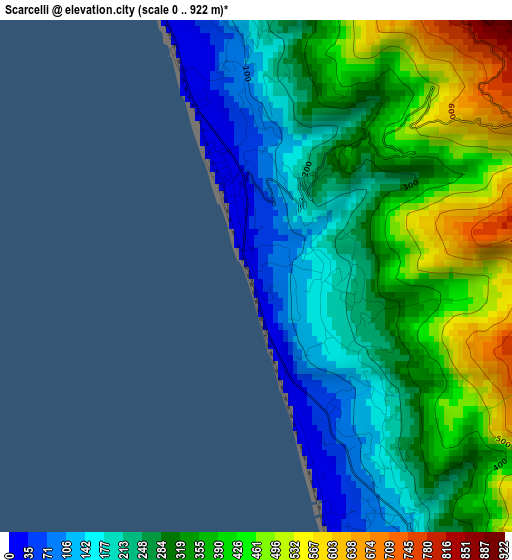
Below is the Elevation map of Scarcelli, which displays elevation range with different colors. Scale of the first map is from 0 to 922 m (0 to 3025 ft) with average elevation of 310 meters (=1017 ft) [note 1]
These maps also provides idea of topography and contour of this city, they are displayed at different zoom levels. More info about maps, scale and edge coordinates you can find below images.
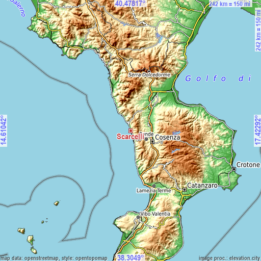
| \ | Map #1 | Topo.Map |
| Scale [m] | 0..922 m | × |
| Scale [ft] | 0..3025 ft | × |
| Average | 310 m = 1017 ft | × |
| Width | 7.55 km = 4.7 mi | 241.6 km = 150.1 mi |
| Height | 7.55 km = 4.7 mi | 241.6 km = 150.1 mi |
| ↑Max Latitude | 39.43395° | 40.47817° |
| Latitude at center | 39.4° | 39.4° |
| ↓Min Latitude | 39.366034° | 38.3049° |
| ← Min Longitude | 15.972725° | 14.61042° |
| Longitude center | 16.01667° | 16.01667° |
| →Max Longitude | 16.060615° | 17.42292° |
Nearby cities:
Cities around Scarcelli sort by population:
• Paola elevation 75 m
4.5 km,  157°
157°
• San Lucido 88 m
10.5 km, 162°
• Marina di Fuscaldo 21 m
2.8 km,  342°
342°
• Montalto Uffugo 423 m
11.9 km,  88°
88°
• Lattarico 415 m
11 km,  59°
59°
• Rota Greca 491 m
11.2 km,  48°
48°
• Marina 8 m
7.7 km, 336°
• Fuscaldo 283 m
1.9 km,  32°
32°
• San Vincenzo la Costa 477 m
12.2 km,  108°
108°
• San Benedetto Ullano 438 m
9.7 km,  71°
71°
• Guardia Piemontese 493 m
7.5 km,  348°
348°
• Acquappesa 100 m
11.9 km,  333°
333°
Multilingual:
 En español:
Scarcelli elevación 46 m.
 En France:
Scarcelli élévation 46 m.
 Auf Deutsch:
Scarcelli höhe über dem Meeresspiegel ist 46 m.

Sources and notes:
- [note 1] Map square and city borders are not equal. Map elevation data is calculated only from area inside that square.
- [src 1] Elevation data from geonames database provided with same terms of usage.
- [src 2] The elevation map of Scarcelli is generated using elevation data from NASA's 3 arcsec (90m) resolution SRTM data.
- [src 3] Base (background) map © OpenStreetMap contributors tiles are generated by Geofabrik and OpenTopoMap.
Copyright & License:
This Scarcelli Elevation Map is licensed under CC BY-SA. You may reuse any part from this page, if you give a proper credit by linking to this URL:
 More info on terms of use page.