Salmās elevation
Salmās (West Azerbaijan), Iran elevation is 1382 meters and Salmās elevation in feet is 4534 ft above sea level [src 1]. Salmās is a seat of a second-order administrative division (feature code) with elevation that is 338 meters (1109 ft) bigger than average city elevation in Iran.
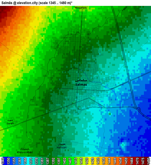
Below is the Elevation map of Salmās, which displays elevation range with different colors. Scale of the first map is from 1345 to 1480 m (4413 to 4856 ft) with average elevation of 1389.8 meters (=4560 ft) [note 1]
These maps also provides idea of topography and contour of this city, they are displayed at different zoom levels. More info about maps, scale and edge coordinates you can find below images.
| \ | Map #1 | Map #2 | Topo.Map |
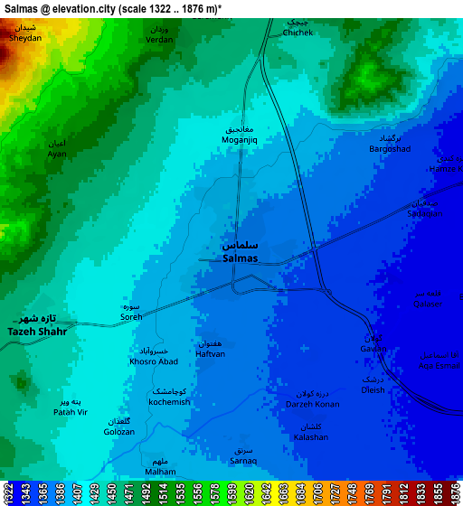
| Scale [m] | 1345..1480 m | 1322..1876 m | × |
| Scale [ft] | 4413..4856 ft | 4337..6155 ft | × |
| Average | 1389.8 m = 4560 ft | 1418.6 m = 4654 ft | × |
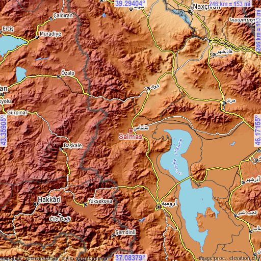
| Width | 7.68 km = 4.8 mi | 15.36 km = 9.5 mi | 245.8 km = 152.7 mi |
| Height | 7.68 km = 4.8 mi | 15.36 km = 9.5 mi | 245.8 km = 152.7 mi |
| ↑Max Latitude | 38.231828° | 38.266339° | 39.29404° |
| Latitude at center | 38.1973° | 38.1973° | 38.1973° |
| ↓Min Latitude | 38.162756° | 38.128195° | 37.08379° |
| ← Min Longitude | 44.721355° | 44.677409° | 43.35905° |
| Longitude center | 44.7653° | 44.7653° | 44.7653° |
| →Max Longitude | 44.809245° | 44.853191° | 46.17155° |
Nearby cities:
Cities around Salmās sort by population:
• Orūmīyeh elevation 1350 m
76.7 km,  159°
159°
• Khowy 1143 m
42.5 km,  22°
22°
• Marand 1322 m
91.9 km,  73°
73°
• Qarah Ẕīā’ od Dīn 1090 m
80.4 km, 16°
• ‘Ajab Shīr 1297 m
127.4 km,  128°
128°
• Varazqān 1532 m
128.8 km, 65°
• Maku 1228 m
124.3 km,  347°
347°
• Oskū 1512 m
122.9 km,  104°
104°
• Āz̄arshahr 1386 m
116.9 km,  114°
114°
• Showţ 994 m
113.6 km,  0°
0°
• Seyah Cheshmeh 1832 m
102 km,  341°
341°
• Shabestar 1433 m
82 km,  91°
91°
Multilingual:
 En español:
Salmās elevación 1382 m.
 En France:
Salmās élévation 1382 m.


Sources and notes:
- [note 1] Map square and city borders are not equal. Map elevation data is calculated only from area inside that square.
- [src 1] Elevation data from geonames database provided with same terms of usage.
- [src 2] The elevation map of Salmās is generated using elevation data from NASA's 3 arcsec (90m) resolution SRTM data.
- [src 3] Base (background) map © OpenStreetMap contributors tiles are generated by Geofabrik and OpenTopoMap.
Copyright & License:
This Salmās Elevation Map is licensed under CC BY-SA. You may reuse any part from this page, if you give a proper credit by linking to this URL:
 More info on terms of use page.