Ad Dujayl elevation
Ad Dujayl (Salah ad Din, Al-Faris), Iraq elevation is 46 meters and Ad Dujayl elevation in feet is 151 ft above sea level [src 1]. Ad Dujayl is a populated place (feature code) with elevation that is 247 meters (810 ft) smaller than average city elevation in Iraq.
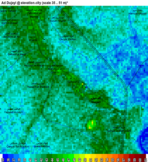
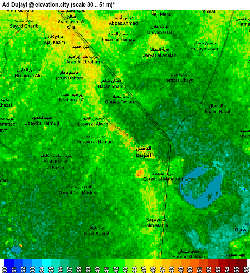
Below is the Elevation map of Ad Dujayl, which displays elevation range with different colors. Scale of the first map is from 35 to 51 m (115 to 167 ft) with average elevation of 40.4 meters (=133 ft) [note 1]
These maps also provides idea of topography and contour of this city, they are displayed at different zoom levels. More info about maps, scale and edge coordinates you can find below images.
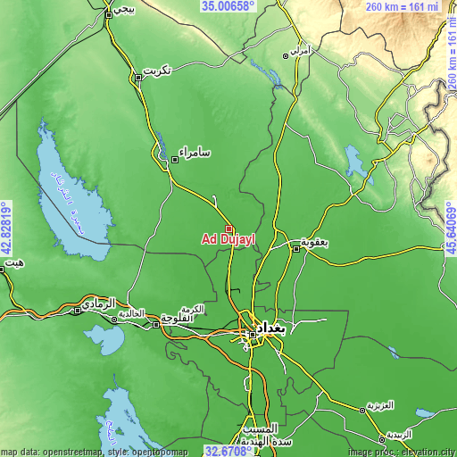
| \ | Map #1 | Map #2 | Topo.Map |
| Scale [m] | 35..51 m | 30..51 m | × |
| Scale [ft] | 115..167 ft | 98..167 ft | × |
| Average | 40.4 m = 133 ft | 40.2 m = 132 ft | × |
| Width | 8.12 km = 5 mi | 16.23 km = 10.1 mi | 259.7 km = 161.4 mi |
| Height | 8.12 km = 5 mi | 16.23 km = 10.1 mi | 259.7 km = 161.4 mi |
| ↑Max Latitude | 33.88316° | 33.919635° | 35.00658° |
| Latitude at center | 33.84667° | 33.84667° | 33.84667° |
| ↓Min Latitude | 33.810164° | 33.773643° | 32.6708° |
| ← Min Longitude | 44.190495° | 44.146549° | 42.82819° |
| Longitude center | 44.23444° | 44.23444° | 44.23444° |
| →Max Longitude | 44.278385° | 44.322331° | 45.64069° |
Nearby cities:
Cities around Ad Dujayl sort by population:
• Baghdad elevation 41 m
58.3 km,  164°
164°
• Abū Ghurayb 42 m
60.3 km,  184°
184°
• Al Fallūjah 45 m
69.2 km,  216°
216°
• Sāmarrā’ 80 m
50.4 km,  320°
320°
• Baqubah 48 m
35.8 km,  106°
106°
• Khāliş 43 m
27.9 km,  98°
98°
• Al Miqdādīyah 60 m
66.5 km,  77°
77°
• Balad 53 m
20.4 km,  336°
336°
• Baladrūz 42 m
79.7 km, 102°
• Ad Dawr 93 m
79 km,  329°
329°
• Al Khāliş 49 m
26.4 km,  88°
88°
• Aţ Ţārmīyah 41 m
24.3 km,  142°
142°
Multilingual:
 En español:
Ad Dujayl elevación 46 m.
 En France:
Doujaïl élévation 46 m.
 Auf Deutsch:
Dudschail höhe über dem Meeresspiegel ist 46 m.

Sources and notes:
- [note 1] Map square and city borders are not equal. Map elevation data is calculated only from area inside that square.
- [src 1] Elevation data from geonames database provided with same terms of usage.
- [src 2] The elevation map of Ad Dujayl is generated using elevation data from NASA's 3 arcsec (90m) resolution SRTM data.
- [src 3] Base (background) map © OpenStreetMap contributors tiles are generated by Geofabrik and OpenTopoMap.
Copyright & License:
This Ad Dujayl Elevation Map is licensed under CC BY-SA. You may reuse any part from this page, if you give a proper credit by linking to this URL:
 More info on terms of use page.