Abū Ghurayb elevation
Abū Ghurayb (Baghdad, Abu Ghraib District), Iraq elevation is 42 meters and Abū Ghurayb elevation in feet is 138 ft above sea level [src 1]. Abū Ghurayb is a seat of a second-order administrative division (feature code) with elevation that is 251 meters (823 ft) smaller than average city elevation in Iraq.
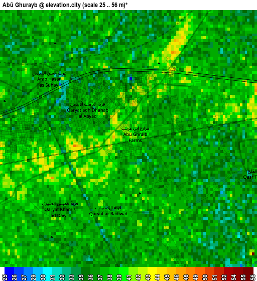
Below is the Elevation map of Abū Ghurayb, which displays elevation range with different colors. Scale of the first map is from 25 to 56 m (82 to 184 ft) with average elevation of 37.2 meters (=122 ft) [note 1]
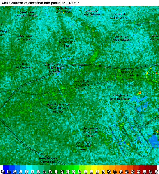
These maps also provides idea of topography and contour of this city, they are displayed at different zoom levels. More info about maps, scale and edge coordinates you can find below images.
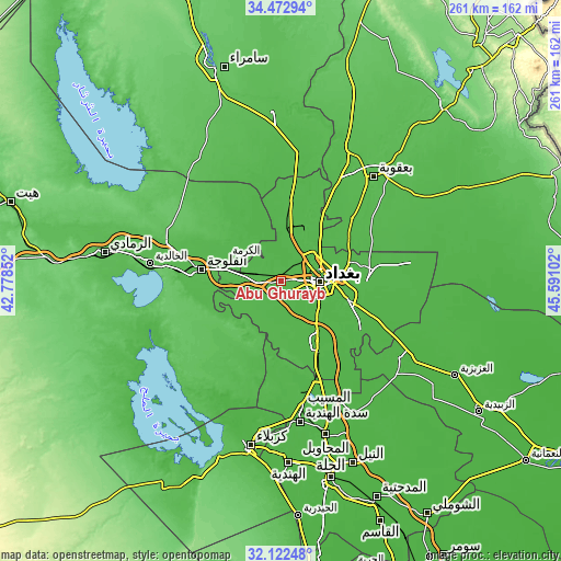
| \ | Map #1 | Map #2 | Topo.Map |
| Scale [m] | 25..56 m | 25..69 m | × |
| Scale [ft] | 82..184 ft | 82..226 ft | × |
| Average | 37.2 m = 122 ft | 36.8 m = 121 ft | × |
| Width | 8.17 km = 5.1 mi | 16.33 km = 10.1 mi | 261.3 km = 162.4 mi |
| Height | 8.17 km = 5.1 mi | 16.33 km = 10.1 mi | 261.3 km = 162.4 mi |
| ↑Max Latitude | 33.34235° | 33.379054° | 34.47294° |
| Latitude at center | 33.30563° | 33.30563° | 33.30563° |
| ↓Min Latitude | 33.268895° | 33.232144° | 32.12248° |
| ← Min Longitude | 44.140825° | 44.096879° | 42.77852° |
| Longitude center | 44.18477° | 44.18477° | 44.18477° |
| →Max Longitude | 44.228715° | 44.272661° | 45.59102° |
Nearby cities:
Cities around Abū Ghurayb sort by population:
• Baghdad elevation 41 m
20.5 km,  79°
79°
• Al Fallūjah 45 m
37.4 km,  277°
277°
• Baqubah 48 m
63.3 km,  38°
38°
• Khāliş 43 m
64.5 km,  30°
30°
• Al Musayyib 37 m
59.4 km,  170°
170°
• Aş Şuwayrah 32 m
69.4 km,  127°
127°
• Nāḩīyat Saddat al Hindīyah 36 m
66.2 km, 172°
• Ad Dujayl 46 m
60.3 km,  4°
4°
• Al Maḩāwīl 30 m
74.6 km,  163°
163°
• Al Khāliş 49 m
68.2 km, 27°
• Aţ Ţārmīyah 41 m
45.4 km, 25°
• Al Maḩmūdīyah 34 m
31.9 km,  148°
148°
Multilingual:
 En español:
Abu Ghraib elevación 42 m.
 En France:
Abou Ghraib élévation 42 m.
 Auf Deutsch:
Abu Ghuraib höhe über dem Meeresspiegel ist 42 m.

Sources and notes:
- [note 1] Map square and city borders are not equal. Map elevation data is calculated only from area inside that square.
- [src 1] Elevation data from geonames database provided with same terms of usage.
- [src 2] The elevation map of Abū Ghurayb is generated using elevation data from NASA's 3 arcsec (90m) resolution SRTM data.
- [src 3] Base (background) map © OpenStreetMap contributors tiles are generated by Geofabrik and OpenTopoMap.
Copyright & License:
This Abū Ghurayb Elevation Map is licensed under CC BY-SA. You may reuse any part from this page, if you give a proper credit by linking to this URL:
 More info on terms of use page.