Singāpur elevation
Singāpur (Telangana, Rangareddi), India elevation is 594 meters and Singāpur elevation in feet is 1949 ft above sea level [src 1]. Singāpur is a populated place (feature code) with elevation that is 301 meters (988 ft) bigger than average city elevation in India.
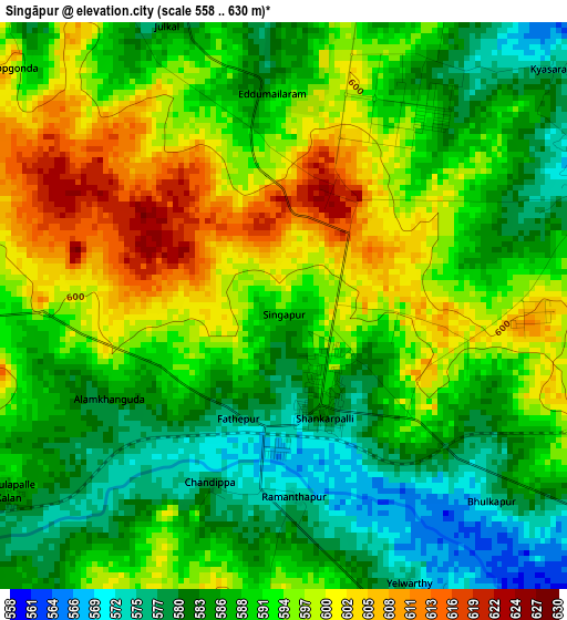
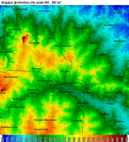
Below is the Elevation map of Singāpur, which displays elevation range with different colors. Scale of the first map is from 558 to 630 m (1831 to 2067 ft) with average elevation of 590.7 meters (=1938 ft) [note 1]
These maps also provides idea of topography and contour of this city, they are displayed at different zoom levels. More info about maps, scale and edge coordinates you can find below images.
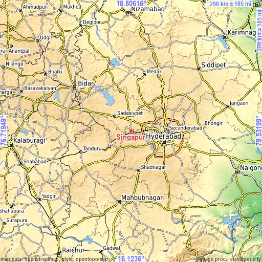
| \ | Map #1 | Map #2 | Topo.Map |
| Scale [m] | 558..630 m | 528..663 m | × |
| Scale [ft] | 1831..2067 ft | 1732..2175 ft | × |
| Average | 590.7 m = 1938 ft | 583.2 m = 1913 ft | × |
| Width | 9.32 km = 5.8 mi | 18.64 km = 11.6 mi | 298.3 km = 185.4 mi |
| Height | 9.32 km = 5.8 mi | 18.64 km = 11.6 mi | 298.3 km = 185.4 mi |
| ↑Max Latitude | 17.511734° | 17.553637° | 18.80616° |
| Latitude at center | 17.46982° | 17.46982° | 17.46982° |
| ↓Min Latitude | 17.427897° | 17.385964° | 16.1236° |
| ← Min Longitude | 78.081795° | 78.037849° | 76.71949° |
| Longitude center | 78.12574° | 78.12574° | 78.12574° |
| →Max Longitude | 78.169685° | 78.213631° | 79.53199° |
Nearby cities:
Cities around Singāpur sort by population:
• Hyderabad elevation 515 m
36.3 km,  105°
105°
• Kūkatpalli 566 m
30.6 km,  86°
86°
• Quthbullapur 554 m
35.4 km,  84°
84°
• Serilingampalle 564 m
18.9 km, 82°
• Malkajgiri 536 m
42.6 km, 93°
• Sangāreddi 514 m
17.7 km,  346°
346°
• Patancheru 540 m
16.3 km,  64°
64°
• Vikārābād 638 m
27.7 km,  238°
238°
• Sadāseopet 550 m
24.8 km,  312°
312°
• Andol 503 m
38.7 km, 352°
• Srīrāmnagar 571 m
26.5 km,  148°
148°
• Medchal 591 m
41.7 km, 64°
Multilingual:
 En español:
Singāpur elevación 594 m.
 En France:
Singāpur élévation 594 m.
 Auf Deutsch:
Singāpur höhe über dem Meeresspiegel ist 594 m.

Sources and notes:
- [note 1] Map square and city borders are not equal. Map elevation data is calculated only from area inside that square.
- [src 1] Elevation data from geonames database provided with same terms of usage.
- [src 2] The elevation map of Singāpur is generated using elevation data from NASA's 3 arcsec (90m) resolution SRTM data.
- [src 3] Base (background) map © OpenStreetMap contributors tiles are generated by Geofabrik and OpenTopoMap.
Copyright & License:
This Singāpur Elevation Map is licensed under CC BY-SA. You may reuse any part from this page, if you give a proper credit by linking to this URL:
 More info on terms of use page.