Arang elevation
Arang (Chhattisgarh, Raipur), India elevation is 284 meters and Arang elevation in feet is 932 ft above sea level [src 1]. Arang is a populated place (feature code) with elevation that is 9 meters (30 ft) smaller than average city elevation in India.
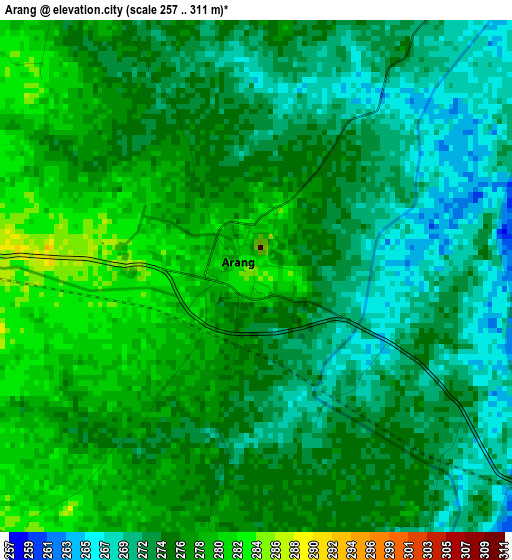
Below is the Elevation map of Arang, which displays elevation range with different colors. Scale of the first map is from 257 to 311 m (843 to 1020 ft) with average elevation of 274.6 meters (=901 ft) [note 1]
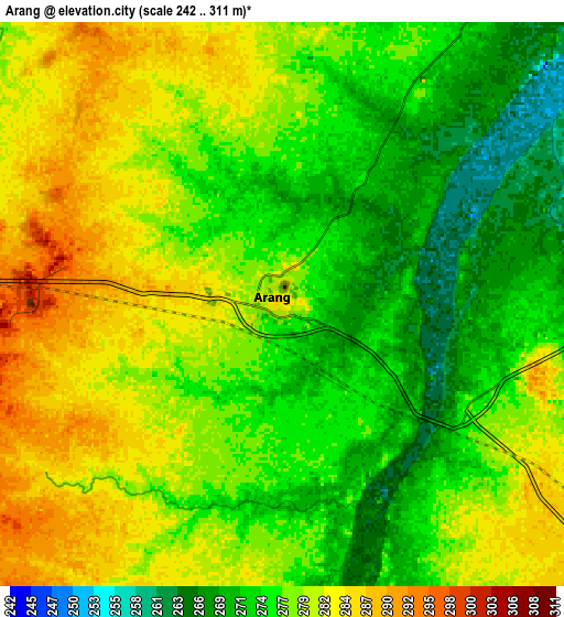
These maps also provides idea of topography and contour of this city, they are displayed at different zoom levels. More info about maps, scale and edge coordinates you can find below images.
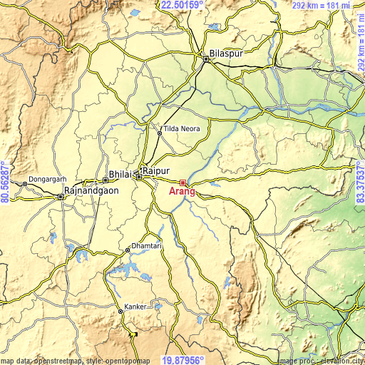
| \ | Map #1 | Map #2 | Topo.Map |
| Scale [m] | 257..311 m | 242..311 m | × |
| Scale [ft] | 843..1020 ft | 794..1020 ft | × |
| Average | 274.6 m = 901 ft | 277.4 m = 910 ft | × |
| Width | 9.11 km = 5.7 mi | 18.22 km = 11.3 mi | 291.5 km = 181.1 mi |
| Height | 9.11 km = 5.7 mi | 18.22 km = 11.3 mi | 291.6 km = 181.2 mi |
| ↑Max Latitude | 21.237357° | 21.278312° | 22.50159° |
| Latitude at center | 21.19639° | 21.19639° | 21.19639° |
| ↓Min Latitude | 21.155412° | 21.114423° | 19.87956° |
| ← Min Longitude | 81.925175° | 81.881229° | 80.56287° |
| Longitude center | 81.96912° | 81.96912° | 81.96912° |
| →Max Longitude | 82.013065° | 82.057011° | 83.37537° |
Nearby cities:
Cities around Arang sort by population:
• Raipur elevation 296 m
35 km,  276°
276°
• Bhilai 307 m
56.1 km,  271°
271°
• Bhātāpāra 275 m
59.9 km,  357°
357°
• Mahāsamund 299 m
16.4 km,  127°
127°
• Kumhāri 279 m
47.5 km, 279°
• Baloda Bāzār 259 m
54.9 km,  21°
21°
• Simga 270 m
55.3 km,  330°
330°
• Kurud 311 m
48.1 km,  212°
212°
• Pātan 300 m
48.7 km,  248°
248°
• Bhatgaon 294 m
28.4 km,  259°
259°
• Pithora 301 m
57.1 km,  83°
83°
• Khamharia 328 m
38.2 km, 129°
Multilingual:
 En español:
Arang elevación 284 m.
 En France:
Arang élévation 284 m.


Sources and notes:
- [note 1] Map square and city borders are not equal. Map elevation data is calculated only from area inside that square.
- [src 1] Elevation data from geonames database provided with same terms of usage.
- [src 2] The elevation map of Arang is generated using elevation data from NASA's 3 arcsec (90m) resolution SRTM data.
- [src 3] Base (background) map © OpenStreetMap contributors tiles are generated by Geofabrik and OpenTopoMap.
Copyright & License:
This Arang Elevation Map is licensed under CC BY-SA. You may reuse any part from this page, if you give a proper credit by linking to this URL:
 More info on terms of use page.