Bāgli elevation
Bāgli (Madhya Pradesh, Dewas), India elevation is 553 meters and Bāgli elevation in feet is 1814 ft above sea level [src 1]. Bāgli is a populated place (feature code) with elevation that is 260 meters (853 ft) bigger than average city elevation in India.
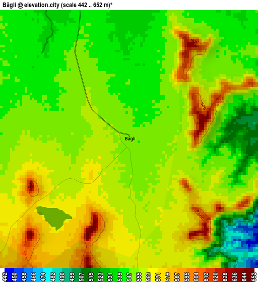
Below is the Elevation map of Bāgli, which displays elevation range with different colors. Scale of the first map is from 442 to 652 m (1450 to 2139 ft) with average elevation of 555.9 meters (=1824 ft) [note 1]
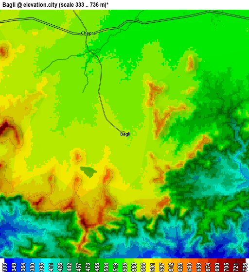
These maps also provides idea of topography and contour of this city, they are displayed at different zoom levels. More info about maps, scale and edge coordinates you can find below images.
| \ | Map #1 | Map #2 | Topo.Map |
| Scale [m] | 442..652 m | 333..736 m | × |
| Scale [ft] | 1450..2139 ft | 1093..2415 ft | × |
| Average | 555.9 m = 1824 ft | 522.3 m = 1714 ft | × |
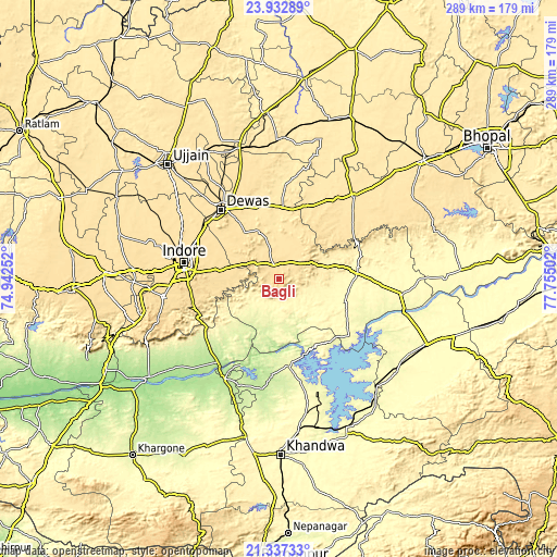
| Width | 9.02 km = 5.6 mi | 18.04 km = 11.2 mi | 288.6 km = 179.3 mi |
| Height | 9.02 km = 5.6 mi | 18.04 km = 11.2 mi | 288.6 km = 179.3 mi |
| ↑Max Latitude | 22.681793° | 22.722333° | 23.93289° |
| Latitude at center | 22.64124° | 22.64124° | 22.64124° |
| ↓Min Latitude | 22.600675° | 22.560099° | 21.33733° |
| ← Min Longitude | 76.304825° | 76.260879° | 74.94252° |
| Longitude center | 76.34877° | 76.34877° | 76.34877° |
| →Max Longitude | 76.392715° | 76.436661° | 77.75502° |
Nearby cities:
Cities around Bāgli sort by population:
• Indore elevation 550 m
53.6 km,  279°
279°
• Punāsa 278 m
45.4 km,  174°
174°
• Dewas 544 m
47 km,  320°
320°
• Ashta 498 m
56.7 km,  42°
42°
• Sanāwad 197 m
59.3 km,  208°
208°
• Khātegaon 302 m
58.2 km,  94°
94°
• Kannod 332 m
40.5 km, 85°
• Sānwer 512 m
65 km,  304°
304°
• Satwās 306 m
36.4 km,  108°
108°
• Hātod 540 m
64.8 km,  285°
285°
• Iklehra 459 m
56.4 km,  4°
4°
• Iāwar 496 m
43.8 km,  20°
20°
Multilingual:
 En español:
Bāgli elevación 553 m.
 En France:
Bāgli élévation 553 m.


Sources and notes:
- [note 1] Map square and city borders are not equal. Map elevation data is calculated only from area inside that square.
- [src 1] Elevation data from geonames database provided with same terms of usage.
- [src 2] The elevation map of Bāgli is generated using elevation data from NASA's 3 arcsec (90m) resolution SRTM data.
- [src 3] Base (background) map © OpenStreetMap contributors tiles are generated by Geofabrik and OpenTopoMap.
Copyright & License:
This Bāgli Elevation Map is licensed under CC BY-SA. You may reuse any part from this page, if you give a proper credit by linking to this URL:
 More info on terms of use page.