Begowāl elevation
Begowāl (Punjab, Kapurthala), India elevation is 233 meters and Begowāl elevation in feet is 764 ft above sea level [src 1]. Begowāl is a populated place (feature code) with elevation that is 60 meters (197 ft) smaller than average city elevation in India.
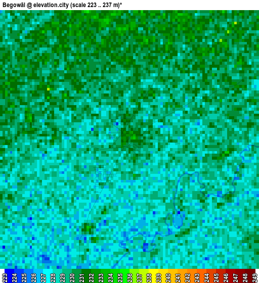
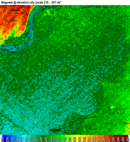
Below is the Elevation map of Begowāl, which displays elevation range with different colors. Scale of the first map is from 223 to 237 m (732 to 778 ft) with average elevation of 228.9 meters (=751 ft) [note 1]
These maps also provides idea of topography and contour of this city, they are displayed at different zoom levels. More info about maps, scale and edge coordinates you can find below images.
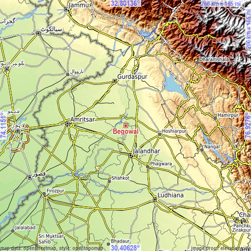
| \ | Map #1 | Map #2 | Topo.Map |
| Scale [m] | 223..237 m | 216..257 m | × |
| Scale [ft] | 732..778 ft | 709..843 ft | × |
| Average | 228.9 m = 751 ft | 230.5 m = 756 ft | × |
| Width | 8.32 km = 5.2 mi | 16.65 km = 10.3 mi | 266.3 km = 165.5 mi |
| Height | 8.32 km = 5.2 mi | 16.64 km = 10.3 mi | 266.3 km = 165.5 mi |
| ↑Max Latitude | 31.648937° | 31.686339° | 32.80136° |
| Latitude at center | 31.61152° | 31.61152° | 31.61152° |
| ↓Min Latitude | 31.574088° | 31.53664° | 30.40628° |
| ← Min Longitude | 75.477405° | 75.433459° | 74.1151° |
| Longitude center | 75.52135° | 75.52135° | 75.52135° |
| →Max Longitude | 75.565295° | 75.609241° | 76.9276° |
Nearby cities:
Cities around Begowāl sort by population:
• Kapūrthala elevation 229 m
29 km,  207°
207°
• Kartārpur 237 m
18.9 km,  186°
186°
• Qādiān 254 m
27.1 km,  329°
329°
• Dasūya 260 m
26 km,  28°
28°
• Bhogpur 244 m
13.1 km,  118°
118°
• Adampur 248 m
27.1 km,  137°
137°
• Bhulath Gharbi 235 m
7.8 km, 189°
• Dhilwan 230 m
19.8 km,  236°
236°
• Hariāna 310 m
30.2 km,  85°
85°
• Alāwalpur 248 m
23.7 km,  147°
147°
• Garhdiwāla 290 m
26.5 km,  56°
56°
• Shām Churāsi 262 m
24.9 km, 119°
Multilingual:
 En español:
Begowāl elevación 233 m.
 En France:
Begowāl élévation 233 m.


Sources and notes:
- [note 1] Map square and city borders are not equal. Map elevation data is calculated only from area inside that square.
- [src 1] Elevation data from geonames database provided with same terms of usage.
- [src 2] The elevation map of Begowāl is generated using elevation data from NASA's 3 arcsec (90m) resolution SRTM data.
- [src 3] Base (background) map © OpenStreetMap contributors tiles are generated by Geofabrik and OpenTopoMap.
Copyright & License:
This Begowāl Elevation Map is licensed under CC BY-SA. You may reuse any part from this page, if you give a proper credit by linking to this URL:
 More info on terms of use page.