Garhdiwāla elevation
Garhdiwāla (Punjab, Hoshiarpur), India elevation is 290 meters and Garhdiwāla elevation in feet is 951 ft above sea level [src 1]. Garhdiwāla is a populated place (feature code) with elevation that is 3 meters (10 ft) smaller than average city elevation in India.
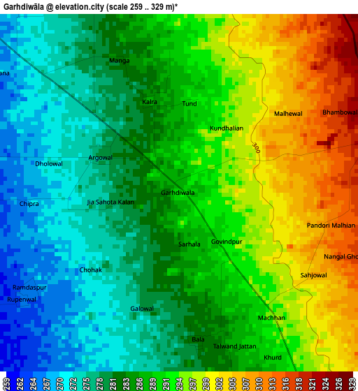
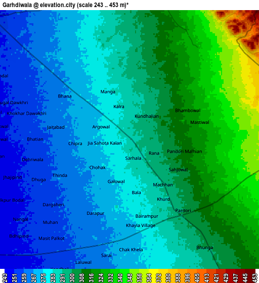
Below is the Elevation map of Garhdiwāla, which displays elevation range with different colors. Scale of the first map is from 259 to 329 m (850 to 1079 ft) with average elevation of 287.1 meters (=942 ft) [note 1]
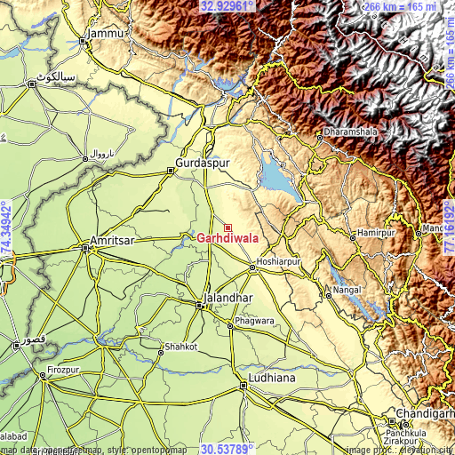
These maps also provides idea of topography and contour of this city, they are displayed at different zoom levels. More info about maps, scale and edge coordinates you can find below images.
| \ | Map #1 | Map #2 | Topo.Map |
| Scale [m] | 259..329 m | 243..453 m | × |
| Scale [ft] | 850..1079 ft | 797..1486 ft | × |
| Average | 287.1 m = 942 ft | 292.1 m = 958 ft | × |
| Width | 8.31 km = 5.2 mi | 16.62 km = 10.3 mi | 265.9 km = 165.2 mi |
| Height | 8.31 km = 5.2 mi | 16.62 km = 10.3 mi | 265.9 km = 165.2 mi |
| ↑Max Latitude | 31.778835° | 31.816185° | 32.92961° |
| Latitude at center | 31.74147° | 31.74147° | 31.74147° |
| ↓Min Latitude | 31.70409° | 31.666695° | 30.53789° |
| ← Min Longitude | 75.711725° | 75.667779° | 74.34942° |
| Longitude center | 75.75567° | 75.75567° | 75.75567° |
| →Max Longitude | 75.799615° | 75.843561° | 77.16192° |
Nearby cities:
Cities around Garhdiwāla sort by population:
• Hoshiārpur elevation 311 m
27.1 km,  146°
146°
• Talwāra 356 m
25.1 km,  29°
29°
• Mukeriān 264 m
27 km,  331°
331°
• Dasūya 260 m
12.8 km,  310°
310°
• Bhogpur 244 m
23.4 km,  207°
207°
• Bhulath Gharbi 235 m
32.2 km,  226°
226°
• Begowāl 233 m
26.5 km,  236°
236°
• Hariāna 310 m
14.2 km, 146°
• Hājipur 307 m
26.2 km,  359°
359°
• Daulatpur 540 m
22.9 km,  76°
76°
• Shām Churāsi 262 m
26.8 km,  181°
181°
• Gagret 470 m
30.4 km,  107°
107°
Multilingual:
 En español:
Garhdiwāla elevación 290 m.
 En France:
Garhdiwāla élévation 290 m.
 Auf Deutsch:
Garhdiwāla höhe über dem Meeresspiegel ist 290 m.

Sources and notes:
- [note 1] Map square and city borders are not equal. Map elevation data is calculated only from area inside that square.
- [src 1] Elevation data from geonames database provided with same terms of usage.
- [src 2] The elevation map of Garhdiwāla is generated using elevation data from NASA's 3 arcsec (90m) resolution SRTM data.
- [src 3] Base (background) map © OpenStreetMap contributors tiles are generated by Geofabrik and OpenTopoMap.
Copyright & License:
This Garhdiwāla Elevation Map is licensed under CC BY-SA. You may reuse any part from this page, if you give a proper credit by linking to this URL:
 More info on terms of use page.