Berasia elevation
Berasia (Madhya Pradesh, Bhopāl), India elevation is 483 meters and Berasia elevation in feet is 1585 ft above sea level [src 1]. Berasia is a populated place (feature code) with elevation that is 190 meters (623 ft) bigger than average city elevation in India.
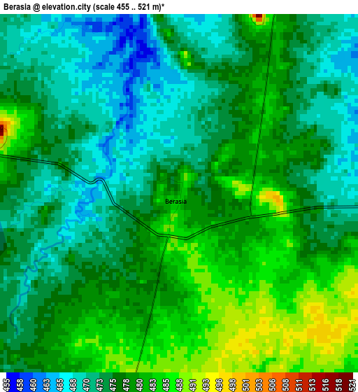
Below is the Elevation map of Berasia, which displays elevation range with different colors. Scale of the first map is from 455 to 521 m (1493 to 1709 ft) with average elevation of 476.6 meters (=1564 ft) [note 1]
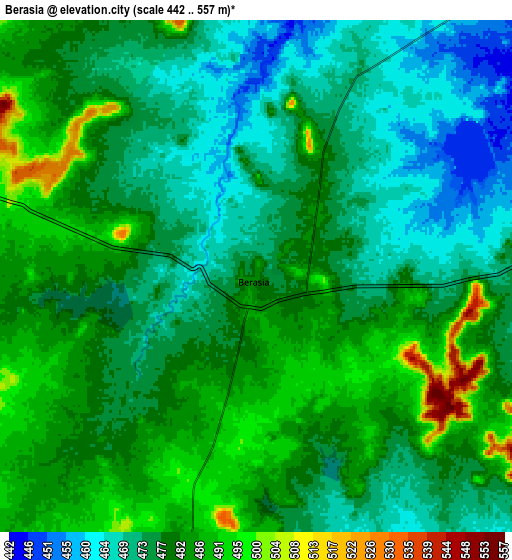
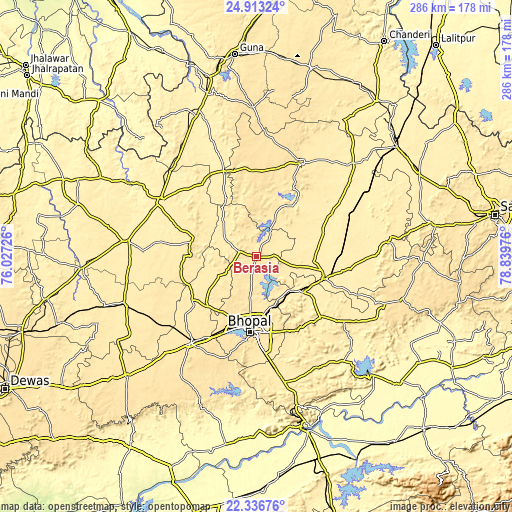
These maps also provides idea of topography and contour of this city, they are displayed at different zoom levels. More info about maps, scale and edge coordinates you can find below images.
| \ | Map #1 | Map #2 | Topo.Map |
| Scale [m] | 455..521 m | 442..557 m | × |
| Scale [ft] | 1493..1709 ft | 1450..1827 ft | × |
| Average | 476.6 m = 1564 ft | 478.3 m = 1569 ft | × |
| Width | 8.95 km = 5.6 mi | 17.91 km = 11.1 mi | 286.5 km = 178 mi |
| Height | 8.95 km = 5.6 mi | 17.91 km = 11.1 mi | 286.5 km = 178 mi |
| ↑Max Latitude | 23.671594° | 23.711836° | 24.91324° |
| Latitude at center | 23.63134° | 23.63134° | 23.63134° |
| ↓Min Latitude | 23.591074° | 23.550795° | 22.33676° |
| ← Min Longitude | 77.389565° | 77.345619° | 76.02726° |
| Longitude center | 77.43351° | 77.43351° | 77.43351° |
| →Max Longitude | 77.477455° | 77.521401° | 78.83976° |
Nearby cities:
Cities around Berasia sort by population:
• Bhopal elevation 523 m
42 km,  184°
184°
• Vidisha 429 m
40.2 km,  106°
106°
• Sehore 497 m
59.8 km,  216°
216°
• Bāsoda 410 m
56.7 km,  64°
64°
• Sironj 472 m
58.6 km,  26°
26°
• Biaora 433 m
62.2 km,  301°
301°
• Raisen 448 m
48.8 km,  133°
133°
• Mandideep 443 m
62 km,  170°
170°
• Narsinghgarh 461 m
35.7 km,  283°
283°
• Leteri 534 m
47.7 km,  356°
356°
• Sānchi 427 m
34.9 km,  117°
117°
• Garha Brahman 470 m
27.5 km,  343°
343°
Multilingual:
 En español:
Berasia elevación 483 m.
 En France:
Berasia élévation 483 m.


Sources and notes:
- [note 1] Map square and city borders are not equal. Map elevation data is calculated only from area inside that square.
- [src 1] Elevation data from geonames database provided with same terms of usage.
- [src 2] The elevation map of Berasia is generated using elevation data from NASA's 3 arcsec (90m) resolution SRTM data.
- [src 3] Base (background) map © OpenStreetMap contributors tiles are generated by Geofabrik and OpenTopoMap.
Copyright & License:
This Berasia Elevation Map is licensed under CC BY-SA. You may reuse any part from this page, if you give a proper credit by linking to this URL:
 More info on terms of use page.