Bīdar elevation
Bīdar (Karnataka), India elevation is 677 meters and Bīdar elevation in feet is 2221 ft above sea level [src 1]. Bīdar is a populated place (feature code) with elevation that is 384 meters (1260 ft) bigger than average city elevation in India.
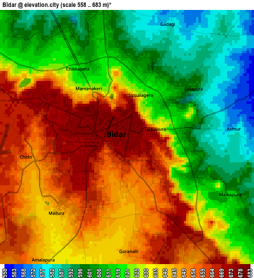
Below is the Elevation map of Bīdar, which displays elevation range with different colors. Scale of the first map is from 558 to 683 m (1831 to 2241 ft) with average elevation of 628.4 meters (=2062 ft) [note 1]
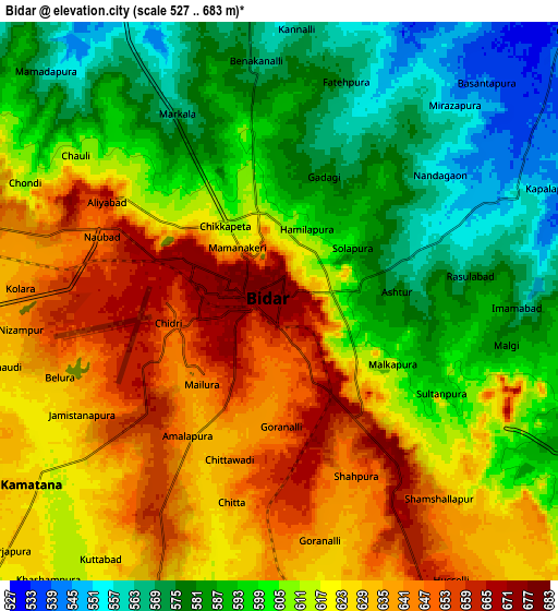
These maps also provides idea of topography and contour of this city, they are displayed at different zoom levels. More info about maps, scale and edge coordinates you can find below images.
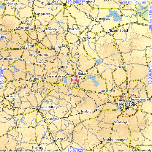
| \ | Map #1 | Map #2 | Topo.Map |
| Scale [m] | 558..683 m | 527..683 m | × |
| Scale [ft] | 1831..2241 ft | 1729..2241 ft | × |
| Average | 628.4 m = 2062 ft | 609.8 m = 2001 ft | × |
| Width | 9.3 km = 5.8 mi | 18.6 km = 11.6 mi | 297.5 km = 184.9 mi |
| Height | 9.3 km = 5.8 mi | 18.6 km = 11.6 mi | 297.6 km = 184.9 mi |
| ↑Max Latitude | 17.95512° | 17.99692° | 19.24623° |
| Latitude at center | 17.91331° | 17.91331° | 17.91331° |
| ↓Min Latitude | 17.87149° | 17.82966° | 16.57029° |
| ← Min Longitude | 77.486165° | 77.442219° | 76.12386° |
| Longitude center | 77.53011° | 77.53011° | 77.53011° |
| →Max Longitude | 77.574055° | 77.618001° | 78.93636° |
Nearby cities:
Cities around Bīdar sort by population:
• Udgīr elevation 643 m
68.8 km,  320°
320°
• Basavakalyān 631 m
61.6 km,  265°
265°
• Sangāreddi 514 m
67.1 km,  118°
118°
• Zahirābād 626 m
27.1 km,  162°
162°
• Homnābād 641 m
45.7 km,  249°
249°
• Bhālki 583 m
37.2 km,  292°
292°
• Sadāseopet 550 m
55.4 km,  126°
126°
• Andol 503 m
58.9 km,  100°
100°
• Bānswāda 387 m
63.5 km,  35°
35°
• Chincholi 462 m
51.2 km,  193°
193°
• Aurād 545 m
39.7 km,  342°
342°
• Chandūr 503 m
60.5 km,  94°
94°
Multilingual:
 En español:
Bīdar elevación 677 m.
 En France:
Bīdar élévation 677 m.


Sources and notes:
- [note 1] Map square and city borders are not equal. Map elevation data is calculated only from area inside that square.
- [src 1] Elevation data from geonames database provided with same terms of usage.
- [src 2] The elevation map of Bīdar is generated using elevation data from NASA's 3 arcsec (90m) resolution SRTM data.
- [src 3] Base (background) map © OpenStreetMap contributors tiles are generated by Geofabrik and OpenTopoMap.
Copyright & License:
This Bīdar Elevation Map is licensed under CC BY-SA. You may reuse any part from this page, if you give a proper credit by linking to this URL:
 More info on terms of use page.