Daulatpur elevation
Daulatpur (West Bengal, Dakshin Dinajpur), India elevation is 37 meters and Daulatpur elevation in feet is 121 ft above sea level [src 1]. Daulatpur is a populated place (feature code) with elevation that is 256 meters (840 ft) smaller than average city elevation in India.
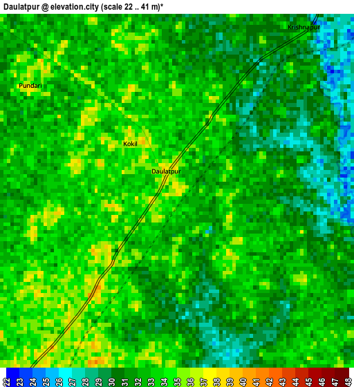
Below is the Elevation map of Daulatpur, which displays elevation range with different colors. Scale of the first map is from 22 to 41 m (72 to 135 ft) with average elevation of 32 meters (=105 ft) [note 1]
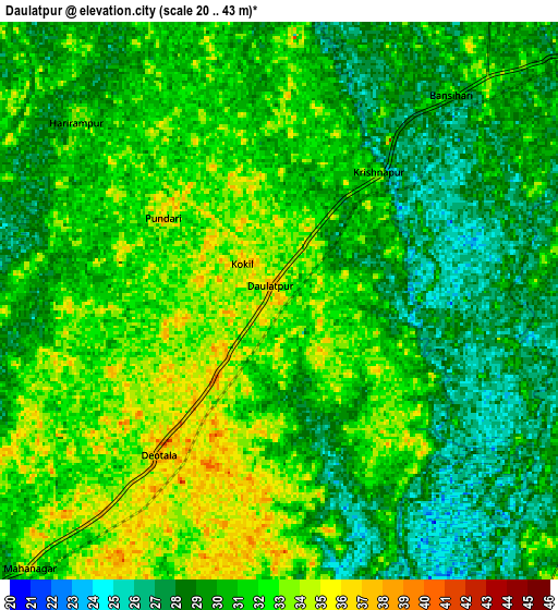
These maps also provides idea of topography and contour of this city, they are displayed at different zoom levels. More info about maps, scale and edge coordinates you can find below images.
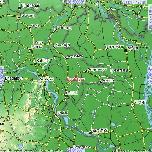
| \ | Map #1 | Map #2 | Topo.Map |
| Scale [m] | 22..41 m | 20..43 m | × |
| Scale [ft] | 72..135 ft | 66..141 ft | × |
| Average | 32 m = 105 ft | 30.4 m = 100 ft | × |
| Width | 8.83 km = 5.5 mi | 17.67 km = 11 mi | 282.6 km = 175.6 mi |
| Height | 8.83 km = 5.5 mi | 17.67 km = 11 mi | 282.7 km = 175.7 mi |
| ↑Max Latitude | 25.365765° | 25.405467° | 26.59039° |
| Latitude at center | 25.32605° | 25.32605° | 25.32605° |
| ↓Min Latitude | 25.286322° | 25.246581° | 24.04837° |
| ← Min Longitude | 88.285945° | 88.241999° | 86.92364° |
| Longitude center | 88.32989° | 88.32989° | 88.32989° |
| →Max Longitude | 88.373835° | 88.417781° | 89.73614° |
Nearby cities:
Cities around Daulatpur sort by population:
• Rāiganj elevation 38 m
38 km,  327°
327°
• Ingrāj Bāzār 32 m
40.3 km,  207°
207°
• Bālurghāt 29 m
46.5 km,  104°
104°
• Sāhibganj 44 m
70.5 km,  262°
262°
• Gangārāmpur 32 m
21.8 km,  67°
67°
• Kāliyāganj 41 m
34.3 km,  359°
359°
• Manihāri 37 m
71.4 km,  271°
271°
• Farakka 25 m
71.3 km,  217°
217°
• Rājmahal 34 m
58.7 km,  238°
238°
• Dalkola 44 m
78.4 km,  321°
321°
• Raghunāthpur 38 m
54.5 km,  310°
310°
• Paikpara 29 m
74.1 km, 213°
Multilingual:
 En español:
Daulatpur elevación 37 m.
 En France:
Daulatpur élévation 37 m.
 Auf Deutsch:
Daulatpur höhe über dem Meeresspiegel ist 37 m.

Sources and notes:
- [note 1] Map square and city borders are not equal. Map elevation data is calculated only from area inside that square.
- [src 1] Elevation data from geonames database provided with same terms of usage.
- [src 2] The elevation map of Daulatpur is generated using elevation data from NASA's 3 arcsec (90m) resolution SRTM data.
- [src 3] Base (background) map © OpenStreetMap contributors tiles are generated by Geofabrik and OpenTopoMap.
Copyright & License:
This Daulatpur Elevation Map is licensed under CC BY-SA. You may reuse any part from this page, if you give a proper credit by linking to this URL:
 More info on terms of use page.