Dongargarh elevation
Dongargarh (Chhattisgarh, Rāj Nāndgaon), India elevation is 352 meters and Dongargarh elevation in feet is 1155 ft above sea level [src 1]. Dongargarh is a populated place (feature code) with elevation that is 59 meters (194 ft) bigger than average city elevation in India.
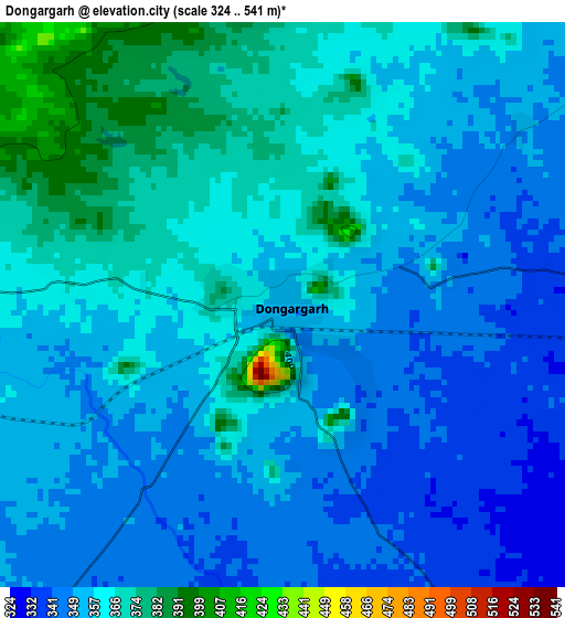
Below is the Elevation map of Dongargarh, which displays elevation range with different colors. Scale of the first map is from 324 to 541 m (1063 to 1775 ft) with average elevation of 357.3 meters (=1172 ft) [note 1]
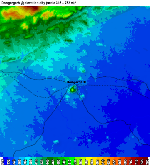
These maps also provides idea of topography and contour of this city, they are displayed at different zoom levels. More info about maps, scale and edge coordinates you can find below images.
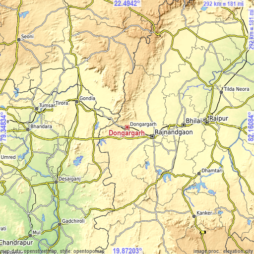
| \ | Map #1 | Map #2 | Topo.Map |
| Scale [m] | 324..541 m | 315..752 m | × |
| Scale [ft] | 1063..1775 ft | 1033..2467 ft | × |
| Average | 357.3 m = 1172 ft | 370.5 m = 1216 ft | × |
| Width | 9.11 km = 5.7 mi | 18.22 km = 11.3 mi | 291.6 km = 181.2 mi |
| Height | 9.11 km = 5.7 mi | 18.22 km = 11.3 mi | 291.6 km = 181.2 mi |
| ↑Max Latitude | 21.229899° | 21.270856° | 22.4942° |
| Latitude at center | 21.18893° | 21.18893° | 21.18893° |
| ↓Min Latitude | 21.14795° | 21.106959° | 19.87203° |
| ← Min Longitude | 80.710645° | 80.666699° | 79.34834° |
| Longitude center | 80.75459° | 80.75459° | 80.75459° |
| →Max Longitude | 80.798535° | 80.842481° | 82.16084° |
Nearby cities:
Cities around Dongargarh sort by population:
• Bhilai elevation 307 m
69.9 km,  88°
88°
• Durg 303 m
54.1 km, 89°
• Rāj-Nāndgaon 306 m
30.2 km,  109°
109°
• Gondiā 322 m
65.6 km,  297°
297°
• Kumhāri 279 m
79.5 km,  83°
83°
• Balod 329 m
69.2 km,  137°
137°
• Bhānpurī 311 m
21.3 km,  120°
120°
• Khairāgarh 317 m
34.6 km,  42°
42°
• Dongargaon 318 m
26.1 km,  157°
157°
• Gandai 327 m
64 km,  33°
33°
• Ambāgarh Chauki 335 m
45.9 km,  181°
181°
• Chhuīkhadān 338 m
44.9 km, 34°
Multilingual:
 En español:
Dongargarh elevación 352 m.
 En France:
Dongargarh élévation 352 m.
 Auf Deutsch:
Dongargarh höhe über dem Meeresspiegel ist 352 m.

Sources and notes:
- [note 1] Map square and city borders are not equal. Map elevation data is calculated only from area inside that square.
- [src 1] Elevation data from geonames database provided with same terms of usage.
- [src 2] The elevation map of Dongargarh is generated using elevation data from NASA's 3 arcsec (90m) resolution SRTM data.
- [src 3] Base (background) map © OpenStreetMap contributors tiles are generated by Geofabrik and OpenTopoMap.
Copyright & License:
This Dongargarh Elevation Map is licensed under CC BY-SA. You may reuse any part from this page, if you give a proper credit by linking to this URL:
 More info on terms of use page.