Gandai elevation
Gandai (Chhattisgarh, Rāj Nāndgaon), India elevation is 327 meters and Gandai elevation in feet is 1073 ft above sea level [src 1]. Gandai is a populated place (feature code) with elevation that is 34 meters (112 ft) bigger than average city elevation in India.
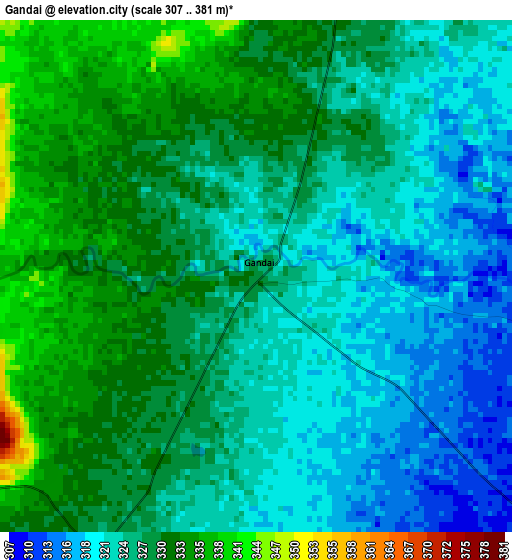
Below is the Elevation map of Gandai, which displays elevation range with different colors. Scale of the first map is from 307 to 381 m (1007 to 1250 ft) with average elevation of 326.1 meters (=1070 ft) [note 1]
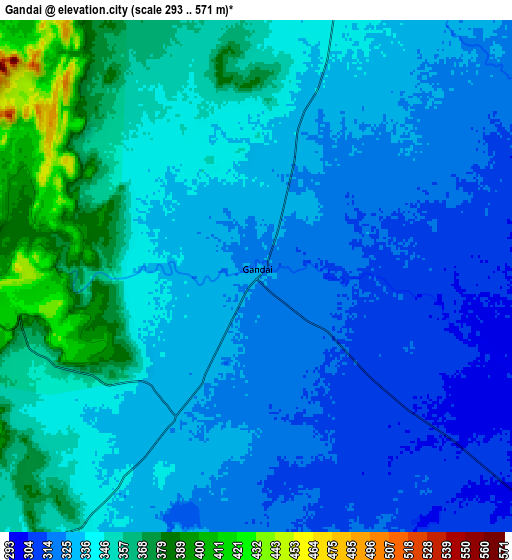
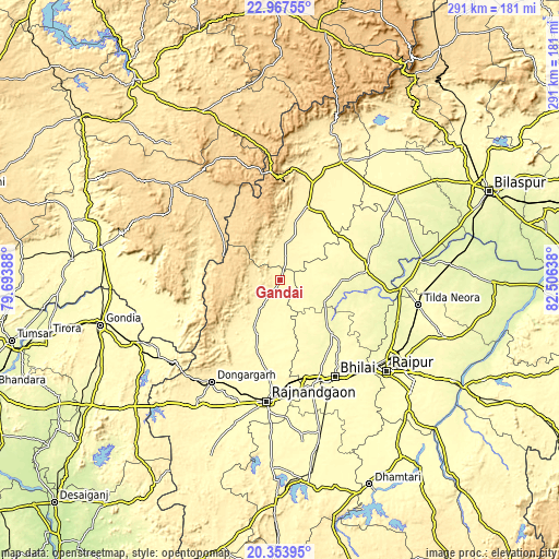
These maps also provides idea of topography and contour of this city, they are displayed at different zoom levels. More info about maps, scale and edge coordinates you can find below images.
| \ | Map #1 | Map #2 | Topo.Map |
| Scale [m] | 307..381 m | 293..571 m | × |
| Scale [ft] | 1007..1250 ft | 961..1873 ft | × |
| Average | 326.1 m = 1070 ft | 338.5 m = 1111 ft | × |
| Width | 9.08 km = 5.6 mi | 18.16 km = 11.3 mi | 290.6 km = 180.6 mi |
| Height | 9.08 km = 5.6 mi | 18.16 km = 11.3 mi | 290.6 km = 180.6 mi |
| ↑Max Latitude | 21.707505° | 21.748328° | 22.96755° |
| Latitude at center | 21.66667° | 21.66667° | 21.66667° |
| ↓Min Latitude | 21.625824° | 21.584966° | 20.35395° |
| ← Min Longitude | 81.056185° | 81.012239° | 79.69388° |
| Longitude center | 81.10013° | 81.10013° | 81.10013° |
| →Max Longitude | 81.144075° | 81.188021° | 82.50638° |
Nearby cities:
Cities around Gandai sort by population:
• Bhilai elevation 307 m
61.2 km,  146°
146°
• Durg 303 m
55.9 km,  160°
160°
• Rāj-Nāndgaon 306 m
63.8 km,  186°
186°
• Kumhāri 279 m
61.9 km,  135°
135°
• Dongargarh 352 m
64 km,  213°
213°
• Kawardha 356 m
40.4 km,  19°
19°
• Bemetāra 291 m
45.2 km,  83°
83°
• Bhānpurī 311 m
66.2 km,  195°
195°
• Khairāgarh 317 m
30.3 km, 204°
• Simga 270 m
62.5 km,  93°
93°
• Pāndātarai 357 m
62.5 km, 22°
• Chhuīkhadān 338 m
19.1 km, 213°
Multilingual:
 En español:
Gandai elevación 327 m.
 En France:
Gandai élévation 327 m.


Sources and notes:
- [note 1] Map square and city borders are not equal. Map elevation data is calculated only from area inside that square.
- [src 1] Elevation data from geonames database provided with same terms of usage.
- [src 2] The elevation map of Gandai is generated using elevation data from NASA's 3 arcsec (90m) resolution SRTM data.
- [src 3] Base (background) map © OpenStreetMap contributors tiles are generated by Geofabrik and OpenTopoMap.
Copyright & License:
This Gandai Elevation Map is licensed under CC BY-SA. You may reuse any part from this page, if you give a proper credit by linking to this URL:
 More info on terms of use page.