Gharaunda elevation
Gharaunda (Haryana, Karnāl), India elevation is 243 meters and Gharaunda elevation in feet is 797 ft above sea level [src 1]. Gharaunda is a populated place (feature code) with elevation that is 50 meters (164 ft) smaller than average city elevation in India.
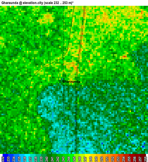
Below is the Elevation map of Gharaunda, which displays elevation range with different colors. Scale of the first map is from 232 to 253 m (761 to 830 ft) with average elevation of 241.7 meters (=793 ft) [note 1]
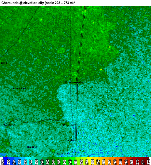
These maps also provides idea of topography and contour of this city, they are displayed at different zoom levels. More info about maps, scale and edge coordinates you can find below images.
| \ | Map #1 | Map #2 | Topo.Map |
| Scale [m] | 232..253 m | 228..273 m | × |
| Scale [ft] | 761..830 ft | 748..896 ft | × |
| Average | 241.7 m = 793 ft | 241.2 m = 791 ft | × |
| Width | 8.5 km = 5.3 mi | 17.01 km = 10.6 mi | 272.1 km = 169.1 mi |
| Height | 8.5 km = 5.3 mi | 17 km = 10.6 mi | 272.1 km = 169.1 mi |
| ↑Max Latitude | 29.575147° | 29.613359° | 30.75295° |
| Latitude at center | 29.53692° | 29.53692° | 29.53692° |
| ↓Min Latitude | 29.498679° | 29.460423° | 28.30609° |
| ← Min Longitude | 76.927475° | 76.883529° | 75.56517° |
| Longitude center | 76.97142° | 76.97142° | 76.97142° |
| →Max Longitude | 77.015365° | 77.059311° | 78.37767° |
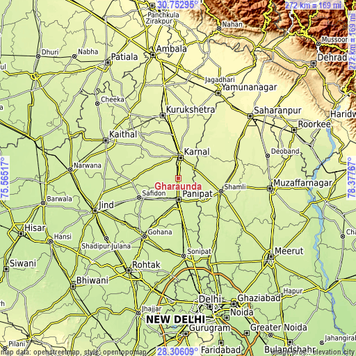
Nearby cities:
Cities around Gharaunda sort by population:
• Pānīpat elevation 232 m
16.6 km,  181°
181°
• Karnāl 255 m
17.3 km,  4°
4°
• Shāmli 248 m
34.1 km,  106°
106°
• Kairāna 243 m
27.6 km,  124°
124°
• Samālkha 226 m
33.8 km,  173°
173°
• Safidon 238 m
32.6 km,  243°
243°
• Āsandh 239 m
35.4 km,  267°
267°
• Jhinjhāna 255 m
24.6 km,  94°
94°
• Nīlokheri 256 m
33.6 km,  353°
353°
• Ūn 253 m
28 km,  79°
79°
• Garhi Pūkhta 252 m
32.7 km, 87°
• Titron 259 m
37.1 km,  66°
66°
Multilingual:
 En español:
Gharaunda elevación 243 m.
 En France:
Gharaunda élévation 243 m.
 Auf Deutsch:
Gharaunda höhe über dem Meeresspiegel ist 243 m.

Sources and notes:
- [note 1] Map square and city borders are not equal. Map elevation data is calculated only from area inside that square.
- [src 1] Elevation data from geonames database provided with same terms of usage.
- [src 2] The elevation map of Gharaunda is generated using elevation data from NASA's 3 arcsec (90m) resolution SRTM data.
- [src 3] Base (background) map © OpenStreetMap contributors tiles are generated by Geofabrik and OpenTopoMap.
Copyright & License:
This Gharaunda Elevation Map is licensed under CC BY-SA. You may reuse any part from this page, if you give a proper credit by linking to this URL:
 More info on terms of use page.