Karnāl elevation
Karnāl (Haryana), India elevation is 255 meters and Karnāl elevation in feet is 837 ft above sea level [src 1]. Karnāl is a populated place (feature code) with elevation that is 38 meters (125 ft) smaller than average city elevation in India.
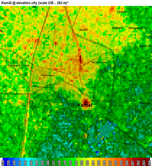
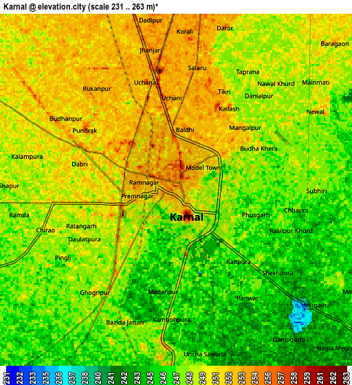
Below is the Elevation map of Karnāl, which displays elevation range with different colors. Scale of the first map is from 238 to 263 m (781 to 863 ft) with average elevation of 249.7 meters (=819 ft) [note 1]
These maps also provides idea of topography and contour of this city, they are displayed at different zoom levels. More info about maps, scale and edge coordinates you can find below images.
| \ | Map #1 | Map #2 | Topo.Map |
| Scale [m] | 238..263 m | 231..263 m | × |
| Scale [ft] | 781..863 ft | 758..863 ft | × |
| Average | 249.7 m = 819 ft | 248.5 m = 815 ft | × |
| Width | 8.49 km = 5.3 mi | 16.98 km = 10.6 mi | 271.6 km = 168.8 mi |
| Height | 8.49 km = 5.3 mi | 16.98 km = 10.6 mi | 271.7 km = 168.8 mi |
| ↑Max Latitude | 29.730138° | 29.768292° | 30.90609° |
| Latitude at center | 29.69197° | 29.69197° | 29.69197° |
| ↓Min Latitude | 29.653787° | 29.61559° | 28.463° |
| ← Min Longitude | 76.940535° | 76.896589° | 75.57823° |
| Longitude center | 76.98448° | 76.98448° | 76.98448° |
| →Max Longitude | 77.028425° | 77.072371° | 78.39073° |
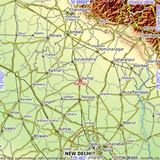
Nearby cities:
Cities around Karnāl sort by population:
• Pānīpat elevation 232 m
33.9 km,  182°
182°
• Thānesar 260 m
34.6 km,  334°
334°
• Gangoh 268 m
28.7 km,  70°
70°
• Gharaunda 243 m
17.3 km, 184°
• Lādwa 266 m
34 km,  9°
9°
• Jhinjhāna 255 m
30 km,  129°
129°
• Nīlokheri 256 m
16.9 km,  342°
342°
• Indri 262 m
22.1 km,  19°
19°
• Ūn 253 m
28.8 km,  114°
114°
• Ambahta 269 m
38.6 km,  61°
61°
• Garhi Pūkhta 252 m
35.1 km,  116°
116°
• Titron 259 m
32.9 km,  94°
94°
Multilingual:
 En español:
Karnāl elevación 255 m.
 En France:
Karnāl élévation 255 m.


Sources and notes:
- [note 1] Map square and city borders are not equal. Map elevation data is calculated only from area inside that square.
- [src 1] Elevation data from geonames database provided with same terms of usage.
- [src 2] The elevation map of Karnāl is generated using elevation data from NASA's 3 arcsec (90m) resolution SRTM data.
- [src 3] Base (background) map © OpenStreetMap contributors tiles are generated by Geofabrik and OpenTopoMap.
Copyright & License:
This Karnāl Elevation Map is licensed under CC BY-SA. You may reuse any part from this page, if you give a proper credit by linking to this URL:
 More info on terms of use page.