Ghāziābād elevation
Ghāziābād (Uttar Pradesh), India elevation is 214 meters and Ghāziābād elevation in feet is 702 ft above sea level [src 1]. Ghāziābād is a seat of a second-order administrative division (feature code) with elevation that is 79 meters (259 ft) smaller than average city elevation in India.
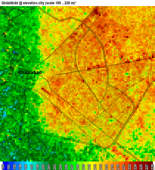
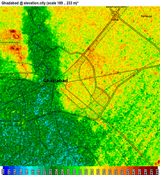
Below is the Elevation map of Ghāziābād, which displays elevation range with different colors. Scale of the first map is from 189 to 228 m (620 to 748 ft) with average elevation of 211.5 meters (=694 ft) [note 1]
These maps also provides idea of topography and contour of this city, they are displayed at different zoom levels. More info about maps, scale and edge coordinates you can find below images.
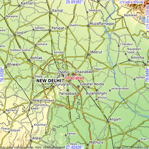
| \ | Map #1 | Map #2 | Topo.Map |
| Scale [m] | 189..228 m | 189..233 m | × |
| Scale [ft] | 620..748 ft | 620..764 ft | × |
| Average | 211.5 m = 694 ft | 210.4 m = 690 ft | × |
| Width | 8.57 km = 5.3 mi | 17.15 km = 10.7 mi | 274.4 km = 170.5 mi |
| Height | 8.57 km = 5.3 mi | 17.15 km = 10.7 mi | 274.4 km = 170.5 mi |
| ↑Max Latitude | 28.703902° | 28.74244° | 29.89192° |
| Latitude at center | 28.66535° | 28.66535° | 28.66535° |
| ↓Min Latitude | 28.626784° | 28.588203° | 27.42426° |
| ← Min Longitude | 77.395205° | 77.351259° | 76.0329° |
| Longitude center | 77.43915° | 77.43915° | 77.43915° |
| →Max Longitude | 77.483095° | 77.527041° | 78.8454° |
Nearby cities:
Cities around Ghāziābād sort by population:
• Delhi elevation 227 m
20.3 km,  265°
265°
• New Delhi 212 m
21.2 km,  261°
261°
• Greater Noida 212 m
21.1 km,  153°
153°
• Noida 206 m
14.3 km,  228°
228°
• Loni 213 m
17.4 km,  303°
303°
• Murādnagar 222 m
14.1 km,  24°
24°
• Pilkhua 220 m
21.8 km,  76°
76°
• Dādri 214 m
16.8 km,  138°
138°
• Dāsna 221 m
8.2 km, 80°
• Farīdnagar 219 m
21.8 km,  58°
58°
• Sector 207 m
15.2 km, 226°
• Defence Colony 214 m
22.7 km,  242°
242°
Multilingual:
 En español:
Ghāziābād elevación 214 m.
 En France:
Ghāziābād élévation 214 m.
 Auf Deutsch:
Ghaziabad höhe über dem Meeresspiegel ist 214 m.

Sources and notes:
- [note 1] Map square and city borders are not equal. Map elevation data is calculated only from area inside that square.
- [src 1] Elevation data from geonames database provided with same terms of usage.
- [src 2] The elevation map of Ghāziābād is generated using elevation data from NASA's 3 arcsec (90m) resolution SRTM data.
- [src 3] Base (background) map © OpenStreetMap contributors tiles are generated by Geofabrik and OpenTopoMap.
Copyright & License:
This Ghāziābād Elevation Map is licensed under CC BY-SA. You may reuse any part from this page, if you give a proper credit by linking to this URL:
 More info on terms of use page.