Harda Khās elevation
Harda Khās (Madhya Pradesh, Harda), India elevation is 294 meters and Harda Khās elevation in feet is 965 ft above sea level [src 1]. Harda Khās is a populated place (feature code) with elevation that is 1 meters (3 ft) bigger than average city elevation in India.
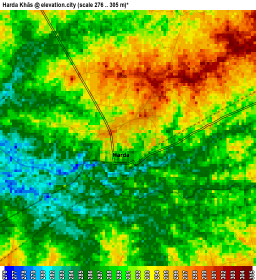
Below is the Elevation map of Harda Khās, which displays elevation range with different colors. Scale of the first map is from 276 to 305 m (906 to 1001 ft) with average elevation of 289.9 meters (=951 ft) [note 1]
These maps also provides idea of topography and contour of this city, they are displayed at different zoom levels. More info about maps, scale and edge coordinates you can find below images.
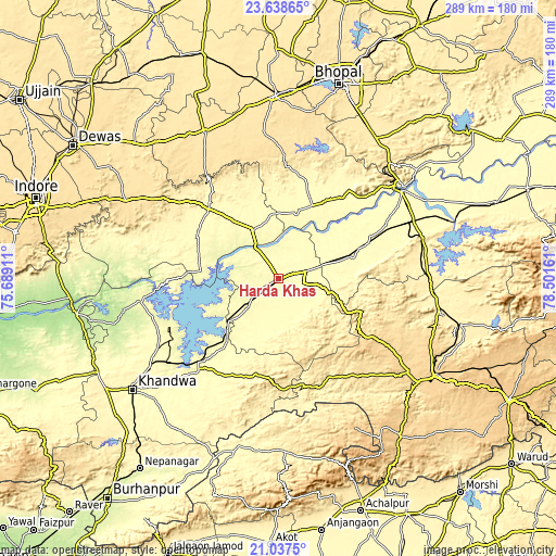
| \ | Map #1 | Map #2 | Topo.Map |
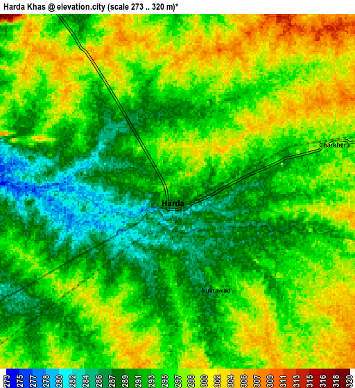
| Scale [m] | 276..305 m | 273..320 m | × |
| Scale [ft] | 906..1001 ft | 896..1050 ft | × |
| Average | 289.9 m = 951 ft | 294.7 m = 967 ft | × |
| Width | 9.04 km = 5.6 mi | 18.08 km = 11.2 mi | 289.2 km = 179.7 mi |
| Height | 9.04 km = 5.6 mi | 18.08 km = 11.2 mi | 289.2 km = 179.7 mi |
| ↑Max Latitude | 22.38478° | 22.425408° | 23.63865° |
| Latitude at center | 22.34414° | 22.34414° | 22.34414° |
| ↓Min Latitude | 22.303488° | 22.262825° | 21.0375° |
| ← Min Longitude | 77.051415° | 77.007469° | 75.68911° |
| Longitude center | 77.09536° | 77.09536° | 77.09536° |
| →Max Longitude | 77.139305° | 77.183251° | 78.50161° |
Nearby cities:
Cities around Harda Khās sort by population:
• Punāsa elevation 278 m
73.2 km,  260°
260°
• Itārsi 325 m
74.8 km,  66°
66°
• Seoni Mālwa 319 m
39.9 km, 72°
• Khātegaon 302 m
33.7 km,  326°
326°
• Khirkiyān 280 m
31.1 km,  230°
230°
• Nasrullāhganj 301 m
41.8 km,  25°
25°
• Harsūd 258 m
46.1 km, 233°
• Kannod 332 m
51 km,  314°
314°
• Ichhāwar 515 m
76.5 km,  353°
353°
• Satwās 306 m
47.3 km,  296°
296°
• Mundi 304 m
69.2 km,  243°
243°
• Rehti 308 m
55.9 km,  38°
38°
Multilingual:
 En español:
Harda Khās elevación 294 m.
 En France:
Harda Khās élévation 294 m.
 Auf Deutsch:
Harda Khās höhe über dem Meeresspiegel ist 294 m.

Sources and notes:
- [note 1] Map square and city borders are not equal. Map elevation data is calculated only from area inside that square.
- [src 1] Elevation data from geonames database provided with same terms of usage.
- [src 2] The elevation map of Harda Khās is generated using elevation data from NASA's 3 arcsec (90m) resolution SRTM data.
- [src 3] Base (background) map © OpenStreetMap contributors tiles are generated by Geofabrik and OpenTopoMap.
Copyright & License:
This Harda Khās Elevation Map is licensed under CC BY-SA. You may reuse any part from this page, if you give a proper credit by linking to this URL:
 More info on terms of use page.