Hārij elevation
Hārij (Gujarat, Patan), India elevation is 50 meters and Hārij elevation in feet is 164 ft above sea level [src 1]. Hārij is a populated place (feature code) with elevation that is 243 meters (797 ft) smaller than average city elevation in India.
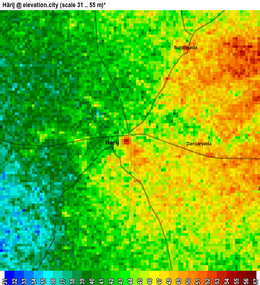
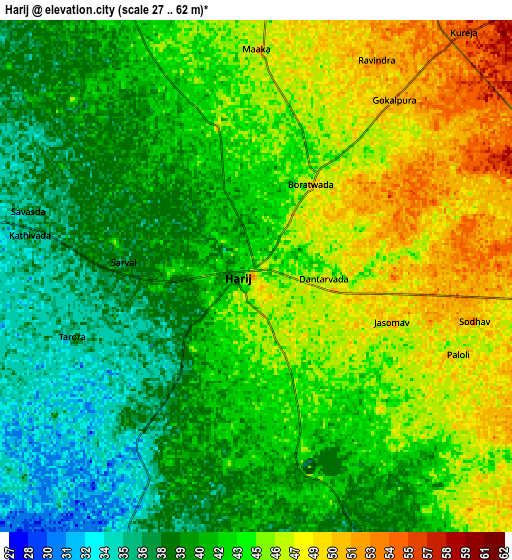
Below is the Elevation map of Hārij, which displays elevation range with different colors. Scale of the first map is from 31 to 55 m (102 to 180 ft) with average elevation of 43.1 meters (=141 ft) [note 1]
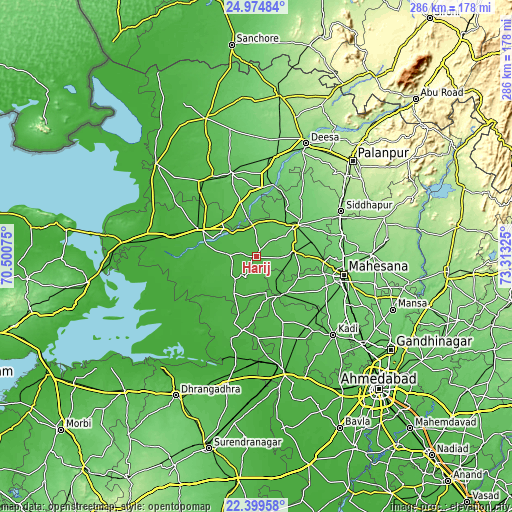
These maps also provides idea of topography and contour of this city, they are displayed at different zoom levels. More info about maps, scale and edge coordinates you can find below images.
| \ | Map #1 | Map #2 | Topo.Map |
| Scale [m] | 31..55 m | 27..62 m | × |
| Scale [ft] | 102..180 ft | 89..203 ft | × |
| Average | 43.1 m = 141 ft | 42.7 m = 140 ft | × |
| Width | 8.95 km = 5.6 mi | 17.9 km = 11.1 mi | 286.3 km = 177.9 mi |
| Height | 8.95 km = 5.6 mi | 17.9 km = 11.1 mi | 286.4 km = 178 mi |
| ↑Max Latitude | 23.733795° | 23.774017° | 24.97484° |
| Latitude at center | 23.69356° | 23.69356° | 23.69356° |
| ↓Min Latitude | 23.653313° | 23.613053° | 22.39958° |
| ← Min Longitude | 71.863055° | 71.819109° | 70.50075° |
| Longitude center | 71.907° | 71.907° | 71.907° |
| →Max Longitude | 71.950945° | 71.994891° | 73.31325° |
Nearby cities:
Cities around Hārij sort by population:
• Pātan elevation 82 m
28.6 km,  52°
52°
• Dīsa 132 m
68.4 km,  23°
23°
• Visnagar 136 m
65.7 km,  89°
89°
• Kadi 66 m
61.8 km,  135°
135°
• Unjha 116 m
50.8 km,  76°
76°
• Siddhapur 140 m
53.5 km,  62°
62°
• Rādhanpur 35 m
34.4 km,  296°
296°
• Un 49 m
25.7 km,  327°
327°
• Chānasma 71 m
21.1 km, 83°
• Māndal 35 m
45 km,  178°
178°
• Kānodar 180 m
66.2 km, 48°
• Jhulasan 77 m
70.6 km,  125°
125°
Multilingual:
 En español:
Hārij elevación 50 m.
 En France:
Hārij élévation 50 m.


Sources and notes:
- [note 1] Map square and city borders are not equal. Map elevation data is calculated only from area inside that square.
- [src 1] Elevation data from geonames database provided with same terms of usage.
- [src 2] The elevation map of Hārij is generated using elevation data from NASA's 3 arcsec (90m) resolution SRTM data.
- [src 3] Base (background) map © OpenStreetMap contributors tiles are generated by Geofabrik and OpenTopoMap.
Copyright & License:
This Hārij Elevation Map is licensed under CC BY-SA. You may reuse any part from this page, if you give a proper credit by linking to this URL:
 More info on terms of use page.