Hāveri elevation
Hāveri (Karnataka, Haveri), India elevation is 576 meters and Hāveri elevation in feet is 1890 ft above sea level [src 1]. Hāveri is a populated place (feature code) with elevation that is 283 meters (928 ft) bigger than average city elevation in India.
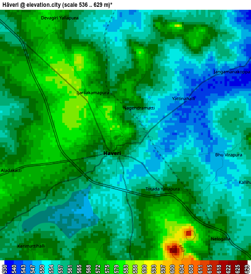
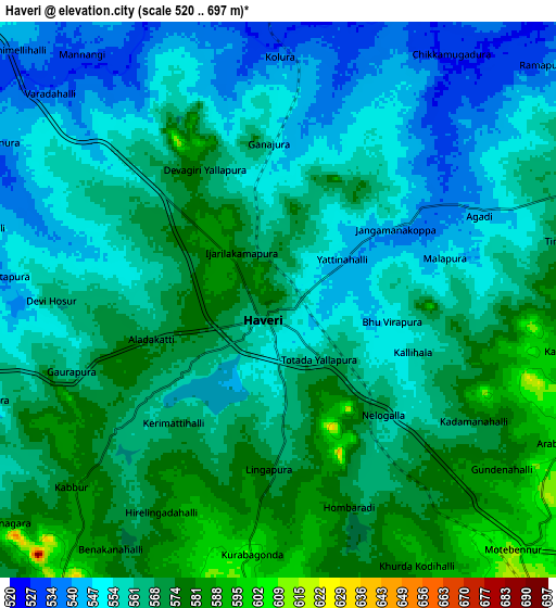
Below is the Elevation map of Hāveri, which displays elevation range with different colors. Scale of the first map is from 536 to 629 m (1759 to 2064 ft) with average elevation of 563 meters (=1847 ft) [note 1]
These maps also provides idea of topography and contour of this city, they are displayed at different zoom levels. More info about maps, scale and edge coordinates you can find below images.
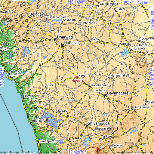
| \ | Map #1 | Map #2 | Topo.Map |
| Scale [m] | 536..629 m | 520..697 m | × |
| Scale [ft] | 1759..2064 ft | 1706..2287 ft | × |
| Average | 563 m = 1847 ft | 562.7 m = 1846 ft | × |
| Width | 9.45 km = 5.9 mi | 18.9 km = 11.7 mi | 302.3 km = 187.8 mi |
| Height | 9.45 km = 5.9 mi | 18.9 km = 11.7 mi | 302.4 km = 187.9 mi |
| ↑Max Latitude | 14.836024° | 14.878501° | 16.1488° |
| Latitude at center | 14.79354° | 14.79354° | 14.79354° |
| ↓Min Latitude | 14.751047° | 14.708546° | 13.42976° |
| ← Min Longitude | 75.360535° | 75.316589° | 73.99823° |
| Longitude center | 75.40448° | 75.40448° | 75.40448° |
| →Max Longitude | 75.448425° | 75.492371° | 76.81073° |
Nearby cities:
Cities around Hāveri sort by population:
• Rānībennur elevation 579 m
30.8 km,  128°
128°
• Harihar 546 m
53.4 km, 125°
• Savanūr 590 m
21.3 km,  340°
340°
• Lakshmeshwar 636 m
37.7 km,  10°
10°
• Byādgi 613 m
16 km,  146°
146°
• Hāngal 586 m
30.3 km,  263°
263°
• Shiggaon 621 m
29.2 km,  318°
318°
• Mulgund 687 m
55.6 km, 13°
• Kundgol 645 m
54.1 km, 341°
• Mundgod 579 m
44.2 km,  296°
296°
• Hirekerūr 611 m
37.6 km,  181°
181°
• Shirhatti 681 m
52.4 km,  21°
21°
Multilingual:
 En español:
Hāveri elevación 576 m.
 En France:
Hāveri élévation 576 m.


Sources and notes:
- [note 1] Map square and city borders are not equal. Map elevation data is calculated only from area inside that square.
- [src 1] Elevation data from geonames database provided with same terms of usage.
- [src 2] The elevation map of Hāveri is generated using elevation data from NASA's 3 arcsec (90m) resolution SRTM data.
- [src 3] Base (background) map © OpenStreetMap contributors tiles are generated by Geofabrik and OpenTopoMap.
Copyright & License:
This Hāveri Elevation Map is licensed under CC BY-SA. You may reuse any part from this page, if you give a proper credit by linking to this URL:
 More info on terms of use page.