Hisar elevation
Hisar (Haryana, Hisār), India elevation is 216 meters and Hisar elevation in feet is 709 ft above sea level [src 1]. Hisar is a populated place (feature code) with elevation that is 77 meters (253 ft) smaller than average city elevation in India.
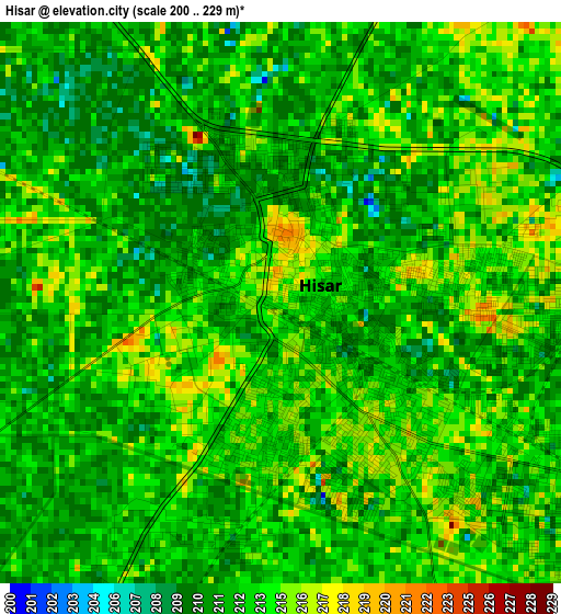
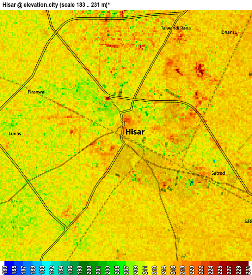
Below is the Elevation map of Hisar, which displays elevation range with different colors. Scale of the first map is from 200 to 229 m (656 to 751 ft) with average elevation of 212.7 meters (=698 ft) [note 1]
These maps also provides idea of topography and contour of this city, they are displayed at different zoom levels. More info about maps, scale and edge coordinates you can find below images.
| \ | Map #1 | Map #2 | Topo.Map |
| Scale [m] | 200..229 m | 183..231 m | × |
| Scale [ft] | 656..751 ft | 600..758 ft | × |
| Average | 212.7 m = 698 ft | 212.7 m = 698 ft | × |
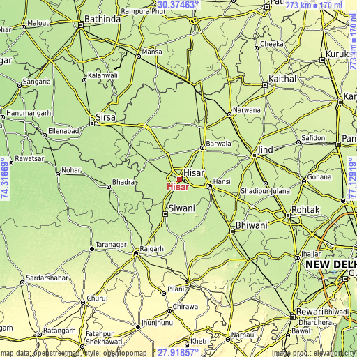
| Width | 8.53 km = 5.3 mi | 17.07 km = 10.6 mi | 273.1 km = 169.7 mi |
| Height | 8.53 km = 5.3 mi | 17.07 km = 10.6 mi | 273.1 km = 169.7 mi |
| ↑Max Latitude | 29.192311° | 29.230667° | 30.37463° |
| Latitude at center | 29.15394° | 29.15394° | 29.15394° |
| ↓Min Latitude | 29.115555° | 29.077155° | 27.91857° |
| ← Min Longitude | 75.678995° | 75.635049° | 74.31669° |
| Longitude center | 75.72294° | 75.72294° | 75.72294° |
| →Max Longitude | 75.766885° | 75.810831° | 77.12919° |
Nearby cities:
Cities around Hisar sort by population:
• Gorakhpur elevation 218 m
33 km,  351°
351°
• Bhiwāni 223 m
57 km,  134°
134°
• Hānsi 225 m
24 km,  103°
103°
• Fatehābād 216 m
47.8 km,  327°
327°
• Bhādra 200 m
53.9 km,  263°
263°
• Barwāla 226 m
29.8 km,  37°
37°
• Nārnaund 230 m
41.4 km,  79°
79°
• Bara Uchāna 229 m
56.2 km,  51°
51°
• Toshām 213 m
36.8 km,  149°
149°
• Uklāna 222 m
42.5 km,  20°
20°
• Inda Chhoi 231 m
54.5 km,  6°
6°
• Mandholi Kalān 234 m
49.7 km,  184°
184°
Multilingual:
 En español:
Hisar elevación 216 m.
 En France:
Hisar élévation 216 m.


Sources and notes:
- [note 1] Map square and city borders are not equal. Map elevation data is calculated only from area inside that square.
- [src 1] Elevation data from geonames database provided with same terms of usage.
- [src 2] The elevation map of Hisar is generated using elevation data from NASA's 3 arcsec (90m) resolution SRTM data.
- [src 3] Base (background) map © OpenStreetMap contributors tiles are generated by Geofabrik and OpenTopoMap.
Copyright & License:
This Hisar Elevation Map is licensed under CC BY-SA. You may reuse any part from this page, if you give a proper credit by linking to this URL:
 More info on terms of use page.