Hosakote elevation
Hosakote (Karnataka, Tumkur), India elevation is 628 meters and Hosakote elevation in feet is 2060 ft above sea level [src 1]. Hosakote is a populated place (feature code) with elevation that is 335 meters (1099 ft) bigger than average city elevation in India.
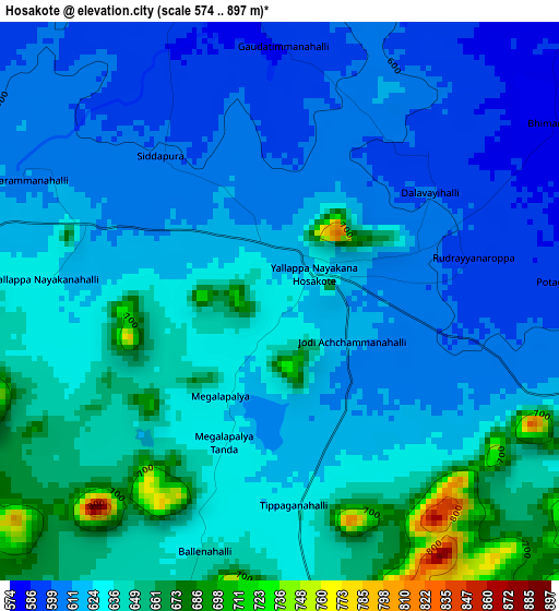
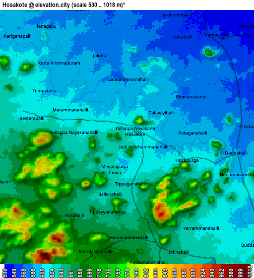
Below is the Elevation map of Hosakote, which displays elevation range with different colors. Scale of the first map is from 574 to 897 m (1883 to 2943 ft) with average elevation of 627.4 meters (=2058 ft) [note 1]
These maps also provides idea of topography and contour of this city, they are displayed at different zoom levels. More info about maps, scale and edge coordinates you can find below images.
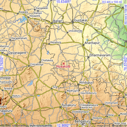
| \ | Map #1 | Map #2 | Topo.Map |
| Scale [m] | 574..897 m | 530..1018 m | × |
| Scale [ft] | 1883..2943 ft | 1739..3340 ft | × |
| Average | 627.4 m = 2058 ft | 632.9 m = 2076 ft | × |
| Width | 9.47 km = 5.9 mi | 18.94 km = 11.8 mi | 303 km = 188.3 mi |
| Height | 9.47 km = 5.9 mi | 18.94 km = 11.8 mi | 303.1 km = 188.3 mi |
| ↑Max Latitude | 14.318614° | 14.36119° | 15.63461° |
| Latitude at center | 14.27603° | 14.27603° | 14.27603° |
| ↓Min Latitude | 14.233438° | 14.190837° | 12.9092° |
| ← Min Longitude | 77.124325° | 77.080379° | 75.76202° |
| Longitude center | 77.16827° | 77.16827° | 77.16827° |
| →Max Longitude | 77.212215° | 77.256161° | 78.57452° |
Nearby cities:
Cities around Hosakote sort by population:
• Anantapur elevation 350 m
65.1 km,  46°
46°
• Hindupur 630 m
60.8 km,  145°
145°
• Dharmavaram 369 m
61.4 km,  75°
75°
• Rāyadrug 553 m
58.1 km,  324°
324°
• Sīra 654 m
65.9 km,  205°
205°
• Hiriyūr 607 m
69.9 km,  238°
238°
• Challakere 586 m
55.9 km,  274°
274°
• Pāvugada 640 m
23 km, 148°
• Kalyandurg 592 m
30.7 km,  347°
347°
• Maddagiri 756 m
68.6 km,  176°
176°
• Penukonda 570 m
50.7 km,  115°
115°
• Kodigenahalli 667 m
66 km,  159°
159°
Multilingual:
 En español:
Hosakote elevación 628 m.
 En France:
Hosakote élévation 628 m.
 Auf Deutsch:
Hosakote höhe über dem Meeresspiegel ist 628 m.

Sources and notes:
- [note 1] Map square and city borders are not equal. Map elevation data is calculated only from area inside that square.
- [src 1] Elevation data from geonames database provided with same terms of usage.
- [src 2] The elevation map of Hosakote is generated using elevation data from NASA's 3 arcsec (90m) resolution SRTM data.
- [src 3] Base (background) map © OpenStreetMap contributors tiles are generated by Geofabrik and OpenTopoMap.
Copyright & License:
This Hosakote Elevation Map is licensed under CC BY-SA. You may reuse any part from this page, if you give a proper credit by linking to this URL:
 More info on terms of use page.