Kodigenahalli elevation
Kodigenahalli (Karnataka, Tumkur), India elevation is 667 meters and Kodigenahalli elevation in feet is 2188 ft above sea level [src 1]. Kodigenahalli is a populated place (feature code) with elevation that is 374 meters (1227 ft) bigger than average city elevation in India.
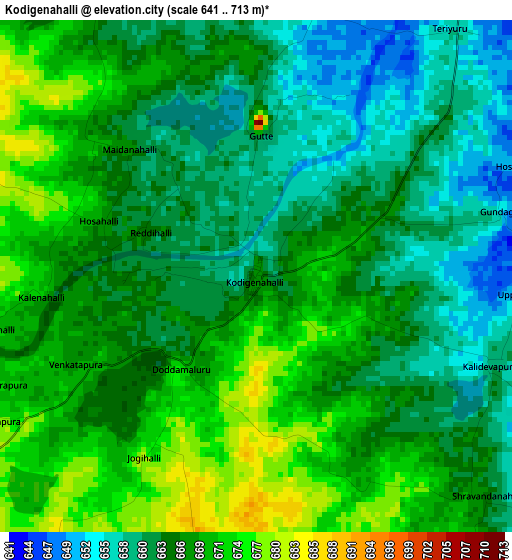
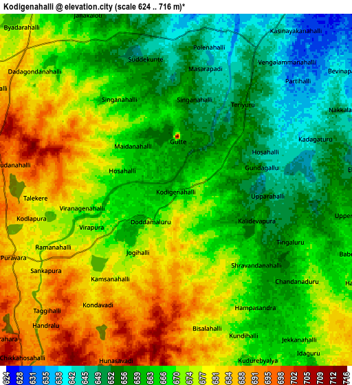
Below is the Elevation map of Kodigenahalli, which displays elevation range with different colors. Scale of the first map is from 641 to 713 m (2103 to 2339 ft) with average elevation of 665.7 meters (=2184 ft) [note 1]
These maps also provides idea of topography and contour of this city, they are displayed at different zoom levels. More info about maps, scale and edge coordinates you can find below images.
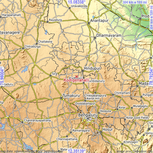
| \ | Map #1 | Map #2 | Topo.Map |
| Scale [m] | 641..713 m | 624..716 m | × |
| Scale [ft] | 2103..2339 ft | 2047..2349 ft | × |
| Average | 665.7 m = 2184 ft | 668.1 m = 2192 ft | × |
| Width | 9.49 km = 5.9 mi | 18.99 km = 11.8 mi | 303.8 km = 188.8 mi |
| Height | 9.49 km = 5.9 mi | 18.99 km = 11.8 mi | 303.8 km = 188.8 mi |
| ↑Max Latitude | 13.764047° | 13.806727° | 15.08338° |
| Latitude at center | 13.72136° | 13.72136° | 13.72136° |
| ↓Min Latitude | 13.678665° | 13.635962° | 12.35139° |
| ← Min Longitude | 77.342345° | 77.298399° | 75.98004° |
| Longitude center | 77.38629° | 77.38629° | 77.38629° |
| →Max Longitude | 77.430235° | 77.474181° | 78.79254° |
Nearby cities:
Cities around Kodigenahalli sort by population:
• Hindupur elevation 630 m
16.4 km,  43°
43°
• Dod Ballāpur 904 m
50.2 km,  160°
160°
• Sīra 654 m
52.1 km,  272°
272°
• Chik Ballāpur 918 m
48.7 km,  130°
130°
• Goribidnūr 690 m
18.8 km, 130°
• Pāvugada 640 m
43.6 km,  344°
344°
• Maddagiri 756 m
20 km,  250°
250°
• Gorantla 649 m
50.9 km,  54°
54°
• Bāgepalli 730 m
44.9 km,  81°
81°
• Penukonda 570 m
46.1 km,  29°
29°
• Koratagere 763 m
27.4 km,  215°
215°
• Gudibanda 832 m
34.8 km,  99°
99°
Multilingual:
 En español:
Kodigenahalli elevación 667 m.
 En France:
Kodigenahalli élévation 667 m.
 Auf Deutsch:
Kodigenahalli höhe über dem Meeresspiegel ist 667 m.

Sources and notes:
- [note 1] Map square and city borders are not equal. Map elevation data is calculated only from area inside that square.
- [src 1] Elevation data from geonames database provided with same terms of usage.
- [src 2] The elevation map of Kodigenahalli is generated using elevation data from NASA's 3 arcsec (90m) resolution SRTM data.
- [src 3] Base (background) map © OpenStreetMap contributors tiles are generated by Geofabrik and OpenTopoMap.
Copyright & License:
This Kodigenahalli Elevation Map is licensed under CC BY-SA. You may reuse any part from this page, if you give a proper credit by linking to this URL:
 More info on terms of use page.