Jāwad elevation
Jāwad (Madhya Pradesh, Neemuch), India elevation is 467 meters and Jāwad elevation in feet is 1532 ft above sea level [src 1]. Jāwad is a populated place (feature code) with elevation that is 174 meters (571 ft) bigger than average city elevation in India.
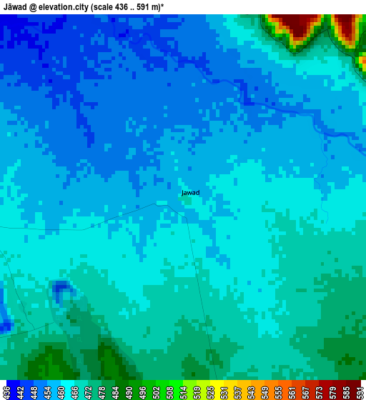
Below is the Elevation map of Jāwad, which displays elevation range with different colors. Scale of the first map is from 436 to 591 m (1430 to 1939 ft) with average elevation of 462.5 meters (=1517 ft) [note 1]
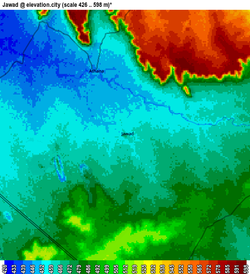
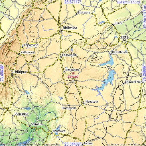
These maps also provides idea of topography and contour of this city, they are displayed at different zoom levels. More info about maps, scale and edge coordinates you can find below images.
| \ | Map #1 | Map #2 | Topo.Map |
| Scale [m] | 436..591 m | 426..598 m | × |
| Scale [ft] | 1430..1939 ft | 1398..1962 ft | × |
| Average | 462.5 m = 1517 ft | 481.2 m = 1579 ft | × |
| Width | 8.89 km = 5.5 mi | 17.77 km = 11 mi | 284.3 km = 176.7 mi |
| Height | 8.89 km = 5.5 mi | 17.77 km = 11 mi | 284.3 km = 176.7 mi |
| ↑Max Latitude | 24.639111° | 24.679048° | 25.87117° |
| Latitude at center | 24.59916° | 24.59916° | 24.59916° |
| ↓Min Latitude | 24.559197° | 24.519221° | 23.31409° |
| ← Min Longitude | 74.818665° | 74.774719° | 73.45636° |
| Longitude center | 74.86261° | 74.86261° | 74.86261° |
| →Max Longitude | 74.906555° | 74.950501° | 76.26886° |
Nearby cities:
Cities around Jāwad sort by population:
• Chittaurgarh elevation 405 m
40.3 km,  323°
323°
• Nīmbāhera 447 m
18.6 km,  277°
277°
• Manāsa 447 m
31.2 km,  115°
115°
• Begūn 420 m
44.9 km,  17°
17°
• Chhoti Sādri 498 m
29.2 km,  214°
214°
• Bari Sādri 500 m
44.5 km,  242°
242°
• Jīran 485 m
32.4 km,  174°
174°
• Nārāyangarh 445 m
41.1 km,  152°
152°
• Singoli 370 m
60.2 km,  47°
47°
• Malhārgarh 463 m
37.5 km,  159°
159°
• Ratangarh 441 m
35.3 km, 46°
• Neemuch 488 m
13.7 km,  180°
180°
Multilingual:
 En español:
Jāwad elevación 467 m.
 En France:
Jāwad élévation 467 m.


Sources and notes:
- [note 1] Map square and city borders are not equal. Map elevation data is calculated only from area inside that square.
- [src 1] Elevation data from geonames database provided with same terms of usage.
- [src 2] The elevation map of Jāwad is generated using elevation data from NASA's 3 arcsec (90m) resolution SRTM data.
- [src 3] Base (background) map © OpenStreetMap contributors tiles are generated by Geofabrik and OpenTopoMap.
Copyright & License:
This Jāwad Elevation Map is licensed under CC BY-SA. You may reuse any part from this page, if you give a proper credit by linking to this URL:
 More info on terms of use page.