Kālāvad elevation
Kālāvad (Gujarat, Jāmnagar), India elevation is 100 meters and Kālāvad elevation in feet is 328 ft above sea level [src 1]. Kālāvad is a populated place (feature code) with elevation that is 193 meters (633 ft) smaller than average city elevation in India.
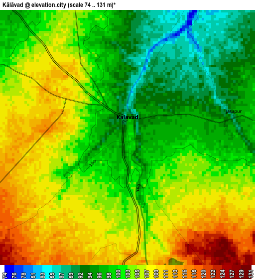
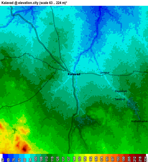
Below is the Elevation map of Kālāvad, which displays elevation range with different colors. Scale of the first map is from 74 to 131 m (243 to 430 ft) with average elevation of 102.6 meters (=337 ft) [note 1]
These maps also provides idea of topography and contour of this city, they are displayed at different zoom levels. More info about maps, scale and edge coordinates you can find below images.
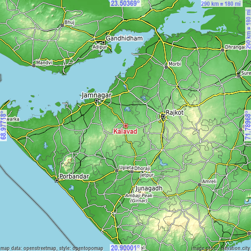
| \ | Map #1 | Map #2 | Topo.Map |
| Scale [m] | 74..131 m | 63..224 m | × |
| Scale [ft] | 243..430 ft | 207..735 ft | × |
| Average | 102.6 m = 337 ft | 108.9 m = 357 ft | × |
| Width | 9.05 km = 5.6 mi | 18.1 km = 11.2 mi | 289.5 km = 179.9 mi |
| Height | 9.05 km = 5.6 mi | 18.1 km = 11.2 mi | 289.5 km = 179.9 mi |
| ↑Max Latitude | 22.248569° | 22.289237° | 23.50369° |
| Latitude at center | 22.20789° | 22.20789° | 22.20789° |
| ↓Min Latitude | 22.167199° | 22.126496° | 20.90001° |
| ← Min Longitude | 70.339485° | 70.295539° | 68.97718° |
| Longitude center | 70.38343° | 70.38343° | 70.38343° |
| →Max Longitude | 70.427375° | 70.471321° | 71.78968° |
Nearby cities:
Cities around Kālāvad sort by population:
• Rājkot elevation 140 m
43.2 km,  77°
77°
• Jamnagar 18 m
43.9 km,  312°
312°
• Gondal 139 m
51.2 km,  122°
122°
• Dhorāji 63 m
53.2 km,  172°
172°
• Upleta 43 m
53 km,  191°
191°
• Jodhpur 99 m
49.7 km,  226°
226°
• Dhrol 34 m
40.1 km,  5°
5°
• Bedi 9 m
47.8 km, 313°
• Bhāyāvadar 86 m
41.6 km,  199°
199°
• Lālpur 79 m
43.3 km,  267°
267°
• Shāhpur 182 m
40.3 km,  98°
98°
• Paddhari 68 m
33.9 km,  41°
41°
Multilingual:
 En español:
Kālāvad elevación 100 m.
 En France:
Kālāvad élévation 100 m.


Sources and notes:
- [note 1] Map square and city borders are not equal. Map elevation data is calculated only from area inside that square.
- [src 1] Elevation data from geonames database provided with same terms of usage.
- [src 2] The elevation map of Kālāvad is generated using elevation data from NASA's 3 arcsec (90m) resolution SRTM data.
- [src 3] Base (background) map © OpenStreetMap contributors tiles are generated by Geofabrik and OpenTopoMap.
Copyright & License:
This Kālāvad Elevation Map is licensed under CC BY-SA. You may reuse any part from this page, if you give a proper credit by linking to this URL:
 More info on terms of use page.