Keshod elevation
Keshod (Gujarat, Jūnāgadh), India elevation is 44 meters and Keshod elevation in feet is 144 ft above sea level [src 1]. Keshod is a populated place (feature code) with elevation that is 249 meters (817 ft) smaller than average city elevation in India.
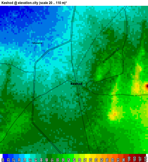
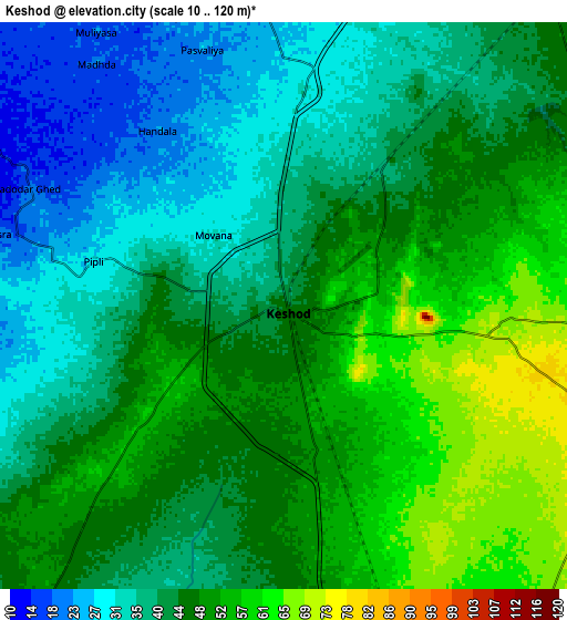
Below is the Elevation map of Keshod, which displays elevation range with different colors. Scale of the first map is from 20 to 110 m (66 to 361 ft) with average elevation of 45.9 meters (=151 ft) [note 1]
These maps also provides idea of topography and contour of this city, they are displayed at different zoom levels. More info about maps, scale and edge coordinates you can find below images.
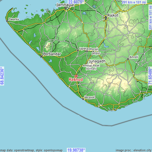
| \ | Map #1 | Map #2 | Topo.Map |
| Scale [m] | 20..110 m | 10..120 m | × |
| Scale [ft] | 66..361 ft | 33..394 ft | × |
| Average | 45.9 m = 151 ft | 43.7 m = 143 ft | × |
| Width | 9.1 km = 5.7 mi | 18.21 km = 11.3 mi | 291.3 km = 181 mi |
| Height | 9.1 km = 5.7 mi | 18.21 km = 11.3 mi | 291.3 km = 181 mi |
| ↑Max Latitude | 21.344217° | 21.385142° | 22.6075° |
| Latitude at center | 21.30328° | 21.30328° | 21.30328° |
| ↓Min Latitude | 21.262332° | 21.221372° | 19.98738° |
| ← Min Longitude | 70.204665° | 70.160719° | 68.84236° |
| Longitude center | 70.24861° | 70.24861° | 70.24861° |
| →Max Longitude | 70.292555° | 70.336501° | 71.65486° |
Nearby cities:
Cities around Keshod sort by population:
• Jūnāgadh elevation 97 m
32.5 km,  42°
42°
• Verāval 10 m
45.7 km,  164°
164°
• Dhorāji 63 m
52.2 km,  23°
23°
• Māngrol 22 m
24.4 km,  214°
214°
• Upleta 43 m
48.7 km,  4°
4°
• Mānāvadar 29 m
24.5 km,  332°
332°
• Vīsāvadar 140 m
52.1 km,  85°
85°
• Mendarda 91 m
20 km,  84°
84°
• Kutiyāna 21 m
44.9 km,  322°
322°
• Bāntva 26 m
27.3 km, 318°
• Jetalsar 103 m
56.5 km, 36°
• Bilkha 97 m
39.6 km,  67°
67°
Multilingual:
 En español:
Keshod elevación 44 m.
 En France:
Keshod élévation 44 m.


Sources and notes:
- [note 1] Map square and city borders are not equal. Map elevation data is calculated only from area inside that square.
- [src 1] Elevation data from geonames database provided with same terms of usage.
- [src 2] The elevation map of Keshod is generated using elevation data from NASA's 3 arcsec (90m) resolution SRTM data.
- [src 3] Base (background) map © OpenStreetMap contributors tiles are generated by Geofabrik and OpenTopoMap.
Copyright & License:
This Keshod Elevation Map is licensed under CC BY-SA. You may reuse any part from this page, if you give a proper credit by linking to this URL:
 More info on terms of use page.