Kotwa elevation
Kotwa (Madhya Pradesh, Rewa), India elevation is 148 meters and Kotwa elevation in feet is 486 ft above sea level [src 1]. Kotwa is a populated place (feature code) with elevation that is 145 meters (476 ft) smaller than average city elevation in India.
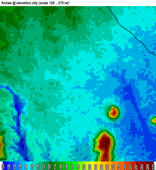
Below is the Elevation map of Kotwa, which displays elevation range with different colors. Scale of the first map is from 120 to 275 m (394 to 902 ft) with average elevation of 150.9 meters (=495 ft) [note 1]
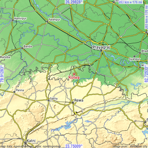
These maps also provides idea of topography and contour of this city, they are displayed at different zoom levels. More info about maps, scale and edge coordinates you can find below images.
| \ | Map #1 | Map #2 | Topo.Map |
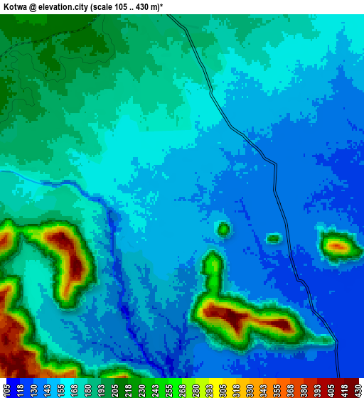
| Scale [m] | 120..275 m | 105..430 m | × |
| Scale [ft] | 394..902 ft | 344..1411 ft | × |
| Average | 150.9 m = 495 ft | 170.7 m = 560 ft | × |
| Width | 8.85 km = 5.5 mi | 17.71 km = 11 mi | 283.3 km = 176 mi |
| Height | 8.85 km = 5.5 mi | 17.71 km = 11 mi | 283.3 km = 176 mi |
| ↑Max Latitude | 25.070612° | 25.11041° | 26.29828° |
| Latitude at center | 25.0308° | 25.0308° | 25.0308° |
| ↓Min Latitude | 24.990976° | 24.951138° | 23.75009° |
| ← Min Longitude | 81.275135° | 81.231189° | 79.91283° |
| Longitude center | 81.31908° | 81.31908° | 81.31908° |
| →Max Longitude | 81.363025° | 81.406971° | 82.72533° |
Nearby cities:
Cities around Kotwa sort by population:
• Sarāi Ākil elevation 107 m
43.2 km,  26°
26°
• Teonthar 117 m
33 km,  99°
99°
• Mānikpur 243 m
22.4 km,  278°
278°
• Karārī 109 m
48.1 km,  13°
13°
• Shankargarh 136 m
34.4 km,  60°
60°
• Simaria 298 m
31.2 km,  212°
212°
• Rājāpur 111 m
43.1 km,  336°
336°
• Mangawān 310 m
46.5 km,  150°
150°
• Sirmaur 313 m
22.1 km,  168°
168°
• Baikunthpur 305 m
34.9 km,  164°
164°
• Sohāgi 116 m
38.3 km, 98°
• Kotār 303 m
50.3 km,  222°
222°
Multilingual:
 En español:
Kotwa elevación 148 m.
 En France:
Kotwa élévation 148 m.


Sources and notes:
- [note 1] Map square and city borders are not equal. Map elevation data is calculated only from area inside that square.
- [src 1] Elevation data from geonames database provided with same terms of usage.
- [src 2] The elevation map of Kotwa is generated using elevation data from NASA's 3 arcsec (90m) resolution SRTM data.
- [src 3] Base (background) map © OpenStreetMap contributors tiles are generated by Geofabrik and OpenTopoMap.
Copyright & License:
This Kotwa Elevation Map is licensed under CC BY-SA. You may reuse any part from this page, if you give a proper credit by linking to this URL:
 More info on terms of use page.