Sohāgi elevation
Sohāgi (Madhya Pradesh, Rewa), India elevation is 116 meters and Sohāgi elevation in feet is 381 ft above sea level [src 1]. Sohāgi is a populated place (feature code) with elevation that is 177 meters (581 ft) smaller than average city elevation in India.
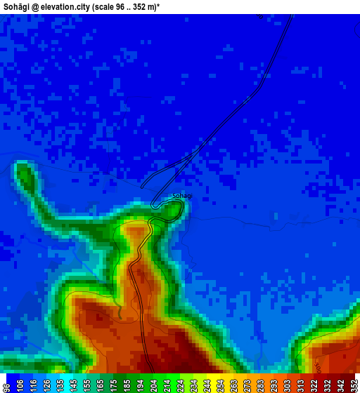
Below is the Elevation map of Sohāgi, which displays elevation range with different colors. Scale of the first map is from 96 to 352 m (315 to 1155 ft) with average elevation of 136.4 meters (=448 ft) [note 1]
These maps also provides idea of topography and contour of this city, they are displayed at different zoom levels. More info about maps, scale and edge coordinates you can find below images.

| \ | Map #1 | Map #2 | Topo.Map |
| Scale [m] | 96..352 m | 79..363 m | × |
| Scale [ft] | 315..1155 ft | 259..1191 ft | × |
| Average | 136.4 m = 448 ft | 165 m = 541 ft | × |
| Width | 8.86 km = 5.5 mi | 17.72 km = 11 mi | 283.4 km = 176.1 mi |
| Height | 8.86 km = 5.5 mi | 17.72 km = 11 mi | 283.5 km = 176.2 mi |
| ↑Max Latitude | 25.021637° | 25.061452° | 26.24981° |
| Latitude at center | 24.98181° | 24.98181° | 24.98181° |
| ↓Min Latitude | 24.94197° | 24.902116° | 23.7006° |
| ← Min Longitude | 81.651635° | 81.607689° | 80.28933° |
| Longitude center | 81.69558° | 81.69558° | 81.69558° |
| →Max Longitude | 81.739525° | 81.783471° | 83.10183° |
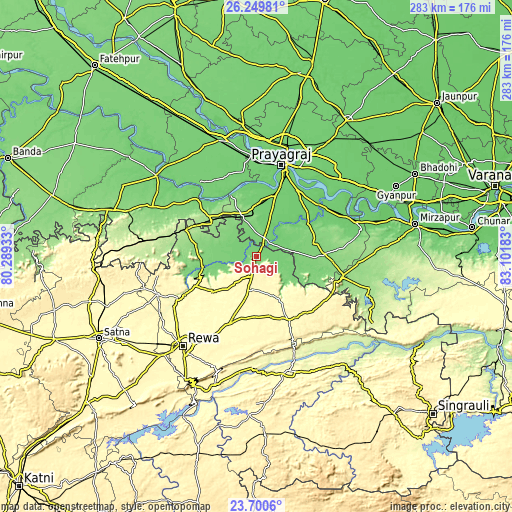
Nearby cities:
Cities around Sohāgi sort by population:
• Allahābād elevation 99 m
53.6 km,  16°
16°
• Mauganj 351 m
39.3 km,  152°
152°
• Sarāi Ākil 107 m
47.9 km,  337°
337°
• Teonthar 117 m
5.4 km,  270°
270°
• Shankargarh 136 m
23.6 km, 340°
• Kotwa 148 m
38.3 km,  278°
278°
• Sirsā 96 m
50.7 km,  51°
51°
• Mangawān 310 m
38 km,  203°
203°
• Sirmaur 313 m
37.1 km,  244°
244°
• Baikunthpur 305 m
40.4 km,  225°
225°
• Naīgarhi 325 m
23.2 km,  158°
158°
• Chail 105 m
49.9 km,  352°
352°
Multilingual:
 En español:
Sohāgi elevación 116 m.
 En France:
Sohāgi élévation 116 m.


Sources and notes:
- [note 1] Map square and city borders are not equal. Map elevation data is calculated only from area inside that square.
- [src 1] Elevation data from geonames database provided with same terms of usage.
- [src 2] The elevation map of Sohāgi is generated using elevation data from NASA's 3 arcsec (90m) resolution SRTM data.
- [src 3] Base (background) map © OpenStreetMap contributors tiles are generated by Geofabrik and OpenTopoMap.
Copyright & License:
This Sohāgi Elevation Map is licensed under CC BY-SA. You may reuse any part from this page, if you give a proper credit by linking to this URL:
 More info on terms of use page.