Kulu elevation
Kulu (Himachal Pradesh), India elevation is 1240 meters and Kulu elevation in feet is 4068 ft above sea level [src 1]. Kulu is a populated place (feature code) with elevation that is 947 meters (3107 ft) bigger than average city elevation in India.
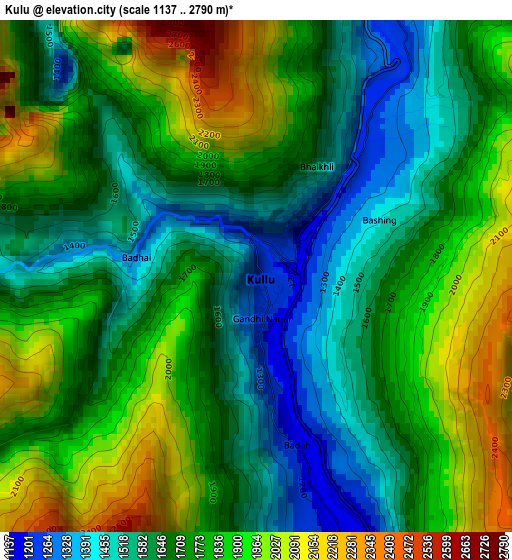
Below is the Elevation map of Kulu, which displays elevation range with different colors. Scale of the first map is from 1137 to 2790 m (3730 to 9154 ft) with average elevation of 1750.4 meters (=5743 ft) [note 1]
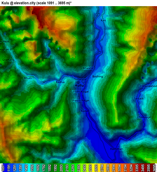
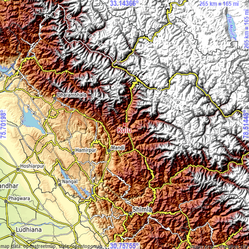
These maps also provides idea of topography and contour of this city, they are displayed at different zoom levels. More info about maps, scale and edge coordinates you can find below images.
| \ | Map #1 | Map #2 | Topo.Map |
| Scale [m] | 1137..2790 m | 1091..3695 m | × |
| Scale [ft] | 3730..9154 ft | 3579..12123 ft | × |
| Average | 1750.4 m = 5743 ft | 1986.2 m = 6516 ft | × |
| Width | 8.29 km = 5.2 mi | 16.58 km = 10.3 mi | 265.3 km = 164.8 mi |
| Height | 8.29 km = 5.2 mi | 16.58 km = 10.3 mi | 265.3 km = 164.8 mi |
| ↑Max Latitude | 31.995627° | 32.032889° | 33.14366° |
| Latitude at center | 31.95835° | 31.95835° | 31.95835° |
| ↓Min Latitude | 31.921058° | 31.88375° | 30.75755° |
| ← Min Longitude | 77.064285° | 77.020339° | 75.70198° |
| Longitude center | 77.10823° | 77.10823° | 77.10823° |
| →Max Longitude | 77.152175° | 77.196121° | 78.51448° |
Nearby cities:
Cities around Kulu sort by population:
• Mandi elevation 764 m
32 km,  211°
211°
• Sundarnagar 884 m
50.8 km,  202°
202°
• Hamīrpur 768 m
63 km,  241°
241°
• Manāli 2108 m
33.8 km,  10°
10°
• Tīra Sujānpur 565 m
58.6 km,  256°
256°
• Ghumārwīn 644 m
68.4 km, 212°
• Jogindarnagar 1175 m
30.3 km,  276°
276°
• Pāndoh 864 m
32.6 km,  189°
189°
• Pālampur 1355 m
54.8 km,  288°
288°
• Sarka Ghāt 958 m
45.5 km,  230°
230°
• Nagar 1693 m
20.9 km,  17°
17°
• Banjār 1442 m
41.7 km,  148°
148°
Multilingual:
 En español:
Kulu elevación 1240 m.
 En France:
Kulu élévation 1240 m.


Sources and notes:
- [note 1] Map square and city borders are not equal. Map elevation data is calculated only from area inside that square.
- [src 1] Elevation data from geonames database provided with same terms of usage.
- [src 2] The elevation map of Kulu is generated using elevation data from NASA's 3 arcsec (90m) resolution SRTM data.
- [src 3] Base (background) map © OpenStreetMap contributors tiles are generated by Geofabrik and OpenTopoMap.
Copyright & License:
This Kulu Elevation Map is licensed under CC BY-SA. You may reuse any part from this page, if you give a proper credit by linking to this URL:
 More info on terms of use page.