Maddūr elevation
Maddūr (Karnataka, Mandya), India elevation is 643 meters and Maddūr elevation in feet is 2110 ft above sea level [src 1]. Maddūr is a populated place (feature code) with elevation that is 350 meters (1148 ft) bigger than average city elevation in India.
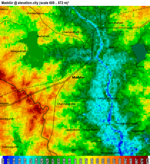
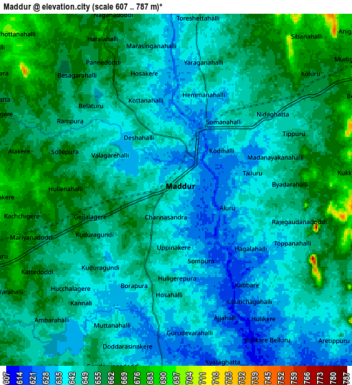
Below is the Elevation map of Maddūr, which displays elevation range with different colors. Scale of the first map is from 609 to 672 m (1998 to 2205 ft) with average elevation of 638.2 meters (=2094 ft) [note 1]
These maps also provides idea of topography and contour of this city, they are displayed at different zoom levels. More info about maps, scale and edge coordinates you can find below images.
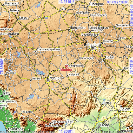
| \ | Map #1 | Map #2 | Topo.Map |
| Scale [m] | 609..672 m | 607..787 m | × |
| Scale [ft] | 1998..2205 ft | 1991..2582 ft | × |
| Average | 638.2 m = 2094 ft | 649.3 m = 2130 ft | × |
| Width | 9.54 km = 5.9 mi | 19.08 km = 11.9 mi | 305.2 km = 189.6 mi |
| Height | 9.54 km = 5.9 mi | 19.08 km = 11.9 mi | 305.2 km = 189.6 mi |
| ↑Max Latitude | 12.625716° | 12.668595° | 13.95151° |
| Latitude at center | 12.58283° | 12.58283° | 12.58283° |
| ↓Min Latitude | 12.539937° | 12.497036° | 11.20681° |
| ← Min Longitude | 76.998995° | 76.955049° | 75.63669° |
| Longitude center | 77.04294° | 77.04294° | 77.04294° |
| →Max Longitude | 77.086885° | 77.130831° | 78.44919° |
Nearby cities:
Cities around Maddūr sort by population:
• Mandya elevation 681 m
17.2 km,  246°
246°
• Closepet 695 m
30.1 km,  59°
59°
• Channapatna 669 m
19.3 km,  66°
66°
• Kānkānhalli 639 m
41.1 km,  95°
95°
• Malavalli 621 m
22 km,  175°
175°
• Māgadi 879 m
46 km,  25°
25°
• Bannūr 677 m
34 km,  215°
215°
• Shrīrangapattana 689 m
42.8 km, 245°
• French Rocks 734 m
41 km,  257°
257°
• Nāgamangala 790 m
40.9 km,  310°
310°
• Tirumakūdal Narsipur 654 m
44 km,  200°
200°
• Melukote 1018 m
43.7 km,  281°
281°
Multilingual:
 En español:
Maddūr elevación 643 m.
 En France:
Maddūr élévation 643 m.


Sources and notes:
- [note 1] Map square and city borders are not equal. Map elevation data is calculated only from area inside that square.
- [src 1] Elevation data from geonames database provided with same terms of usage.
- [src 2] The elevation map of Maddūr is generated using elevation data from NASA's 3 arcsec (90m) resolution SRTM data.
- [src 3] Base (background) map © OpenStreetMap contributors tiles are generated by Geofabrik and OpenTopoMap.
Copyright & License:
This Maddūr Elevation Map is licensed under CC BY-SA. You may reuse any part from this page, if you give a proper credit by linking to this URL:
 More info on terms of use page.