Mārāndahalli elevation
Mārāndahalli (Tamil Nadu, Dharmapuri), India elevation is 585 meters and Mārāndahalli elevation in feet is 1919 ft above sea level [src 1]. Mārāndahalli is a populated place (feature code) with elevation that is 292 meters (958 ft) bigger than average city elevation in India.
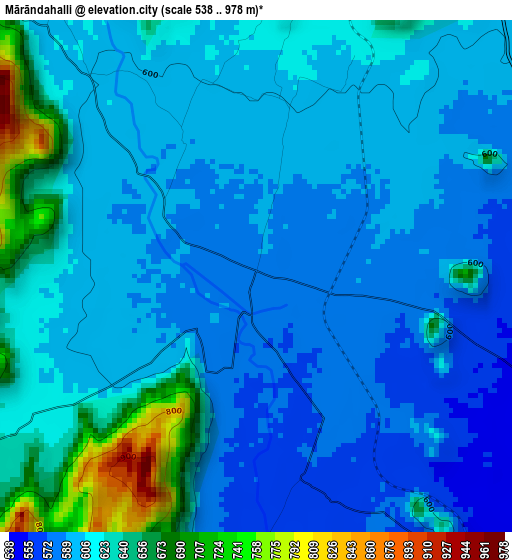
Below is the Elevation map of Mārāndahalli, which displays elevation range with different colors. Scale of the first map is from 538 to 978 m (1765 to 3209 ft) with average elevation of 611.1 meters (=2005 ft) [note 1]
These maps also provides idea of topography and contour of this city, they are displayed at different zoom levels. More info about maps, scale and edge coordinates you can find below images.
| \ | Map #1 | Map #2 | Topo.Map |
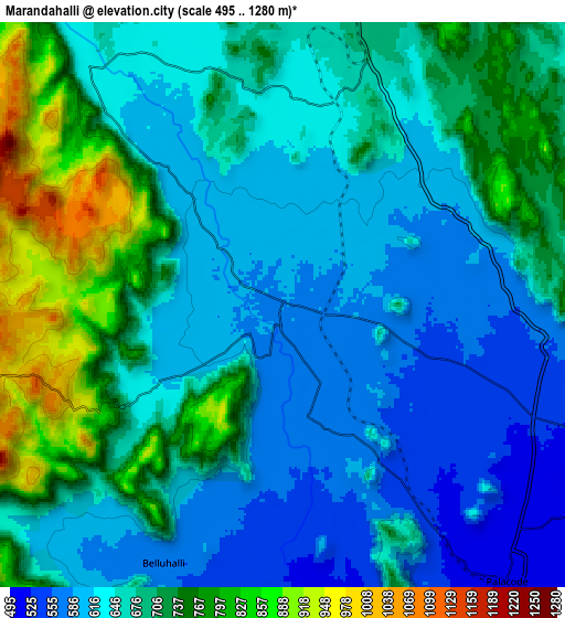
| Scale [m] | 538..978 m | 495..1280 m | × |
| Scale [ft] | 1765..3209 ft | 1624..4199 ft | × |
| Average | 611.1 m = 2005 ft | 672.1 m = 2205 ft | × |
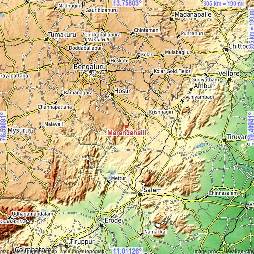
| Width | 9.54 km = 5.9 mi | 19.09 km = 11.9 mi | 305.4 km = 189.8 mi |
| Height | 9.55 km = 5.9 mi | 19.09 km = 11.9 mi | 305.4 km = 189.8 mi |
| ↑Max Latitude | 12.431179° | 12.47409° | 13.75803° |
| Latitude at center | 12.38826° | 12.38826° | 12.38826° |
| ↓Min Latitude | 12.345334° | 12.302402° | 11.01126° |
| ← Min Longitude | 77.959215° | 77.915269° | 76.59691° |
| Longitude center | 78.00316° | 78.00316° | 78.00316° |
| →Max Longitude | 78.047105° | 78.091051° | 79.40941° |
Nearby cities:
Cities around Mārāndahalli sort by population:
• Hosūr elevation 871 m
42.9 km,  334°
334°
• Krishnagiri 492 m
27.1 km,  57°
57°
• Dharmapuri 468 m
33.5 km,  149°
149°
• Anekal 927 m
49 km,  317°
317°
• Kuppam 683 m
54.4 km,  42°
42°
• Pālakkodu 509 m
11.6 km,  141°
141°
• Denkanikota 886 m
28.1 km,  304°
304°
• Pennāgaram 510 m
30.6 km,  202°
202°
• Kāveripatnam 466 m
23.7 km,  80°
80°
• Mallāpuram 428 m
52.4 km, 149°
• Pāppārappatti 496 m
19.6 km,  161°
161°
• Kelamangalam 796 m
29 km, 325°
Multilingual:
 En español:
Mārāndahalli elevación 585 m.
 En France:
Mārāndahalli élévation 585 m.
 Auf Deutsch:
Mārāndahalli höhe über dem Meeresspiegel ist 585 m.

Sources and notes:
- [note 1] Map square and city borders are not equal. Map elevation data is calculated only from area inside that square.
- [src 1] Elevation data from geonames database provided with same terms of usage.
- [src 2] The elevation map of Mārāndahalli is generated using elevation data from NASA's 3 arcsec (90m) resolution SRTM data.
- [src 3] Base (background) map © OpenStreetMap contributors tiles are generated by Geofabrik and OpenTopoMap.
Copyright & License:
This Mārāndahalli Elevation Map is licensed under CC BY-SA. You may reuse any part from this page, if you give a proper credit by linking to this URL:
 More info on terms of use page.