Maurānwān elevation
Maurānwān (Uttar Pradesh, Unnāo), India elevation is 128 meters and Maurānwān elevation in feet is 420 ft above sea level [src 1]. Maurānwān is a populated place (feature code) with elevation that is 165 meters (541 ft) smaller than average city elevation in India.
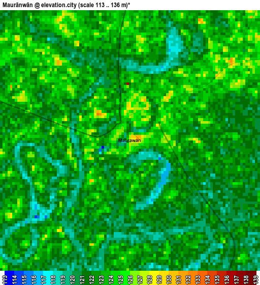
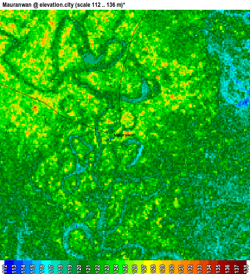
Below is the Elevation map of Maurānwān, which displays elevation range with different colors. Scale of the first map is from 113 to 136 m (371 to 446 ft) with average elevation of 122 meters (=400 ft) [note 1]
These maps also provides idea of topography and contour of this city, they are displayed at different zoom levels. More info about maps, scale and edge coordinates you can find below images.
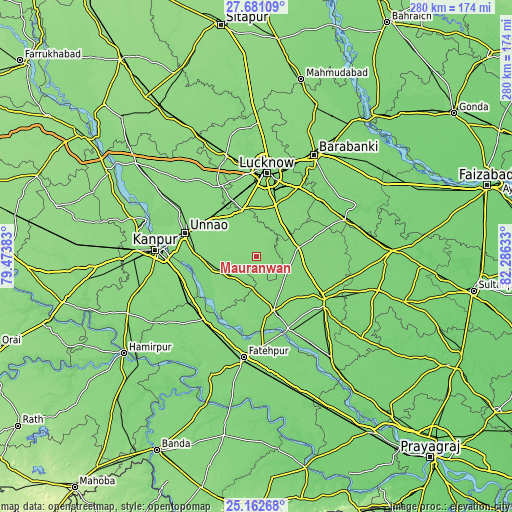
| \ | Map #1 | Map #2 | Topo.Map |
| Scale [m] | 113..136 m | 112..136 m | × |
| Scale [ft] | 371..446 ft | 367..446 ft | × |
| Average | 122 m = 400 ft | 121.5 m = 399 ft | × |
| Width | 8.75 km = 5.4 mi | 17.5 km = 10.9 mi | 280 km = 174 mi |
| Height | 8.75 km = 5.4 mi | 17.5 km = 10.9 mi | 280 km = 174 mi |
| ↑Max Latitude | 26.468106° | 26.507438° | 27.68109° |
| Latitude at center | 26.42876° | 26.42876° | 26.42876° |
| ↓Min Latitude | 26.389401° | 26.350028° | 25.16268° |
| ← Min Longitude | 80.836135° | 80.792189° | 79.47383° |
| Longitude center | 80.88008° | 80.88008° | 80.88008° |
| →Max Longitude | 80.924025° | 80.967971° | 82.28633° |
Nearby cities:
Cities around Maurānwān sort by population:
• Lucknow elevation 126 m
45.8 km,  5°
5°
• Raebareli 118 m
41.5 km,  122°
122°
• Unnāo 134 m
41.2 km,  288°
288°
• Purwā 128 m
11 km, 286°
• Mohān 126 m
44.1 km,  332°
332°
• Bachhrāwān 120 m
23.9 km,  78°
78°
• Dalmau 108 m
43.1 km,  159°
159°
• Nagrām 127 m
33.4 km,  50°
50°
• Goshāīnganj 121 m
44 km,  30°
30°
• Bhagwantnagar 127 m
25.9 km,  208°
208°
• Mahārājganj 123 m
39.6 km,  97°
97°
• Bīghāpur Khurd 125 m
24 km,  247°
247°
Multilingual:
 En español:
Maurānwān elevación 128 m.
 En France:
Maurānwān élévation 128 m.
 Auf Deutsch:
Maurānwān höhe über dem Meeresspiegel ist 128 m.

Sources and notes:
- [note 1] Map square and city borders are not equal. Map elevation data is calculated only from area inside that square.
- [src 1] Elevation data from geonames database provided with same terms of usage.
- [src 2] The elevation map of Maurānwān is generated using elevation data from NASA's 3 arcsec (90m) resolution SRTM data.
- [src 3] Base (background) map © OpenStreetMap contributors tiles are generated by Geofabrik and OpenTopoMap.
Copyright & License:
This Maurānwān Elevation Map is licensed under CC BY-SA. You may reuse any part from this page, if you give a proper credit by linking to this URL:
 More info on terms of use page.