Mohān elevation
Mohān (Uttar Pradesh, Unnāo), India elevation is 126 meters and Mohān elevation in feet is 413 ft above sea level [src 1]. Mohān is a populated place (feature code) with elevation that is 167 meters (548 ft) smaller than average city elevation in India.
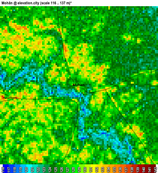
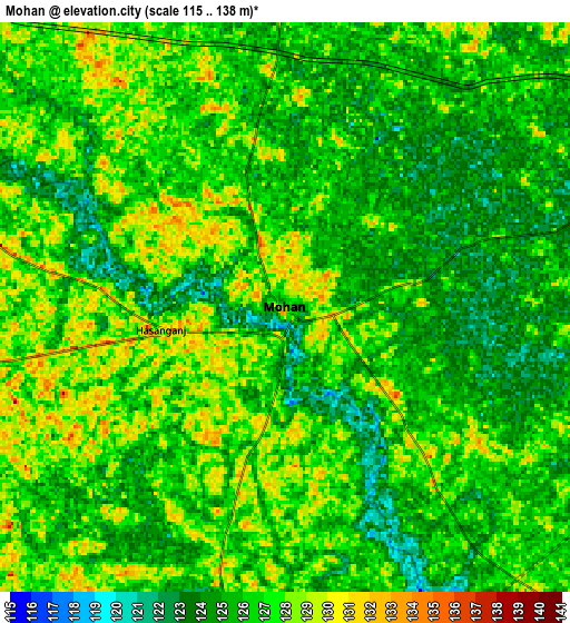
Below is the Elevation map of Mohān, which displays elevation range with different colors. Scale of the first map is from 116 to 137 m (381 to 449 ft) with average elevation of 126.3 meters (=414 ft) [note 1]
These maps also provides idea of topography and contour of this city, they are displayed at different zoom levels. More info about maps, scale and edge coordinates you can find below images.
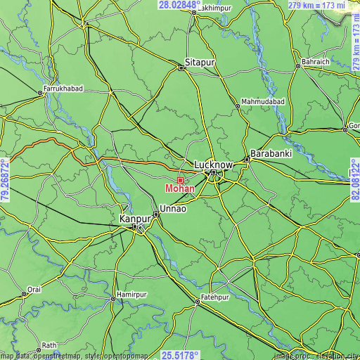
| \ | Map #1 | Map #2 | Topo.Map |
| Scale [m] | 116..137 m | 115..138 m | × |
| Scale [ft] | 381..449 ft | 377..453 ft | × |
| Average | 126.3 m = 414 ft | 126 m = 413 ft | × |
| Width | 8.72 km = 5.4 mi | 17.45 km = 10.8 mi | 279.2 km = 173.5 mi |
| Height | 8.72 km = 5.4 mi | 17.45 km = 10.8 mi | 279.2 km = 173.5 mi |
| ↑Max Latitude | 26.819305° | 26.858517° | 28.02848° |
| Latitude at center | 26.78008° | 26.78008° | 26.78008° |
| ↓Min Latitude | 26.740841° | 26.701589° | 25.5178° |
| ← Min Longitude | 80.631025° | 80.587079° | 79.26872° |
| Longitude center | 80.67497° | 80.67497° | 80.67497° |
| →Max Longitude | 80.718915° | 80.762861° | 82.08122° |
Nearby cities:
Cities around Mohān sort by population:
• Lucknow elevation 126 m
25.5 km,  75°
75°
• Unnāo 134 m
31.9 km,  215°
215°
• Sandīla 139 m
35.9 km,  333°
333°
• Jagdīshpur 132 m
13.3 km,  255°
255°
• Safīpur 135 m
33.2 km, 261°
• Purwā 128 m
37.2 km,  164°
164°
• Kākori 128 m
14.7 km,  48°
48°
• Malīhābād 129 m
16.2 km,  12°
12°
• Rasūlābād 131 m
18.8 km, 257°
• Itaunja 129 m
40.3 km,  33°
33°
• Aurās 131 m
22.3 km,  311°
311°
• Ugu 134 m
35.2 km,  273°
273°
Multilingual:
 En español:
Mohān elevación 126 m.
 En France:
Mohān élévation 126 m.


Sources and notes:
- [note 1] Map square and city borders are not equal. Map elevation data is calculated only from area inside that square.
- [src 1] Elevation data from geonames database provided with same terms of usage.
- [src 2] The elevation map of Mohān is generated using elevation data from NASA's 3 arcsec (90m) resolution SRTM data.
- [src 3] Base (background) map © OpenStreetMap contributors tiles are generated by Geofabrik and OpenTopoMap.
Copyright & License:
This Mohān Elevation Map is licensed under CC BY-SA. You may reuse any part from this page, if you give a proper credit by linking to this URL:
 More info on terms of use page.