Miriālgūda elevation
Miriālgūda (Telangana, Nalgonda), India elevation is 134 meters and Miriālgūda elevation in feet is 440 ft above sea level [src 1]. Miriālgūda is a populated place (feature code) with elevation that is 159 meters (522 ft) smaller than average city elevation in India.
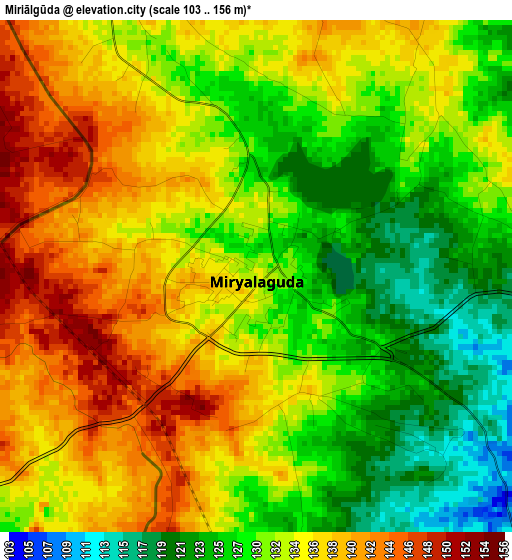
Below is the Elevation map of Miriālgūda, which displays elevation range with different colors. Scale of the first map is from 103 to 156 m (338 to 512 ft) with average elevation of 132.3 meters (=434 ft) [note 1]
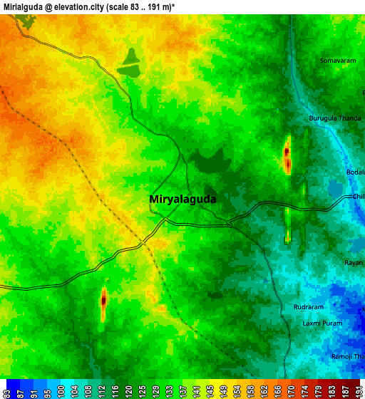
These maps also provides idea of topography and contour of this city, they are displayed at different zoom levels. More info about maps, scale and edge coordinates you can find below images.
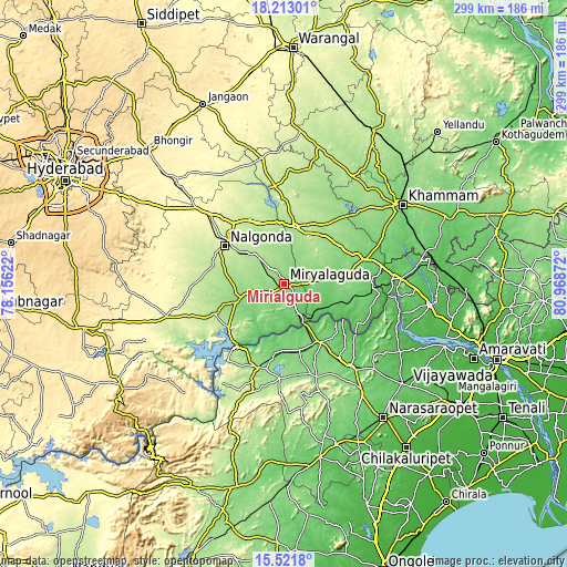
| \ | Map #1 | Map #2 | Topo.Map |
| Scale [m] | 103..156 m | 83..191 m | × |
| Scale [ft] | 338..512 ft | 272..627 ft | × |
| Average | 132.3 m = 434 ft | 131 m = 430 ft | × |
| Width | 9.35 km = 5.8 mi | 18.7 km = 11.6 mi | 299.2 km = 185.9 mi |
| Height | 9.35 km = 5.8 mi | 18.7 km = 11.6 mi | 299.3 km = 186 mi |
| ↑Max Latitude | 16.914249° | 16.956289° | 18.21301° |
| Latitude at center | 16.8722° | 16.8722° | 16.8722° |
| ↓Min Latitude | 16.830142° | 16.788074° | 15.5218° |
| ← Min Longitude | 79.518525° | 79.474579° | 78.15622° |
| Longitude center | 79.56247° | 79.56247° | 79.56247° |
| →Max Longitude | 79.606415° | 79.650361° | 80.96872° |
Nearby cities:
Cities around Miriālgūda sort by population:
• Khammam elevation 120 m
74.6 km,  55°
55°
• Nalgonda 235 m
37.4 km,  302°
302°
• Suriāpet 177 m
30.5 km,  11°
11°
• Narasaraopet 76 m
87.8 km,  143°
143°
• Vinukonda 96 m
93 km,  168°
168°
• Kodār 113 m
45.1 km,  71°
71°
• Sattenapalle 78 m
82.3 km,  130°
130°
• Mācherla 142 m
46.1 km,  197°
197°
• Jaggayyapeta 56 m
57 km,  87°
87°
• Nandigāma 54 m
77.8 km,  98°
98°
• Devarkonda 282 m
71.2 km,  253°
253°
• Dornakal 153 m
89.1 km,  44°
44°
Multilingual:
 En español:
Miriālgūda elevación 134 m.
 En France:
Miriālgūda élévation 134 m.
 Auf Deutsch:
Miriālgūda höhe über dem Meeresspiegel ist 134 m.

Sources and notes:
- [note 1] Map square and city borders are not equal. Map elevation data is calculated only from area inside that square.
- [src 1] Elevation data from geonames database provided with same terms of usage.
- [src 2] The elevation map of Miriālgūda is generated using elevation data from NASA's 3 arcsec (90m) resolution SRTM data.
- [src 3] Base (background) map © OpenStreetMap contributors tiles are generated by Geofabrik and OpenTopoMap.
Copyright & License:
This Miriālgūda Elevation Map is licensed under CC BY-SA. You may reuse any part from this page, if you give a proper credit by linking to this URL:
 More info on terms of use page.