Mowād elevation
Mowād (Maharashtra, Nagpur Division), India elevation is 407 meters and Mowād elevation in feet is 1335 ft above sea level [src 1]. Mowād is a populated place (feature code) with elevation that is 114 meters (374 ft) bigger than average city elevation in India.
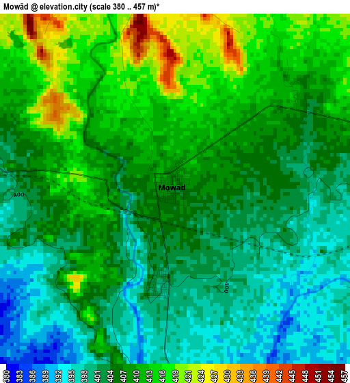
Below is the Elevation map of Mowād, which displays elevation range with different colors. Scale of the first map is from 380 to 457 m (1247 to 1499 ft) with average elevation of 406.5 meters (=1334 ft) [note 1]
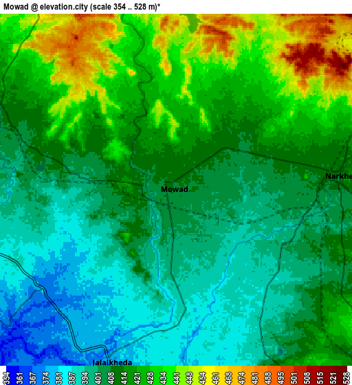
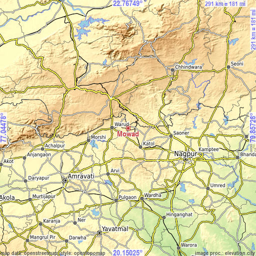
These maps also provides idea of topography and contour of this city, they are displayed at different zoom levels. More info about maps, scale and edge coordinates you can find below images.
| \ | Map #1 | Map #2 | Topo.Map |
| Scale [m] | 380..457 m | 354..528 m | × |
| Scale [ft] | 1247..1499 ft | 1161..1732 ft | × |
| Average | 406.5 m = 1334 ft | 412.9 m = 1355 ft | × |
| Width | 9.09 km = 5.6 mi | 18.19 km = 11.3 mi | 291 km = 180.8 mi |
| Height | 9.09 km = 5.6 mi | 18.19 km = 11.3 mi | 291 km = 180.8 mi |
| ↑Max Latitude | 21.505642° | 21.546522° | 22.76749° |
| Latitude at center | 21.46475° | 21.46475° | 21.46475° |
| ↓Min Latitude | 21.423847° | 21.382932° | 20.15025° |
| ← Min Longitude | 78.407085° | 78.363139° | 77.04478° |
| Longitude center | 78.45103° | 78.45103° | 78.45103° |
| →Max Longitude | 78.494975° | 78.538921° | 79.85728° |
Nearby cities:
Cities around Mowād sort by population:
• Warud elevation 402 m
18.8 km,  272°
272°
• Pāndhurnā 470 m
16.5 km,  28°
28°
• Kātol 413 m
25.4 km,  146°
146°
• Morsi 351 m
47.5 km,  253°
253°
• Saoner 328 m
49.5 km,  100°
100°
• Sausar 360 m
41.6 km,  59°
59°
• Multai 758 m
39.8 km,  329°
329°
• Kalmeshwar 334 m
55 km,  118°
118°
• Khāpa 315 m
55.1 km,  94°
94°
• Mohgaon 371 m
35.3 km, 56°
• Lodhīkheda 347 m
44.2 km,  72°
72°
• Mohpa 361 m
42.8 km,  113°
113°
Multilingual:
 En español:
Mowād elevación 407 m.
 En France:
Mowād élévation 407 m.


Sources and notes:
- [note 1] Map square and city borders are not equal. Map elevation data is calculated only from area inside that square.
- [src 1] Elevation data from geonames database provided with same terms of usage.
- [src 2] The elevation map of Mowād is generated using elevation data from NASA's 3 arcsec (90m) resolution SRTM data.
- [src 3] Base (background) map © OpenStreetMap contributors tiles are generated by Geofabrik and OpenTopoMap.
Copyright & License:
This Mowād Elevation Map is licensed under CC BY-SA. You may reuse any part from this page, if you give a proper credit by linking to this URL:
 More info on terms of use page.